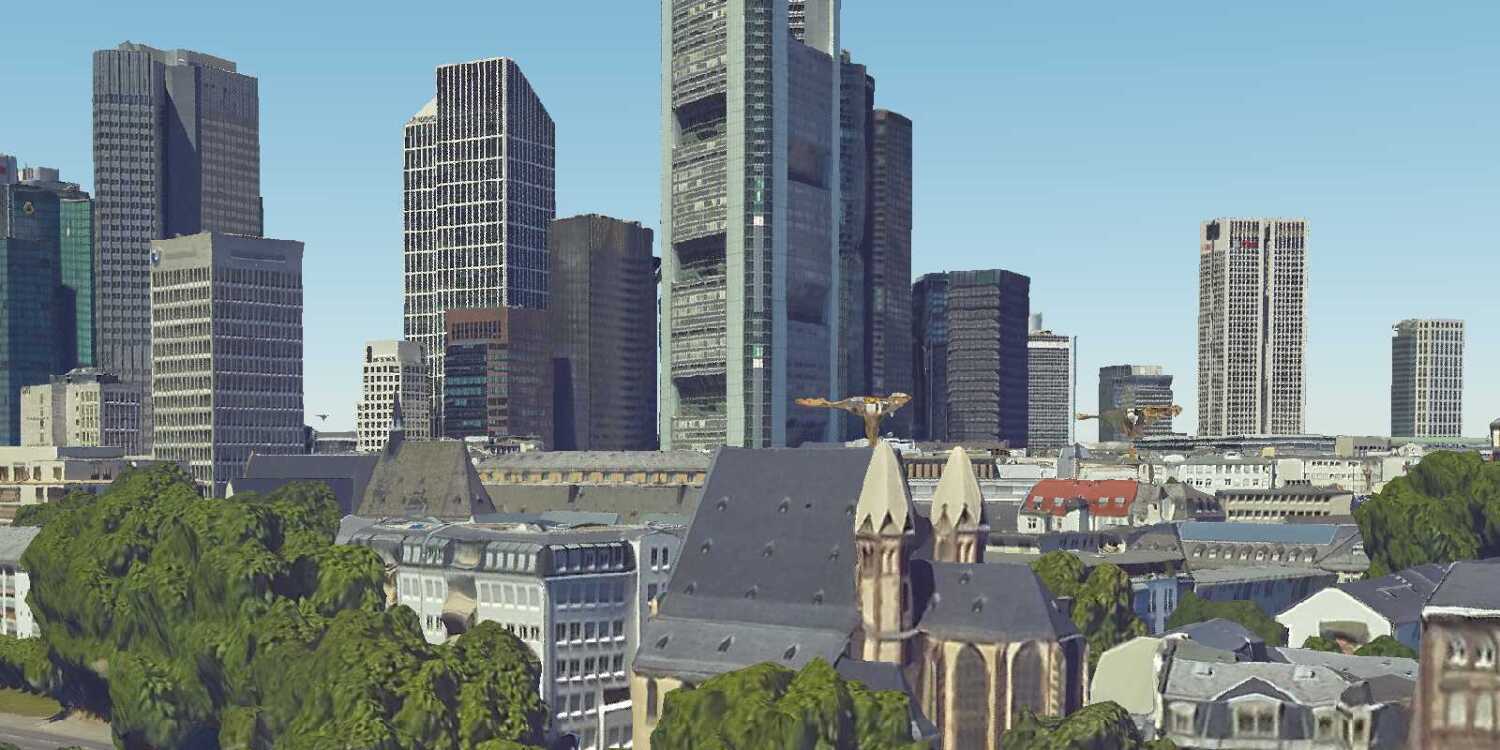
Learn how to display I3S 3D objects in a scene.
3D objects are a type of I3S data that are used to model entities such as buildings. They are typically stored in a hosted ArcGIS scene service. 3D objects are part of the I3S OGC community standard.
This tutorial explains how to add 3D objects from a scene service to your CesiumJS application using the I3SDataProvider class.
The 3D objects you will use are hosted in the San Francisco 3D Objects layer.
Prerequisites
An ArcGIS Location Platform or ArcGIS Online account.
Steps
Get the starter app
Select a type of authentication below and follow the steps to create a new application.
Set up authentication
Create developer credentials in your portal for the type of authentication you selected.
Set developer credentials
Use the API key or OAuth developer credentials created in the previous step in your application.
Get a Cesium ion access token
All Cesium applications must use an access token provided through Cesium ion. This token allows you to access assets such as Cesium World Terrain in your application.
-
Go to your Cesium ion dashboard to generate an access token. Copy the key to your clipboard.
-
Create a
cesiumvariable and replaceAccess Token YOURwith the access token you copied from the Cesium ion dashboard._CESIUM _ACCESS _TOKEN Use dark colors for code blocks <script> /* Use for API key authentication */ const accessToken = "YOUR_ACCESS_TOKEN"; // or /* Use for user authentication */ // const session = await arcgisRest.ArcGISIdentityManager.beginOAuth2({ // clientId: "YOUR_CLIENT_ID", // Your client ID from OAuth credentials // redirectUri: "YOUR_REDIRECT_URI", // The redirect URL registered in your OAuth credentials // portal: "YOUR_PORTAL_URL" // Your portal URL // }) // const accessToken = session.token; Cesium.ArcGisMapService.defaultAccessToken = accessToken; const cesiumAccessToken = "YOUR_CESIUM_ACCESS_TOKEN"; </script> -
Configure
Cesium.with the Cesium access token to validate the application.Ion.default Access Token Use dark colors for code blocks <script> /* Use for API key authentication */ const accessToken = "YOUR_ACCESS_TOKEN"; // or /* Use for user authentication */ // const session = await arcgisRest.ArcGISIdentityManager.beginOAuth2({ // clientId: "YOUR_CLIENT_ID", // Your client ID from OAuth credentials // redirectUri: "YOUR_REDIRECT_URI", // The redirect URL registered in your OAuth credentials // portal: "YOUR_PORTAL_URL" // Your portal URL // }) // const accessToken = session.token; Cesium.ArcGisMapService.defaultAccessToken = accessToken; const cesiumAccessToken = "YOUR_CESIUM_ACCESS_TOKEN"; Cesium.Ion.defaultAccessToken = cesiumAccessToken; </script>
Update the camera position
-
This tutorial uses a 3D object layer centered on the city of San Francisco. Update the camera to focus on the coordinates
[-122.433, 37.777]with a height of500.Use dark colors for code blocks const arcGisImagery = Cesium.ArcGisMapServerImageryProvider.fromBasemapType(Cesium.ArcGisBaseMapType.SATELLITE, { enablePickFeatures:false }); const viewer = new Cesium.Viewer("cesiumContainer", { baseLayer: Cesium.ImageryLayer.fromProviderAsync(arcGisImagery), terrain: Cesium.Terrain.fromWorldTerrain(), timeline: false, animation: false, geocoder:false }); // Add Esri attribution // Learn more in https://esriurl.com/attribution const poweredByEsri = new Cesium.Credit("Powered by <a href='https://www.esri.com/en-us/home' target='_blank'>Esri</a>", true) viewer.creditDisplay.addStaticCredit(poweredByEsri); viewer.camera.setView({ destination: Cesium.Cartesian3.fromDegrees(-122.433,37.777,500), orientation: { heading: Cesium.Math.toRadians(60), pitch: Cesium.Math.toRadians(-15.0), } });
Add a terrain provider
To ensure that your 3D objects sit properly on top of the terrain, you need to use a geoid service. This service will allow the elevation of the 3D objects to align with the elevation values of Cesium World Terrain.
-
Initialize a terrain provider called
geoidthat references the Earth Gravitational Model EGM2008. This provider will allow for geoid conversion between the gravity-based 3D object layer and the ellipsoidal-based Cesium World Terrain.Service Use dark colors for code blocks // Add Esri attribution // Learn more in https://esriurl.com/attribution const poweredByEsri = new Cesium.Credit("Powered by <a href='https://www.esri.com/en-us/home' target='_blank'>Esri</a>", true) viewer.creditDisplay.addStaticCredit(poweredByEsri); viewer.camera.setView({ destination: Cesium.Cartesian3.fromDegrees(-122.433,37.777,500), orientation: { heading: Cesium.Math.toRadians(60), pitch: Cesium.Math.toRadians(-15.0), } }); // The source data used in this transcoding service was compiled from https://earth-info.nga.mil/#tab_wgs84-data and is based on EGM2008 Gravity Model const geoidService = await Cesium.ArcGISTiledElevationTerrainProvider.fromUrl("https://tiles.arcgis.com/tiles/GVgbJbqm8hXASVYi/arcgis/rest/services/EGM2008/ImageServer"); const i3sProvider = await Cesium.I3SDataProvider.fromUrl(i3sLayer, { geoidTiledTerrainProvider: geoidService, token: accessToken, }) -
Add the data attribution for the elevation layer source.
- Go to the EGM2008 item.
- Scroll down to the Credits (Attribution) section and copy its value.
- Create an
attributionproperty and paste the attribution value from the item.Use dark colors for code blocks // Add Esri attribution // Learn more in https://esriurl.com/attribution const poweredByEsri = new Cesium.Credit("Powered by <a href='https://www.esri.com/en-us/home' target='_blank'>Esri</a>", true) viewer.creditDisplay.addStaticCredit(poweredByEsri); viewer.camera.setView({ destination: Cesium.Cartesian3.fromDegrees(-122.433,37.777,500), orientation: { heading: Cesium.Math.toRadians(60), pitch: Cesium.Math.toRadians(-15.0), } }); // The source data used in this transcoding service was compiled from https://earth-info.nga.mil/#tab_wgs84-data and is based on EGM2008 Gravity Model const geoidService = await Cesium.ArcGISTiledElevationTerrainProvider.fromUrl("https://tiles.arcgis.com/tiles/GVgbJbqm8hXASVYi/arcgis/rest/services/EGM2008/ImageServer"); // Attribution text retrieved from https://arcgis.com/home/item.html?id=d798c71512404bbb9c1551b827bf5467 viewer.creditDisplay.addStaticCredit(new Cesium.Credit("National Geospatial-Intelligence Agency (NGA)", false)); const i3sProvider = await Cesium.I3SDataProvider.fromUrl(i3sLayer, { geoidTiledTerrainProvider: geoidService, token: accessToken, })
Add 3D objects
-
Reference the service URL of the San Francisco 3D Objects scene layer.
Use dark colors for code blocks // Add Esri attribution // Learn more in https://esriurl.com/attribution const poweredByEsri = new Cesium.Credit("Powered by <a href='https://www.esri.com/en-us/home' target='_blank'>Esri</a>", true) viewer.creditDisplay.addStaticCredit(poweredByEsri); viewer.camera.setView({ destination: Cesium.Cartesian3.fromDegrees(-122.433,37.777,500), orientation: { heading: Cesium.Math.toRadians(60), pitch: Cesium.Math.toRadians(-15.0), } }); // The source data used in this transcoding service was compiled from https://earth-info.nga.mil/#tab_wgs84-data and is based on EGM2008 Gravity Model const geoidService = await Cesium.ArcGISTiledElevationTerrainProvider.fromUrl("https://tiles.arcgis.com/tiles/GVgbJbqm8hXASVYi/arcgis/rest/services/EGM2008/ImageServer"); // Attribution text retrieved from https://arcgis.com/home/item.html?id=d798c71512404bbb9c1551b827bf5467 viewer.creditDisplay.addStaticCredit(new Cesium.Credit("National Geospatial-Intelligence Agency (NGA)", false)); const i3sLayer = "https://tiles.arcgis.com/tiles/z2tnIkrLQ2BRzr6P/arcgis/rest/services/SanFrancisco_Bldgs/SceneServer"; -
Create an
I3by calling theS Data Provider frommethod. Pass theUrl geoidyou created as well as your access token to provide authentication.Service Use dark colors for code blocks // Add Esri attribution // Learn more in https://esriurl.com/attribution const poweredByEsri = new Cesium.Credit("Powered by <a href='https://www.esri.com/en-us/home' target='_blank'>Esri</a>", true) viewer.creditDisplay.addStaticCredit(poweredByEsri); viewer.camera.setView({ destination: Cesium.Cartesian3.fromDegrees(-122.433,37.777,500), orientation: { heading: Cesium.Math.toRadians(60), pitch: Cesium.Math.toRadians(-15.0), } }); // The source data used in this transcoding service was compiled from https://earth-info.nga.mil/#tab_wgs84-data and is based on EGM2008 Gravity Model const geoidService = await Cesium.ArcGISTiledElevationTerrainProvider.fromUrl("https://tiles.arcgis.com/tiles/GVgbJbqm8hXASVYi/arcgis/rest/services/EGM2008/ImageServer"); // Attribution text retrieved from https://arcgis.com/home/item.html?id=d798c71512404bbb9c1551b827bf5467 viewer.creditDisplay.addStaticCredit(new Cesium.Credit("National Geospatial-Intelligence Agency (NGA)", false)); const i3sLayer = "https://tiles.arcgis.com/tiles/z2tnIkrLQ2BRzr6P/arcgis/rest/services/SanFrancisco_Bldgs/SceneServer"; const i3sProvider = await Cesium.I3SDataProvider.fromUrl(i3sLayer, { geoidTiledTerrainProvider: geoidService, token: accessToken, }) -
Add the data attribution for the scene layer source.
- Go to the San Francisco 3D Objects item.
- Scroll down to the Credits (Attribution) section and copy its value.
- Create an
attributionproperty and paste the attribution value from the item.Use dark colors for code blocks // Add Esri attribution // Learn more in https://esriurl.com/attribution const poweredByEsri = new Cesium.Credit("Powered by <a href='https://www.esri.com/en-us/home' target='_blank'>Esri</a>", true) viewer.creditDisplay.addStaticCredit(poweredByEsri); viewer.camera.setView({ destination: Cesium.Cartesian3.fromDegrees(-122.433,37.777,500), orientation: { heading: Cesium.Math.toRadians(60), pitch: Cesium.Math.toRadians(-15.0), } }); // The source data used in this transcoding service was compiled from https://earth-info.nga.mil/#tab_wgs84-data and is based on EGM2008 Gravity Model const geoidService = await Cesium.ArcGISTiledElevationTerrainProvider.fromUrl("https://tiles.arcgis.com/tiles/GVgbJbqm8hXASVYi/arcgis/rest/services/EGM2008/ImageServer"); // Attribution text retrieved from https://arcgis.com/home/item.html?id=d798c71512404bbb9c1551b827bf5467 viewer.creditDisplay.addStaticCredit(new Cesium.Credit("National Geospatial-Intelligence Agency (NGA)", false)); const i3sLayer = "https://tiles.arcgis.com/tiles/z2tnIkrLQ2BRzr6P/arcgis/rest/services/SanFrancisco_Bldgs/SceneServer"; const i3sProvider = await Cesium.I3SDataProvider.fromUrl(i3sLayer, { geoidTiledTerrainProvider: geoidService, token: accessToken, }) // Attribution text retrieved from https://www.arcgis.com/home/item.html?id=f71313a22abb4431974374a009f2e54b viewer.creditDisplay.addStaticCredit(new Cesium.Credit("Copyright (c) 2010-2011 PLW Modelworks, LLC", false));
-
Add the I3S provider to your viewer as a
Primitive.Use dark colors for code blocks // The source data used in this transcoding service was compiled from https://earth-info.nga.mil/#tab_wgs84-data and is based on EGM2008 Gravity Model const geoidService = await Cesium.ArcGISTiledElevationTerrainProvider.fromUrl("https://tiles.arcgis.com/tiles/GVgbJbqm8hXASVYi/arcgis/rest/services/EGM2008/ImageServer"); // Attribution text retrieved from https://arcgis.com/home/item.html?id=d798c71512404bbb9c1551b827bf5467 viewer.creditDisplay.addStaticCredit(new Cesium.Credit("National Geospatial-Intelligence Agency (NGA)", false)); const i3sLayer = "https://tiles.arcgis.com/tiles/z2tnIkrLQ2BRzr6P/arcgis/rest/services/SanFrancisco_Bldgs/SceneServer"; const i3sProvider = await Cesium.I3SDataProvider.fromUrl(i3sLayer, { geoidTiledTerrainProvider: geoidService, token: accessToken, }) // Attribution text retrieved from https://www.arcgis.com/home/item.html?id=f71313a22abb4431974374a009f2e54b viewer.creditDisplay.addStaticCredit(new Cesium.Credit("Copyright (c) 2010-2011 PLW Modelworks, LLC", false)); viewer.scene.primitives.add(i3sProvider);
Run the app
In CodePen, run your code to display the map. The map should display the city of San Francisco with 3D objects.
What's next?
Learn how to use additional ArcGIS location services in these tutorials:


