Point elevation is the vertical distance (height) of a single location on the Earth's surface based on a datum such as mean sea level or ground level. To find the elevation of a point, you use the /elevation/at-point request for the Elevation service. It is often used to build applications that allow users to interactively inspect elevation values of terrain and water bodies on a map.
You can use point elevation to:
- Get the elevation value of your geolocation.
- Determine the height of a specific location above mean sea level or ground level.
- Find the elevation of terrain and geographic features such as a mountaintop, tower, or landmark.
- Compare the relative elevation of different points to determine slope.
- Measure the depth of a water body at a specific location.
How to find the elevation of a point
The typical workflow to find the elevation of a point is to:
- Define the latitude and longitude of a location.
- Define the datum, e.g. mean sea level or ellipsoid (ground level).
- Access the elevation service using an access token with Elevation service privileges.
URL request
https://elevation-api.arcgis.com/arcgis/rest/services/elevation-service/v1/elevation/at-pointRequired parameters
| Name | Description | Examples |
|---|---|---|
lon | The longitude of the specified point. | lon=-157.7079 |
lat | The latitude of the specified point. | lat=21.4040 |
token | An API key or OAuth 2.0 access token. | token= |
Key parameters
| Name | Description | Examples |
|---|---|---|
f | The format of the data returned. | f=json, f=pjson |
relativeTo | The datum from which to measure elevation. The supported datums are above mean sea level or above ground level. | relative (default value), relative |
Code examples
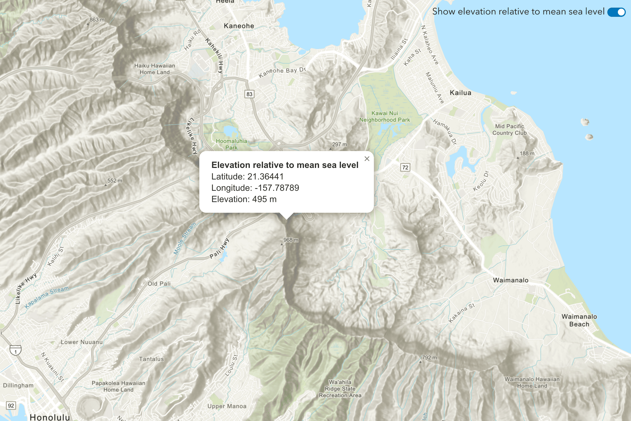
Find the elevation of a point
This example uses the /elevation/at-point request to get the elevation value of a point when you click on the map. The point contains a longitude and latitude that is passed to the service. The datum used in this example is mean to show elevation above mean sea level.
Steps
- Reference the Elevation service.
- Set the
lonandlatparameters to the longitude and latitude of the clicked point on the map. - Optionally, include the
relativeparameter with a value of eitherTo meanorSea Level ellipsoid. - Set the token parameter to your access token.
APIs
async function getElevationData(lon, lat) {
const url =
"https://elevation-api.arcgis.com/arcgis/rest/services/elevation-service/v1/elevation/at-point";
const response = await esriRequest(url, {
query: {
lon: lon,
lat: lat,
},
responseType: "json",
});
const { x, y, z } = response.data.result.point;
arcgisMap.popup = {
visibleElements: {
collapseButton: false,
closeButton: false,
actionBar: false,
},
};
const title = `Elevation relative to mean sea level`;
const content = `
Latitude: ${y.toFixed(5)}<br>
Longitude: ${x.toFixed(5)}<br>
Elevation: ${z} m`;
addPointToMap(lon, lat);
arcgisMap.openPopup({
location: [lon, lat],
content: content,
title: title,
});
}
REST API
# You can also use wget
curl -X GET https://elevation-api.arcgis.com/arcgis/rest/services/elevation-service/v1/elevation/at-point?lon=-179.99&lat=-85.05 \
-d "f=json" \
-d "token=<YOUR_ACCESS_TOKEN>"Tutorials
Find the elevation of a point
Find elevation value of a single location on land or water.