1. Define app functionalities
Before you start building your fully offline app, you need to define the functionalities you want to offer in your app. Your specific use case will determine the most suitable mobile data source for your application. Some questions to get you started are:
- Will you be working with preconfigured 3D scenes or 2D maps?
- Will you be editing data offline and synchronizing offline edits?
- Will you be geocoding, routing, or finding an address using a locator file?
Once you have outlined the requirements of your fully offline app, you can begin to prepare a mobile data source.
2. Prepare a mobile data source
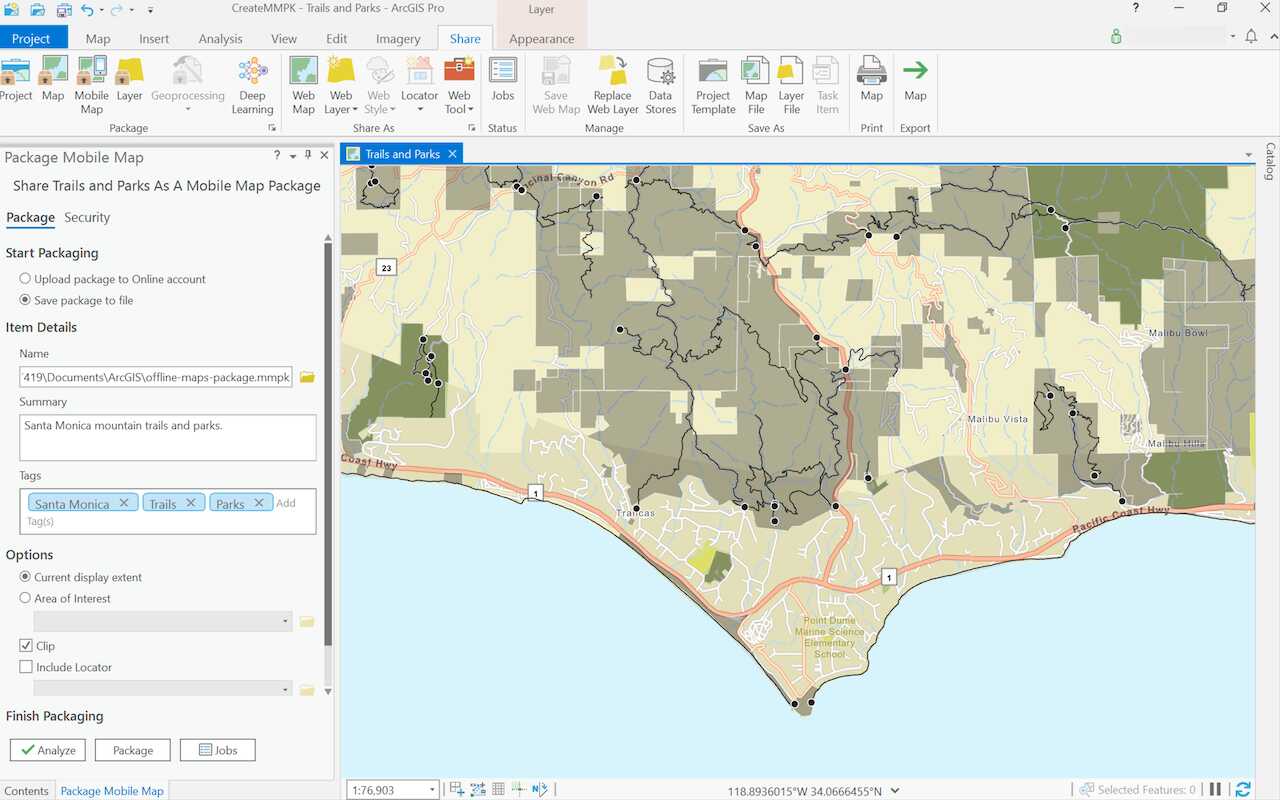
To start building a fully offline app, you first select a mobile data source as the foundation for your app. You can author an ArcGIS Pro project containing scenes or maps and export it as a mobile map package (.mmpk) or mobile scene package (.mspk) to use in your offline app. Alternatively, you can generate or download data files containing geospatial features to incorporate as a layer on your map or scene. Some types of supported data files by ArcGIS Maps SDKs for Native Apps include vector tile package, image tile package, geodatabase, and shapefiles.
Use the following table to help select your mobile data source.
| Mobile packages | Data files | |
|---|---|---|
| 2D maps | 1 | |
| 3D scenes | 2 | |
| Edit data while offline | 3 | |
| Synchronize offline edits | 4 | |
| Fully disconnected apps/devices | ||
| Offline geocoding | 5 | |
| Offline routing | 6 | |
| Offline analysis | ||
| Set expiration date for data access |
- 1. Map constructed in code
- 2. Scene constructed in code
- 3. Shapefiles, GeoPackages, and KML
- 4. Custom sideloading workflows required
- 5. Locator exported from ArcGIS Pro
- 6. Network Analysis dataset exported from ArcGIS Pro
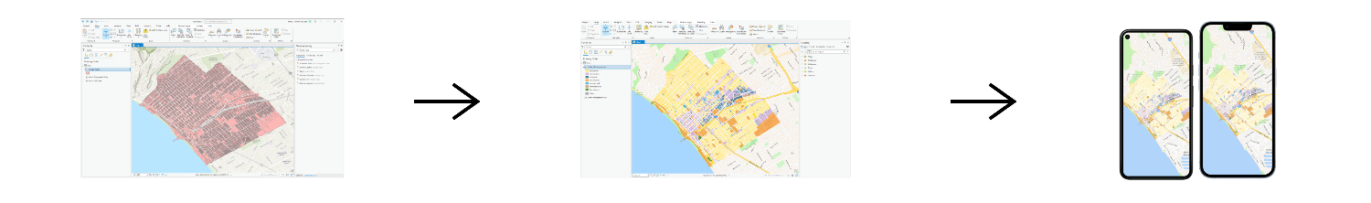
Once you select a mobile data source, the general steps to prepare the mobile data source are:
- Go to ArcGIS Pro.
- Start a new Map project if you are working with 2D maps. Or select a Global Scene or Local Scene project if you are working with 3D scenes.
- Set a basemap and add data into the project.
- Export the project into a mobile map package (
.mmpk) or mobile scene package (.mspk).
3. Build the app
Once you have prepared a mobile data source, you are ready to build an offline application. Use the ArcGIS Maps SDKs for Native Apps to create a fully offline app that runs on your preferred platform.
Example code to access data from a mobile data source in an offline app:
try
{
var mobileMapPackage = await MobileMapPackage.OpenAsync(path: "path\\to\\file.mmpk");
await mobileMapPackage.LoadAsync();
MainMapView.Map = mobileMapPackage.Maps.First();
}
catch(Exception ex)
{
// Handle error.
}