Adding files as new items to the portal is a simple process that allows you to upload various types of data, such as shapefiles, CSV files, imagery, and more. By adding these files as items, you can use the portal's mapping and analysis capabilities to visualize, analyze, and share spatial data. This process enhances data accessibility, and helps with collaboration and decision-making across organizations by adding and sharing geospatial information in ArcGIS.
Supported file types
Various types of files can be added to the portal including:
- Shapefiles (.shp).
- CSV files (.csv).
- TXT files (.txt).
- GPX files (.gpsx).
- Raster datasets (.tiff, .png, .jpg, etc.).
- Vector tile packages.
- Scene layer packages.
These files can be used to create layers and maps using Map Viewer enabling users to visualize and analyze geospatial data. Additionally, the supported data types support a wide range of formats such as:
- CAD datasets.
- Excel worksheets.
- LAS datasets.
- Function rasters.
- TIN datasets.
The flexibility in supported file types allows users to work with various data sources and formats to enhance their spatial analysis and mapping capabilities.
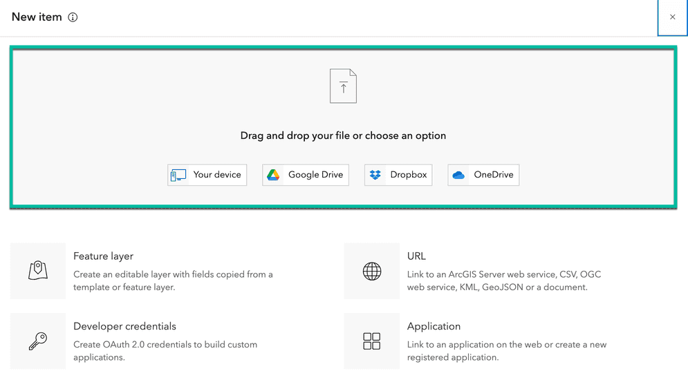
How to add files
Below is an example of adding a Microsoft Excel spreadsheet to the portal.
To add an Excel file, you can follow these step-by-step instructions:
- Click Contents > New Item.
- You can either drag and drop the Excel file you want to add or choose it from your device by browsing to its location.
- Verify the location fields in the Excel file have been correctly identified.
- For example: Ensure longitude and latitude information or address information is correctly configured.
- Provide information for the Excel file like
title,tags, andsummary. - Select a folder where you want to save the item in your account.
- Save the changes.
Services
API support
- 1. Limited operations, use HTTP requests.
- 2. Access via ArcGIS REST JS.
Tools
Use tools to access the portal and create and manage content for applications.