What are items?
An item, also known as a content item, refers to a fundamental unit of content in the portal service. It can represent a wide range of spatial information, such as maps, layers, styles, tools, applications, files, data sources, or notebooks. Each item in the portal is associated with metadata, which includes information like the item's title, description, tags, and thumbnail. Items are important components that enable users to organize, share, and collaborate on spatial data.
Items in portal are created when content is added to the portal by users or shared with them by others. Items can contain various types of data, such as spatial datasets, imagery, web maps, and web apps. Once uploaded or created, items can be used in web map, web scenes and apps, allowing users to visualize and analyze information. Users can search for specific items using keywords, tags, or categories, making it easier to discover relevant content in the portal.
Certain items can be created during the content creation process:
- Running an analysis tool can produce a layer item containing results.
- Creating dashboards, templates in other apps, or saving maps or scenes results in items saved in the organization.
- Adding files to Map Viewer also creates items.
If the content already exists elsewhere, you can add this content to your organization making it accessible as an item. Existing content can be a file on a server, a service on the internet or an organization's intranet, or an app or file accessible via a URL.
Why use items?
You can use an item to:
- Securely store different types of content in the portal.
- Manage all properties and capabilities of the content.
- Share content with different users and groups.
- Access data and services.
Supported item types
Many different types of items can be stored in the portal, including maps, layers, styles, tools, applications, files, data services, or notebooks. Each item has a set of properties that describe and reference the content. For items that reference content that can be stored as text, such as a web map, the JSON data is stored in a child data source. For items that reference services, properties such as the URL are stored, and depending upon the type of service, child data may also be stored with the item such as a renderer or pop-up configuration.
Below is a list of some of the more common content item types, the label used in ArcGIS Online and ArcGIS Enterprise, and the data type.
| Type | Label | Data Type | Description |
|---|---|---|---|
Web Map | Web map | Text/JSON | A map with its configuration stored as a JSON structure. |
Web Scene | Web scene | Text/JSON | A scene with its configuration stored as a JSON structure. |
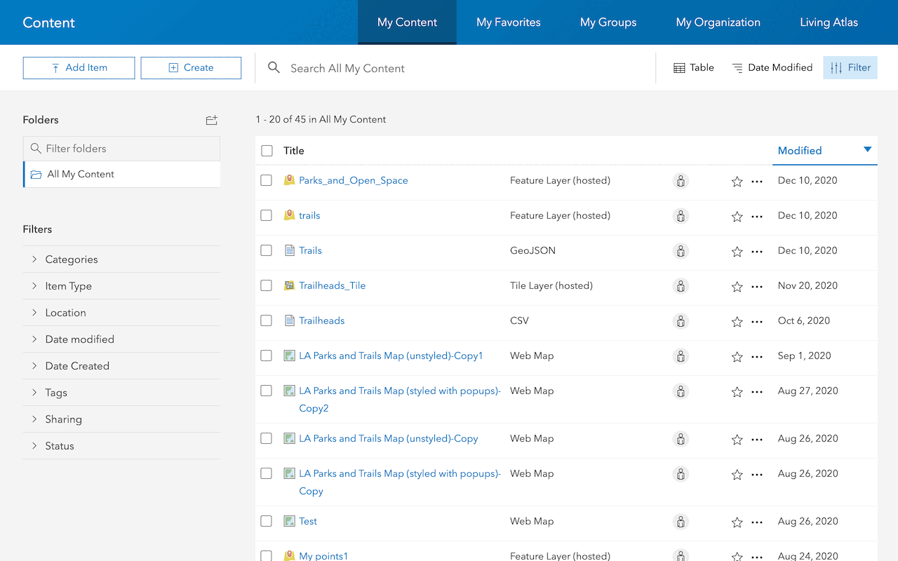
Feature Service | Feature Layer (hosted) | Text/JSON | A hosted layer that references a feature layer in a feature service. |
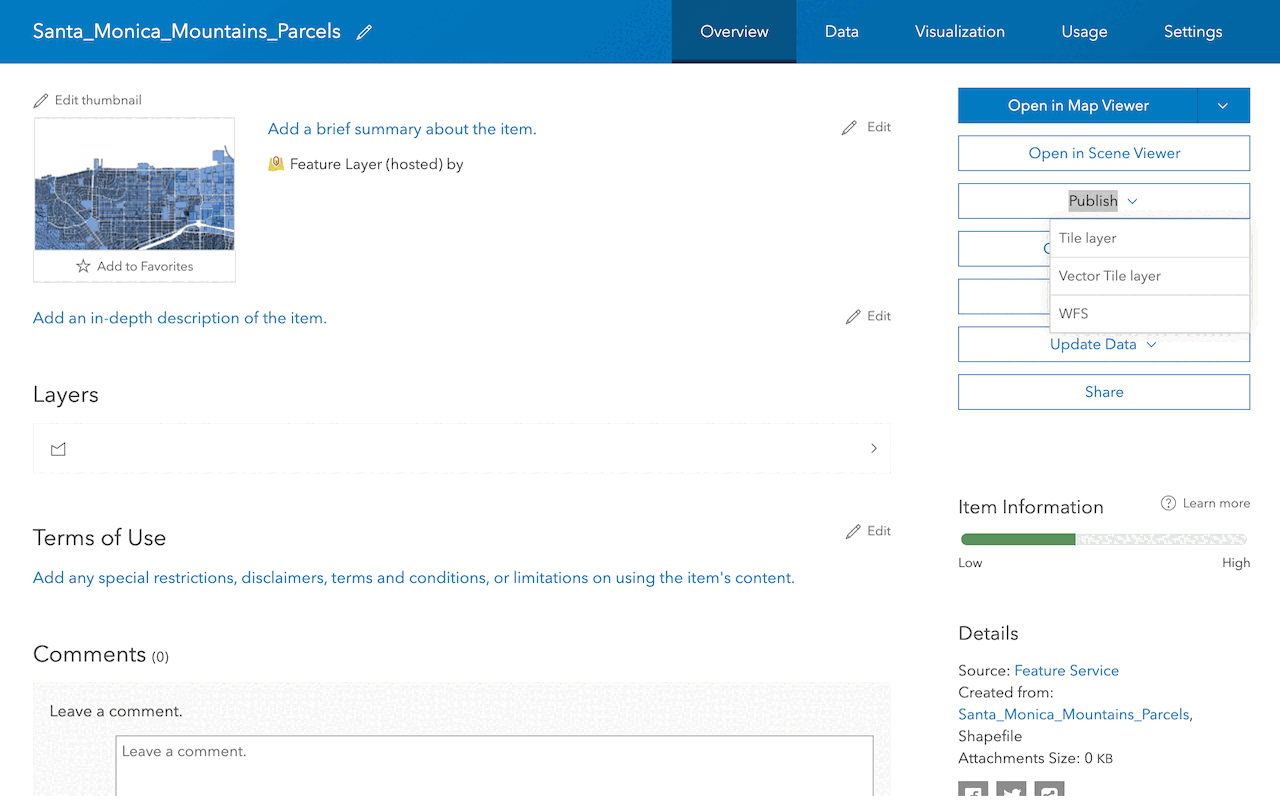
Vector Tile Service | Tile Layer (hosted) | Text/JSON | A hosted layer that references tile data and styles for a vector tile service. |
Map Service | Tile Layer (hosted) | Text/JSON | A hosted layer that references static tile data in a Map service. |
CSV | CSV | File | A reference to a file that contains comma separated values. |
Shapefile | Shapefile | File | A reference to a zipped file that contains a shapefile. |
Another supported item type is developer credentials. Developer credentials are an item created in your portal that contain parameters used in authentication. Below are the two supported developer credential types you can create.
| Type | Description |
|---|---|
AP | Type of developer credentials used to implement API key authentication. |
O | Type of developer credentials used to implement User authentication and App authentication. |
Item properties
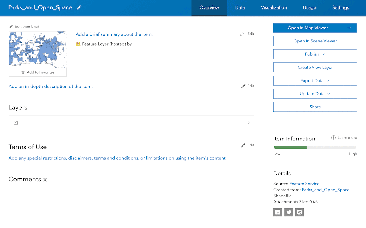
All items contain a common set of properties such as the owner, title, type, tags, thumbnail, and description. These properties are common to all types of items and are set when the item is created. The properties are also used to search for the item.
When an item is created, it is assigned a unique identifier, also known as an item ID. You can use an item ID to find and directly access an item and its content in the portal.
Items that reference services can be used to manage the properties and capabilities of that service. For example, you can use a hosted feature layer item to store the pop-up and styling information for a hosted feature layer. It can also be used to set the editing capabilities for the feature layer in the feature service.
An item's sharing permissions can also be set with its access property, so that it can be accessed by only its owner (private), the members of an organization (org), or everyone (public).
These properties are typically set using an item page. See Manage an item for more details.
Tutorials
Use tools to create different types of content and build content-driven applications.
Web maps
Display a web map
Create and display a map from a web map.
Web scenes
Display a web scene
Create and display a scene from a web scene.
Feature layers
Import data to create a feature layer
Use data management tools to import files and create a feature layer in a feature service.
Manage a feature layer
Use a hosted feature layer item to set the properties and settings of a feature layer in a feature service.
Add a feature layer
Access and display point, line, and polygon features from a feature service.
Vector tile layers
Create a vector tile service
Use data management tools to create a new vector tile service from a feature service.
Add a vector tile layer
Access and display a vector tile layer in a map.
Basemap layers
Create a custom basemap style
Display a custom basemap style
Add and display a styled vector tile basemap layer.
Services
API support
- 1. Limited operations, use HTTP requests.
- 2. Access via ArcGIS REST JS.
Tools
Use tools to access the portal and create and manage content for applications.
ArcGIS Enterprise
Create, manage, analyze, and share data, maps, and applications in your organization.
Portal
Create, manage, and access content and data services for applications.
Map Viewer
Create, explore, and share web maps for 2D applications.
Scene Viewer
Create, style, and explore web scenes.
Vector Tile Style Editor
Create styles for basemap and vector tile layers.
Content management tools
Create, manage, organize, and share items in a portal.
Data management tools
Import data and create hosted layers and data services. Upload and manage documents, images, and other files.
Spatial analysis tools
Perform feature and raster analysis to create new datasets with the Map Viewer.
Developer credentials tool
Create API key and OAuth 2.0 developer credentials for custom applications.
Items
Manage and share items.
ArcGIS Pro
Create, style, and explore maps and scenes.
Geoprocessing tools
Import, manage, and analyze data.