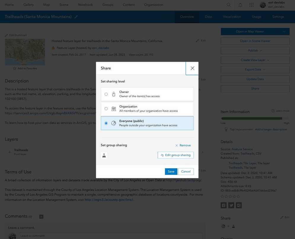
What is sharing?
Sharing is the process of making content, such as web maps, layers, and web apps, in ArcGIS Online or ArcGIS Enterprise accessible to others. The sharing capability helps with collaboration among users within the same ArcGIS organization or across different organizations. By configuring the share setting on an item, you can secure both the item in a portal and the underlying data in the data service.
Why share?
You share an item in a portal to:
- Change the discoverability of an item in a portal.
- Make an item private or public.
- Give specific groups of users or an organization access to an item.
- Require data services to be accessed with an access token.
Types of sharing levels
The following is a list of the sharing levels available for the different types of ArcGIS products:
- Owner (private): Only the owner has access. The hosted layer (item) and data service are private and will not be visible or accessible to others. A valid access token or scoped API key is required. Learn more about scoping items to an API key in API keys.
Tutorials
Import data to create a feature layer
Use data management tools to import files and create a feature layer in a feature service.
Define a new feature layer
Use data management tools to define and create a new empty feature layer in a feature service.
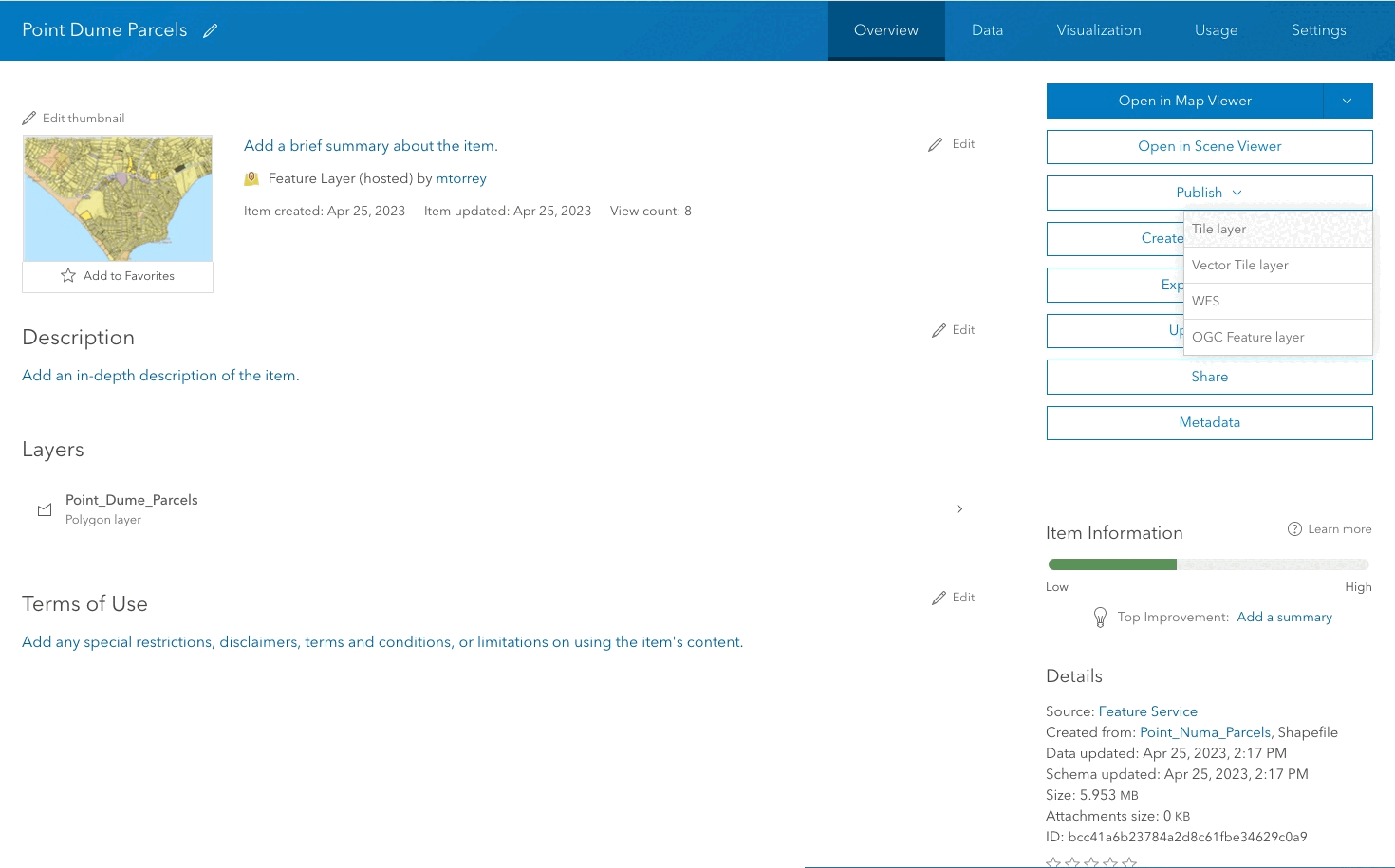
Manage a feature layer
Use a hosted feature layer item to set the properties and settings of a feature layer in a feature service.
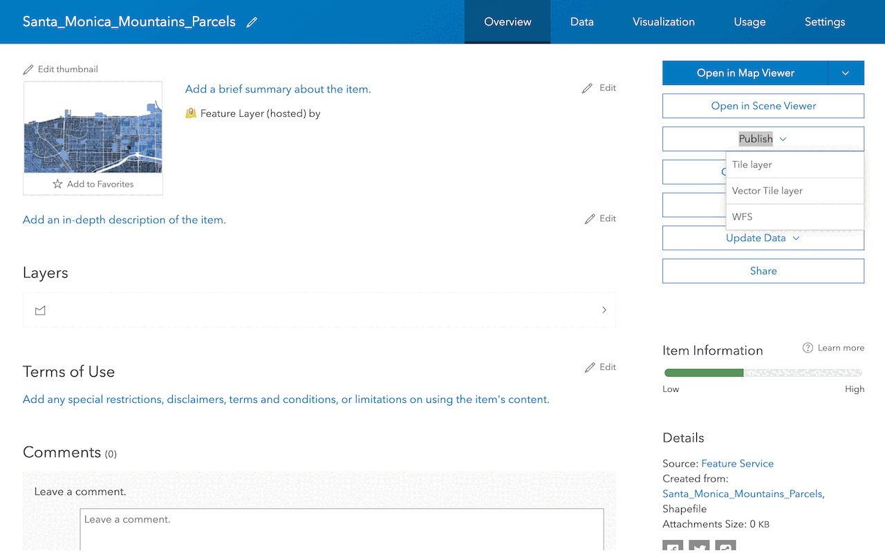
Create a vector tile service
Use data management tools to create a new vector tile service from a feature service.
Create a map tile service
Use ArcGIS Online or scripting APIs to publish a map tile service.
Workflows
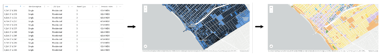
Create a feature service for an app
Learn how to import parcel data, create and style a feature layer, and then access the features in an app.
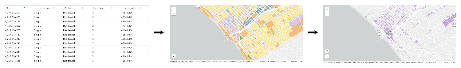
Create a feature layer view for an editor app
Learn how to import parcel data, create and style a feature layer view, and then access the features in an editing app.
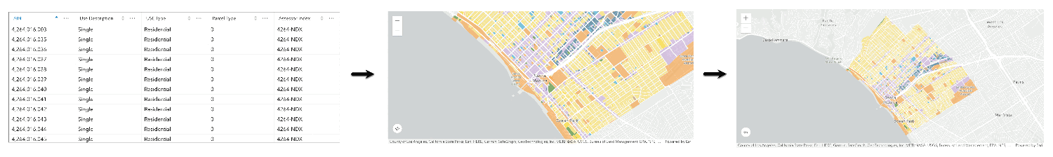
Create a vector tile service for an app
Learn how to import parcel data, style a feature layer, and then create a vector tile service for an app.
Create a map tile service for an app
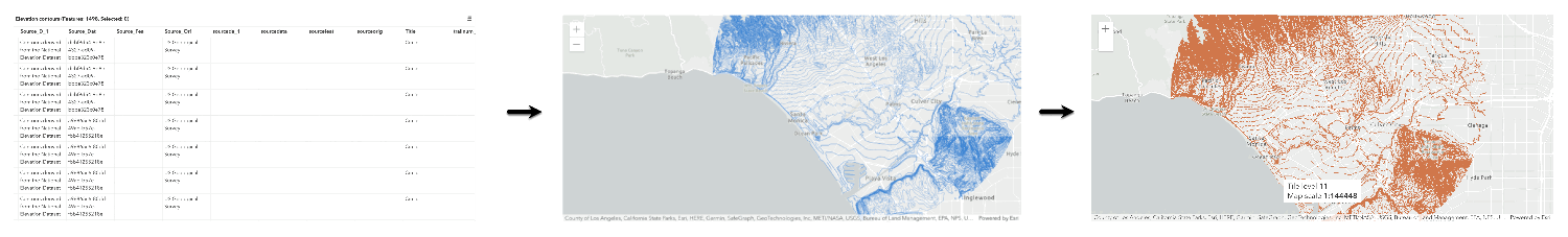
Learn how to import contour data, style a feature layer, and create a map tile service for an app.
Services
Feature service
Add, update, delete, and query feature data.
Vector tile service
Store and access vector tile data.
Map tile service
Store and access map tile data.
Image service
Store and access imagery and raster data.
API support
Use data management tools or Client APIs to create, manage, and access data services. The table below outlines the level of support for each API.
- 1. Use portal class and direct REST API requests
- 2. Access via ArcGIS REST JS
- 3. Requires manually setting styles for renderers