The ArcGIS portal service enables the creation of two main types of applications:
- Admin apps focus on organizing and securing geospatial data, implementing access controls, version management, and metadata organization.
- Content-driven applications leverage curated data to create interactive maps, dashboards, and custom applications, enhancing user engagement and enabling data-driven decision-making.
Admin apps
A content management application is a tool designed using client APIs or REST APIs, enabling direct interaction with the portal service. Developers utilize these APIs to create applications that can efficiently perform fundamental operations. These operations include:
- Creating new geospatial items
- Accessing existing resources
- Managing users permissions and groups within the portal.
By automating tasks such as data creation and user management, these applications simplify the process of organizing and securing geospatial data. Content management applications streamline essential functions, ensuring the portal's content remains well-organized and accessible.
Example apps
You can build applications that:
- Search for public or private content.
- Create new items.
- Manage and update item properties.
- Organize content.
- Create groups, assign users, and share items.
- Update an item's content.
Workflows
The general steps for building content management applications are:
- Connect to the portal service at https://www.arcgis.com/sharing/rest.
- Make requests to the portal service. An access token may be required.
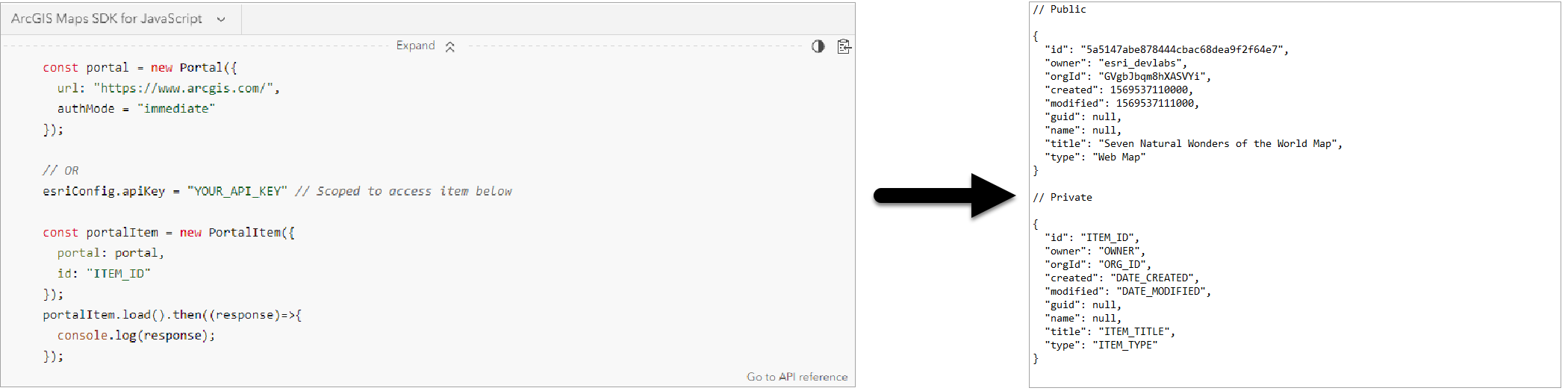
Access token are required to make requests to restricted operations in the portal service, such as accessing private content or creating new content. In most cases, you will need to use an OAuth 2.0 token because API keys only provide access to private content such as feature layers and vector tile layers. To access all other restricted operations, an OAuth 2.0 token is required.
Content-driven applications
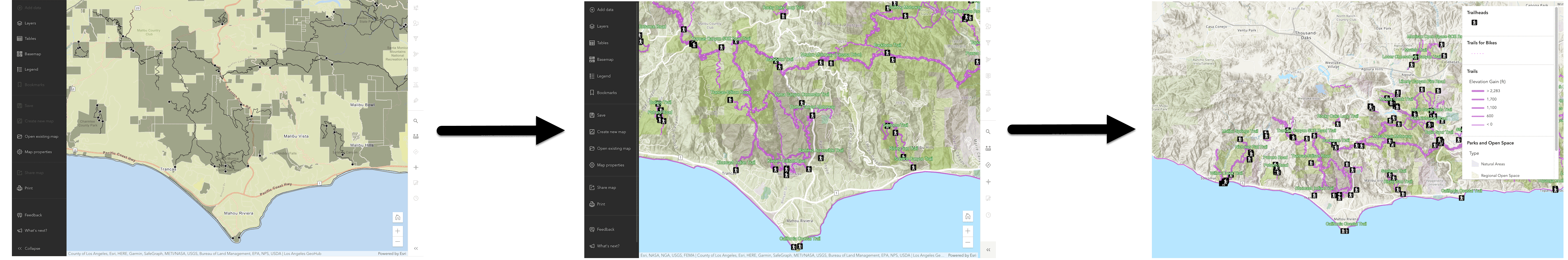
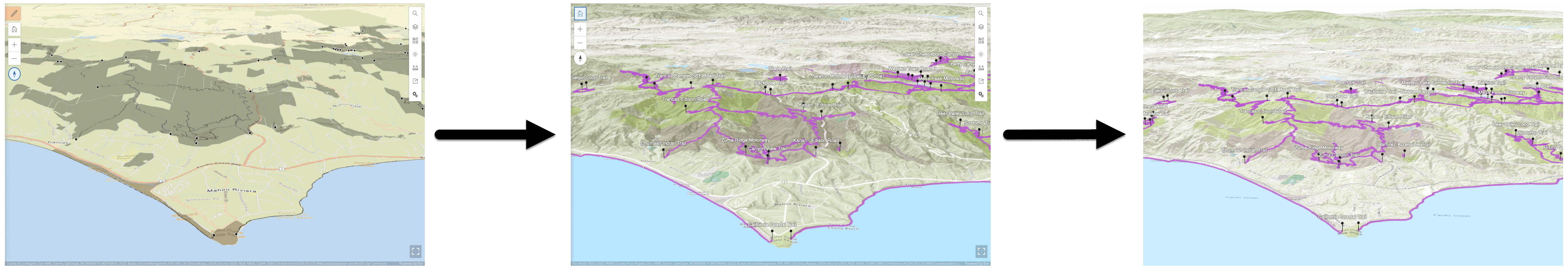
Content-driven applications are created through a practical approach called the tools-first workflow. This method prioritizes efficiency and user-friendly development. Initially, developers use interactive tool like the portal to design content within the portal. These tools offer intuitive interfaces allowing users to create detailed maps and datasets without diving into complex coding.
Once the content is authored in the portal, developers can focus on building customized web applications that access this existing content. This approach significantly reduces development time and complexity. Instead of starting from scratch, developers can use the pre-made content available in the portal in their apps.
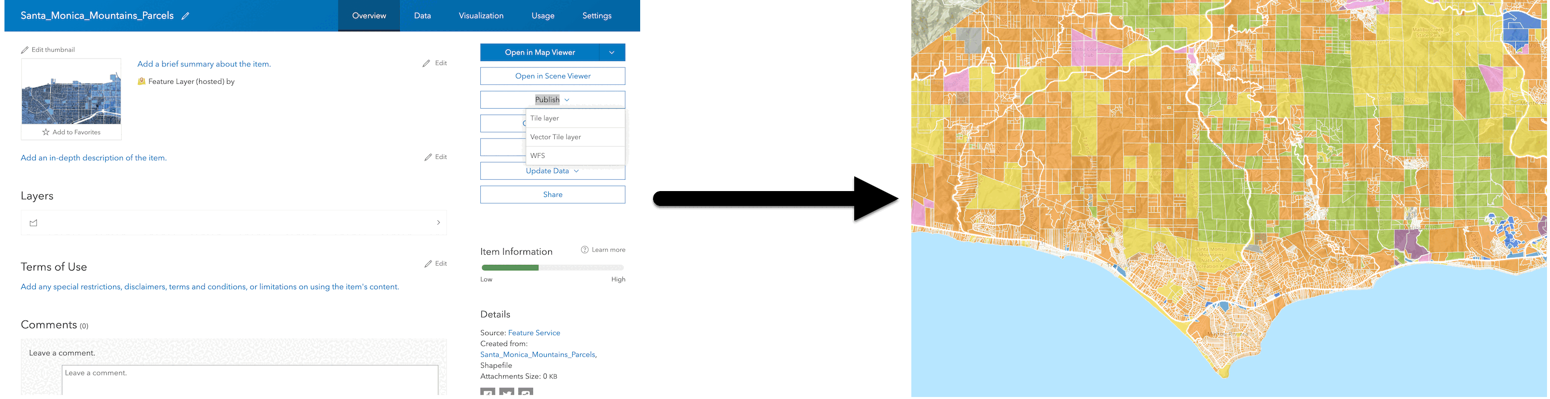
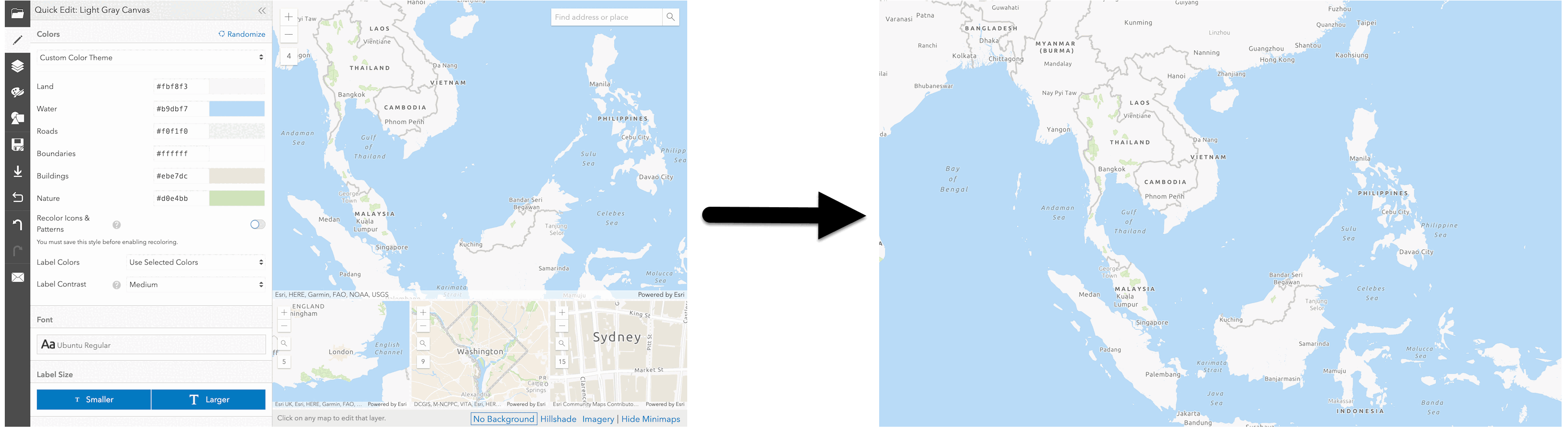
For instance, creating and styling a web map becomes much simpler when done using the Map Viewer. It is far easier to then display this pre-styled map in a web app rather than having to write extensive code to create and style the entire map from scratch. This approach streamlines the development process, making it more efficient and less time-consuming.
Example tools
Tools that can create content for applications are:
- Map Viewer: Create and style layers in a web map.
- Scene Viewer: Create and style layers in a web scene.
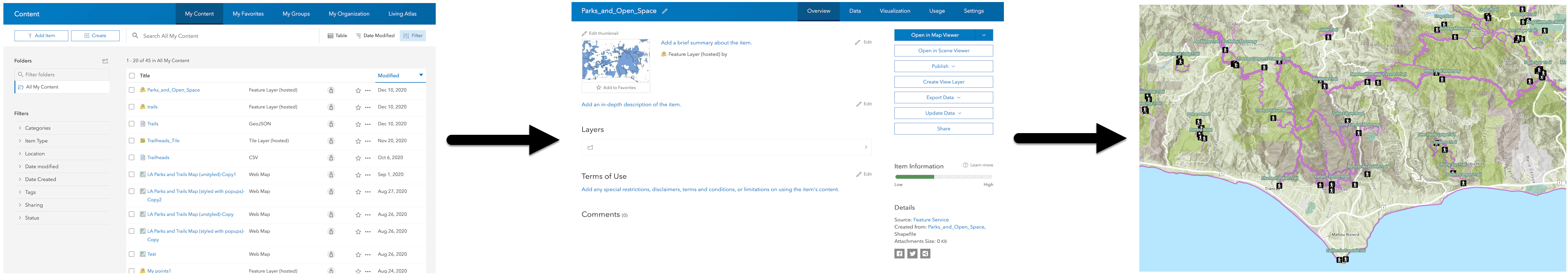
- Portal: Import data as a feature layer and set its properties, publish a vector tile layer.
- ArcGIS Vector Tile Style Editor: Style a basemap layer.
Workflows
The general steps for building content-driven applications are:
- Create content such as a web map, web scene, or hosted layer with tools.
- Manage the content items with tools.
- Access the content items with a custom application.
Create and access a web map
Learn how to create and display a web map.
Create and access a web scene
Learn how to create and display a web scene.
Create and access a feature service
Learn how to create and display a feature service.
Create and access a vector tile service
Learn how to create and display a vector tile service.
Create and access a custom basemap style
Learn how to create and display a custom basemap style.
Services
API support
- 1. Limited operations, use HTTP requests.
- 2. Access via ArcGIS REST JS.
Tools
Use tools to access the portal and create and manage content for applications.
ArcGIS Enterprise
Create, manage, analyze, and share data, maps, and applications in your organization.
Portal
Create, manage, and access content and data services for applications.
Map Viewer
Create, explore, and share web maps for 2D applications.
Scene Viewer
Create, style, and explore web scenes.
Vector Tile Style Editor
Create styles for basemap and vector tile layers.
Content management tools
Create, manage, organize, and share items in a portal.
Data management tools
Import data and create hosted layers and data services. Upload and manage documents, images, and other files.
Spatial analysis tools
Perform feature and raster analysis to create new datasets with the Map Viewer.
Developer credentials tool
Create API key and OAuth 2.0 developer credentials for custom applications.
Items
Manage and share items.
ArcGIS Pro
Create, style, and explore maps and scenes.
Geoprocessing tools
Import, manage, and analyze data.