What are content management tools?
Content management tools are the functionalities in a portal that you use to create and manage content and data for your custom applications. These tool are located in the content manager page which provides a centralized location for you to browse, search, and manage various types of geospatial content in your organization. Here are the key features and functionalities:
You use the content manager page to:
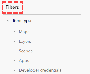
- Browse and organize content using the tabs below:
- Search for items using keywords. Apply additional filters like item type, date range, and categories to refine search results.
- Manage items you own. You can view, edit, move, and delete items in your organization.
- Share items with groups for team collaboration. Configure sharing settings to allow public access or restrict to specific users/groups.
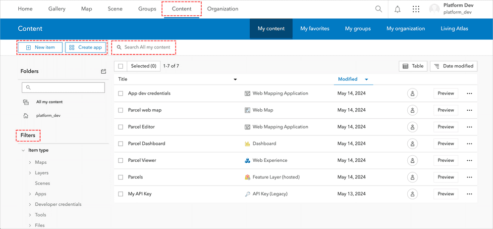
Tools
The content manager page allows you to manage and organize geospatial data and resources. You can upload, create, and store various types of content such as maps, layers, applications, and files. Additionally, the content manager page provides options for sharing content with others, setting permissions, and managing item details and metadata. This functionality supports data management and collaboration in portal.
The section below introduces tools you can use to manage content and data in your portal.
Tabs
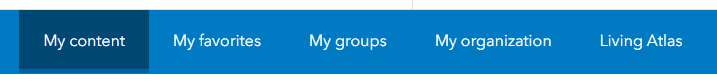
Portal features several tabs to allow developers to manage and use geospatial data. Below is information on each tab.
Tab name | Description |
|---|---|
| My Content | A personalized workspace where users can manage their geospatial content. It allows users to create, upload, organize, and share various items, such as maps, layers, applications, and files. This tab provides tools for categorizing and tagging content, setting sharing permissions, and editing item details. It serves as a central repository for all the user's data and resources. |
| My Favorites | Bookmark and access frequently used items quickly. Users can mark maps, layers, applications, and other geospatial content as favorites, making it easier to locate and reuse these resources. This tab provides a streamlined way to organize and retrieve important content. |
| My Groups | Manage and interact with groups they belong to or have created. This tab provides access to group content, collaboration tools, and settings for group management. Users can view shared maps, layers, and other resources within their groups, invite new members, set permissions, and configure group properties. Learn more in Administration tools > Groups. |
| My Organization | Administrative tools and insights for managing an organization. It allows administrators to oversee user accounts, roles, and permissions, monitor usage and credits, and manage content and data sharing policies. This tab also offers access to organization settings, security configurations, and custom branding options. Learn more in Administration tools > Organization. |
| Living Atlas | Access curated collection of high-quality, authoritative maps, layers, and data from Esri and other contributors. This includes a variety of geographic information, such as demographic data, environmental layers, basemaps, and more, which can be used for analysis, visualization, and mapping projects. Users can browse, search, and integrate Living Atlas content into their own maps and applications. Learn more about Living Atlas of the World. |
Search and filter content
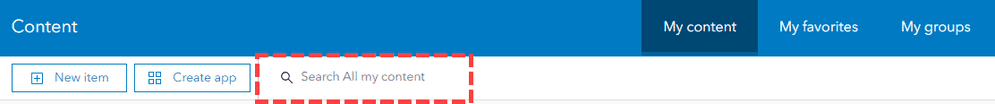
In My Content tab, users can search for specific geospatial items using keywords, filters, and sorting options. This functionality helps in quickly locating maps, layers, applications, and other resources stored in their account.
Advanced filters allow further refinement of search results by item type, date modified, and sharing status, ensuring precise retrieval of content. Sorting options, such as by relevance or date, enhance the ability to locate items efficiently.
New item tool
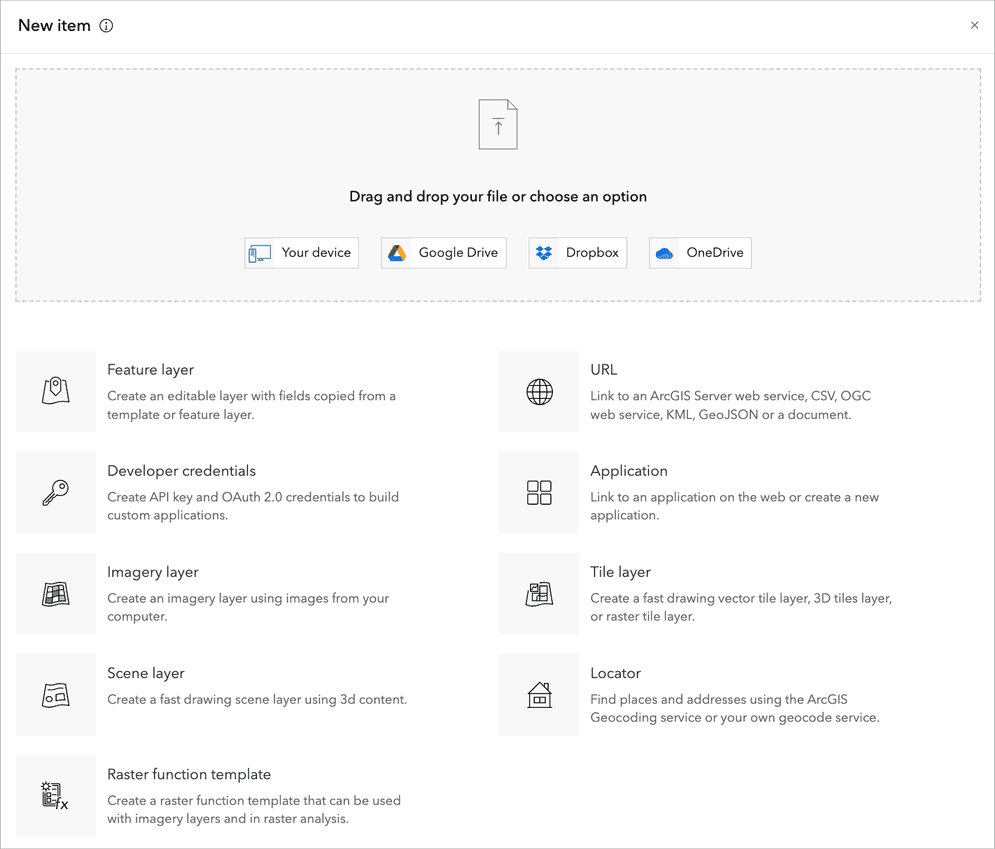
The New Item tool in portal allows you to create and add various types of content to your organization. You can upload files, such as shapefiles, CSVs, and images, or create new items like web maps, feature layers, and applications. You access the new item tool by creating a new item: Content > My Content > New item.
Create app tool
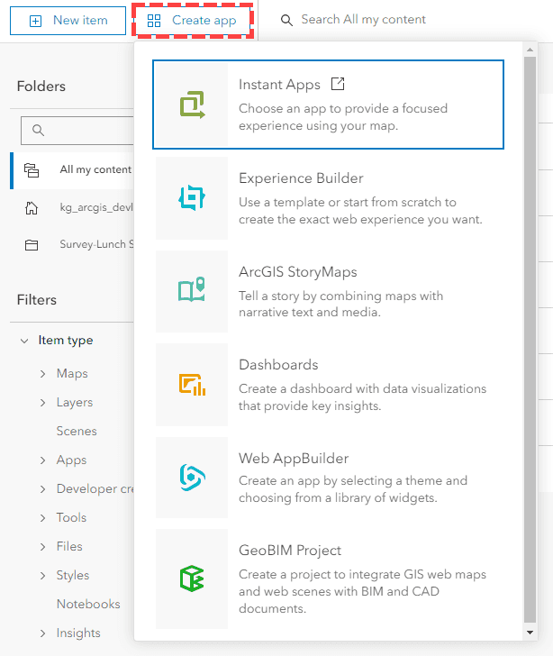
The Create app enables users to convert geospatial data into interactive applications. This feature provides access to low-code/no-code customizable templates and workflows for integrating maps, data visualizations, and geospatial analyses into functional web and mobile applications. Developers can create low-code/no-code web apps such as ArcGIS Instant Apps, ArcGIS Experience Builder, and ArcGIS Dashboards.