ArcGIS is a secure system that only allows authorized users and applications to access secure resources. As a developer, you can build applications that use authentication to access secure resources such as a portal, data services, or location services. ArcGIS supports three types of authentication: API key authentication for building public apps with location services; user authentication for creating private apps for your organization; and app authentication for creating server-enabled applications that work with ArcGIS Enterprise resources. The type of authentication you implement depends on the requirements of your application and whether you want users to sign in or not with an ArcGIS account.
What's in this guide
This guide shows you how to access secure resources with the following types of authentication:
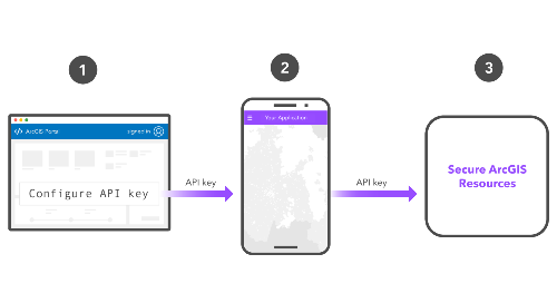
- API key authentication
- User authentication
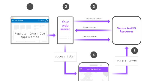
- App authentication


Learn about authentication
Introduction to authentication
Learn how ArcGIS uses authentication to protect secure resources.
Types of authentication
Learn about the different types of authentication and their billing methods.
How to use authentication
Learn how to use authentication to get an access token.
API key authentication
Create a long-lived access token to quickly implement authentication.
User authentication
Prompt users to sign in with ArcGIS to access resources on their behalf.
App authentication
Request access tokens for your application using a set of OAuth credentials.
Best practices
Learn about the security best practices recommended for authentication in custom apps.