Spatial analysis is the process of using analytical techniques to find relationships, discover patterns, and solve problems with geographic data. The goal of every analysis is to turn data into information. Most analyses involve using your data as input, executing one or more operations, and then visualizing the output data on a map. Geometry analysis is a client-side calculation performed on two or more geometries. Feature analysis is a server-side process performed on one or more feature layers. Raster analysis is a server-side or client-side analysis on raster data. 3D visual analysis is a client-side analysis of terrain and objects.
To learn how to perform these analyses, go to the topics below.
Geometry analysis
Client-side analyses on point, polyline, and polygon geometries using the ArcGIS Maps SDK for JavaScript, ArcGIS API for Python, and ArcGIS Maps SDKs for Native Apps.
Introduction
Introduction to geometry analysis and the types of problems you can solve.
Types of geometry analysis
Explore the different types of geometry operations.
How to perform geometry analysis
Learn the steps to perform a geometry analysis.
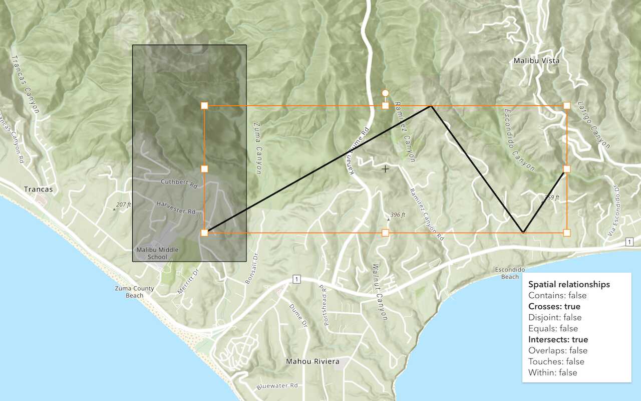
Spatial relationship
Determine the topological relationships between two shapes.
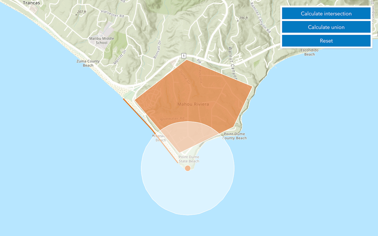
Calculation
Perform geometric calculations such as buffer, intersect, or union.
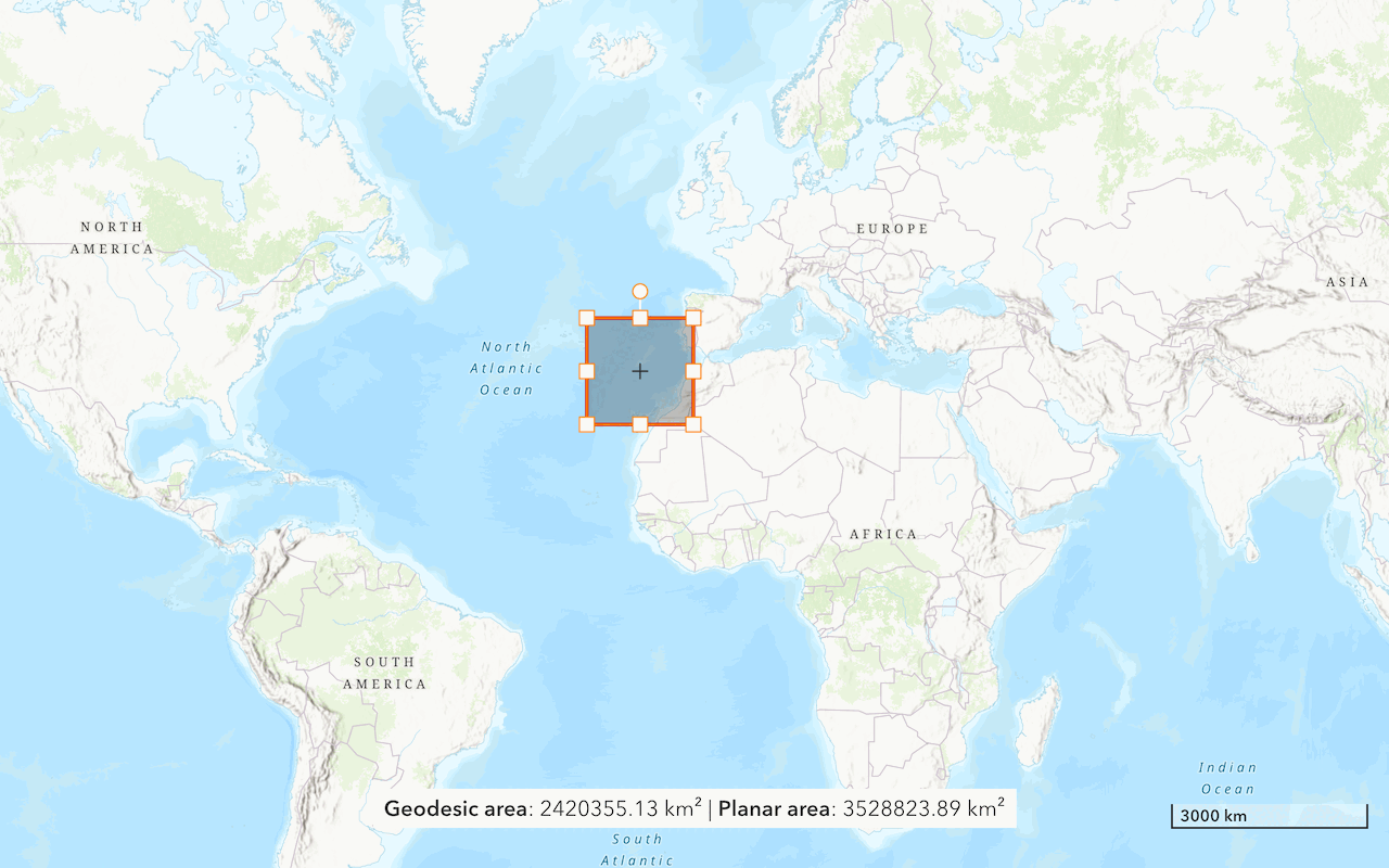
Distance and area
Calculate distance and area for geometric shapes.
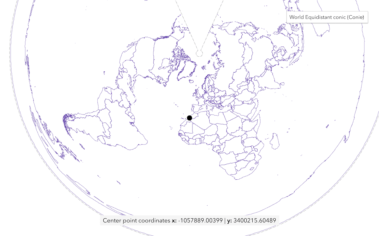
Projection
Project geometric shapes to new coordinate systems.
Feature analysis
Server-side analyses on feature data to find relationships and patterns using the spatial analysis service, ArcGIS API for Python, ArcGIS REST JS, and ArcGIS REST API.
Introduction
Introduction to feature analysis and the types of problems you can solve.
Types of feature analysis
Explore the different types of feature analysis operations.
How to perform feature analysis
Learn the steps to perform a feature analysis with ArcGIS tools and APIs.
Find data
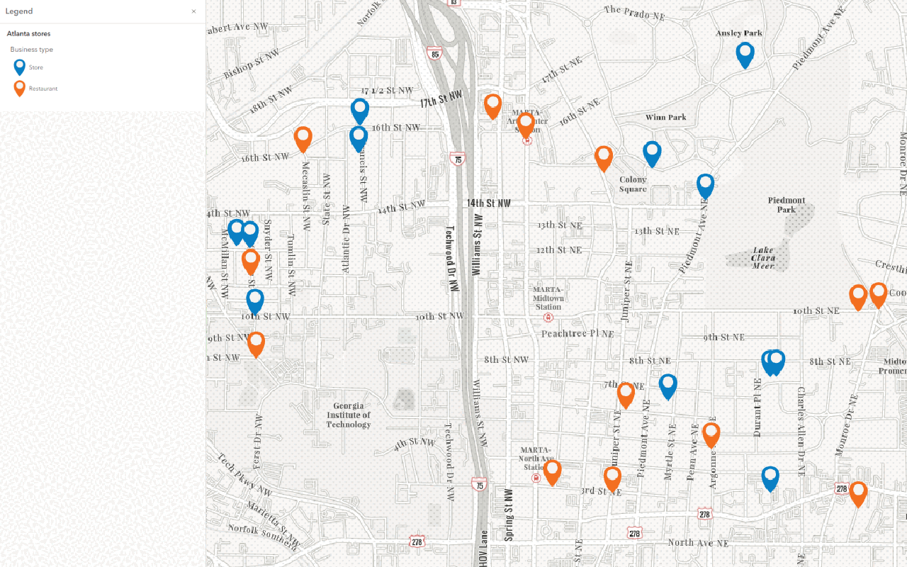
Find and extract features using SQL, spatial queries, and other techniques.
Combine data
Overlay (merge or intersect) two feature collections.
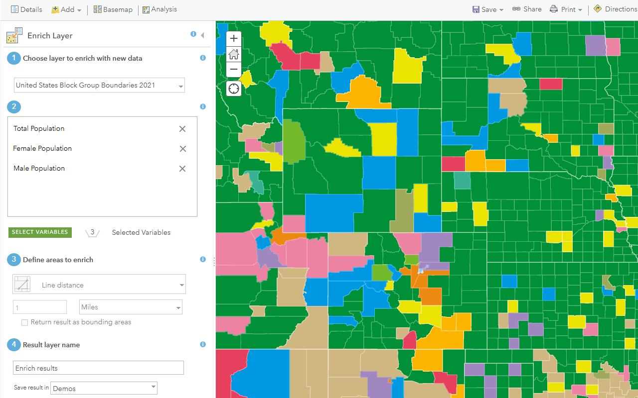
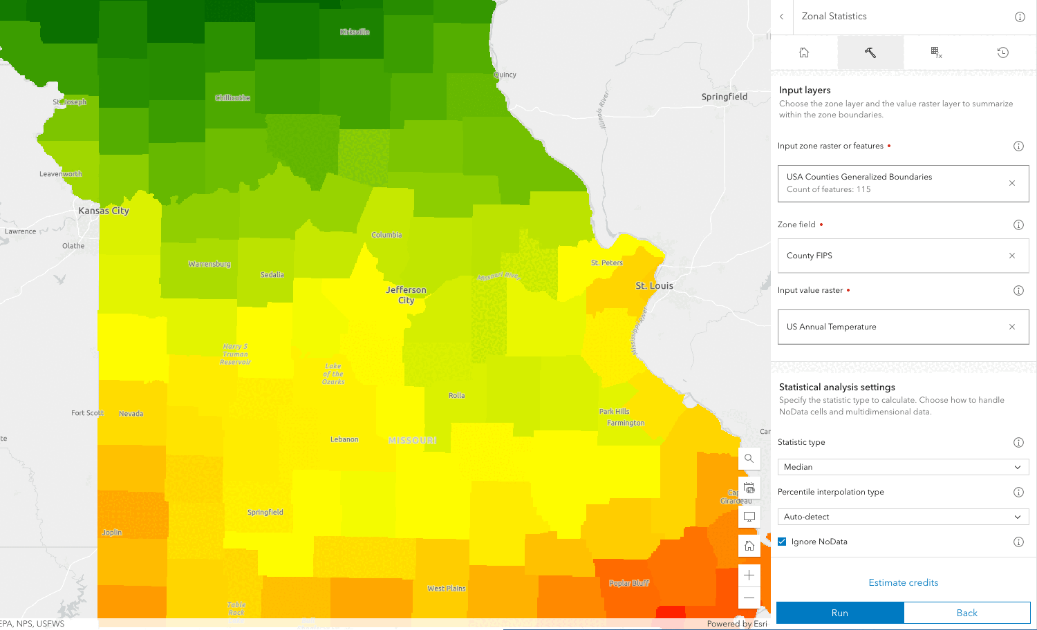
Summarize data
Aggregate, join, or find features near other features.
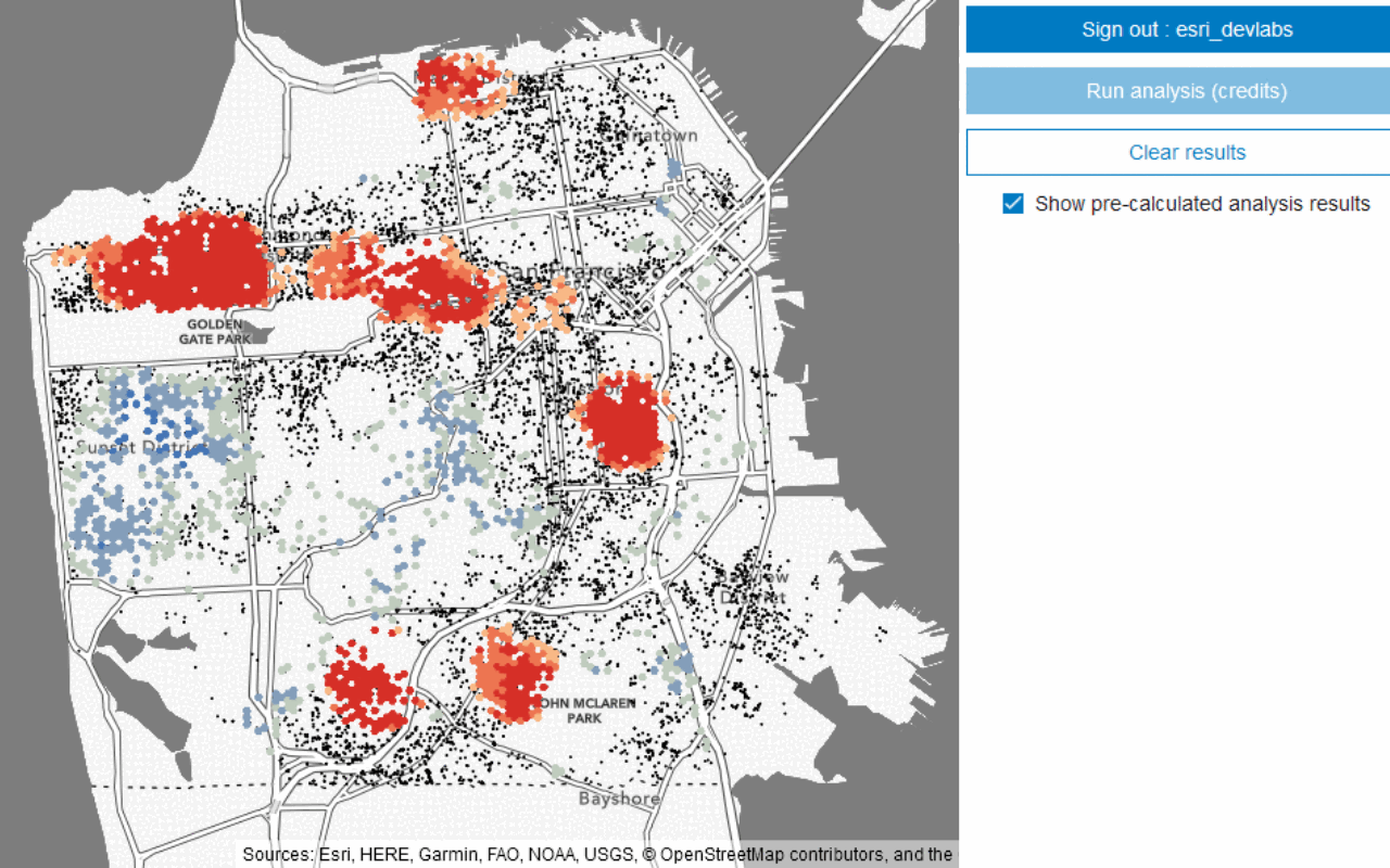
Analyze patterns
Find patterns in data using hot spot, cluster, tessellation, and interpolation operations.
Calculate geometries
Buffer, find centroids, or create tessellations from feature collections.
Raster analysis
Server-side analyses on raster data to derive new information and gain insights using the raster analysis service.
Introduction
Introduction to raster analysis and the types of problems you can solve.
Types of raster analysis
Explore the different methods avialable to perform raster analysis.
Raster data
Learn how to find or create data to use in analysis.
Raster operations
Learn how to use raster operations to perform analysis.
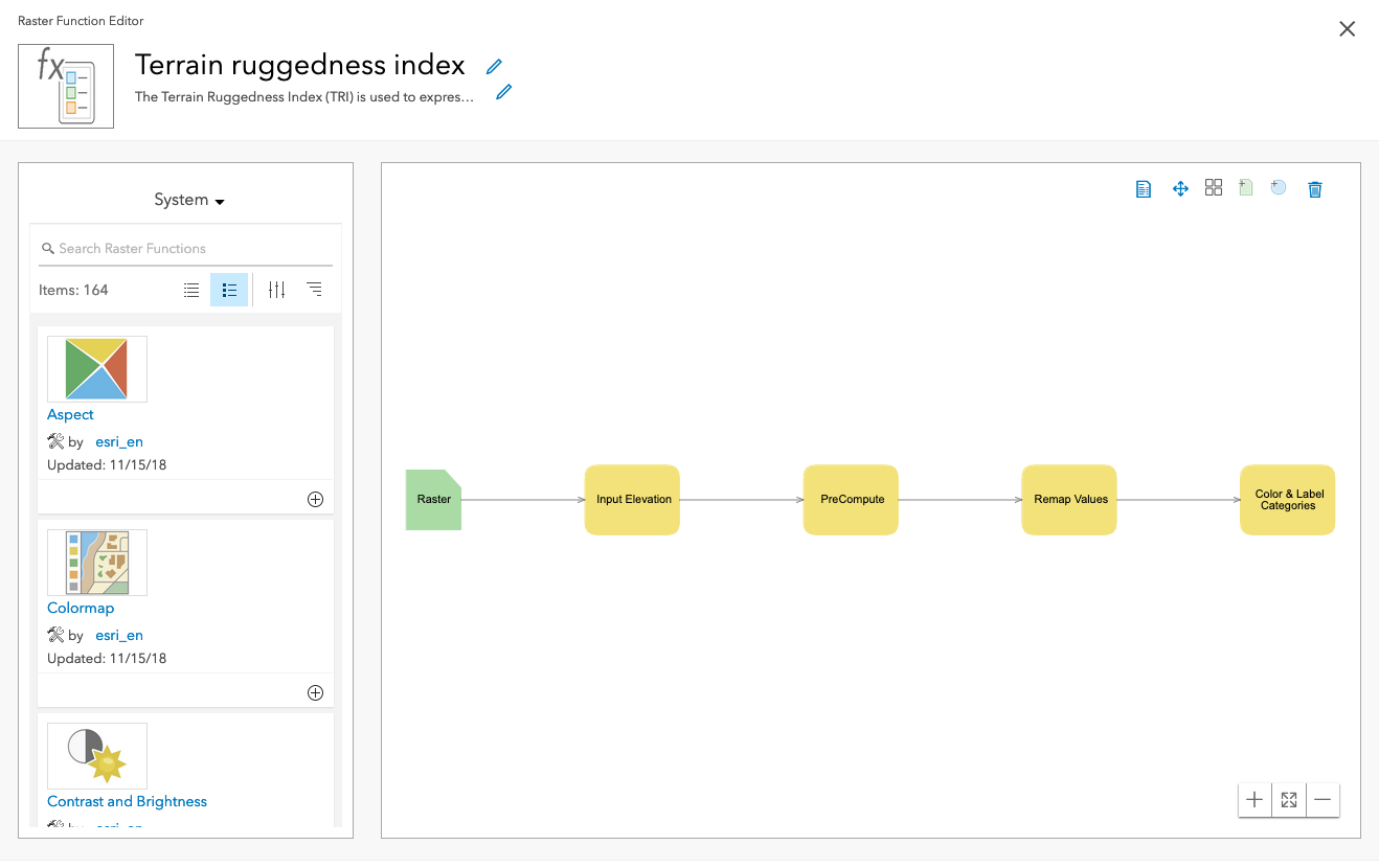
Raster functions
Learn how to use raster functions to perform analysis.
3D visual analysis
Client-side 3D analysis on terrain and objects using the ArcGIS Maps SDK for JavaScript and ArcGIS Maps SDKs for Native Apps.
Introduction
Introduction to 3D visual analyses and the types of problems you can solve.
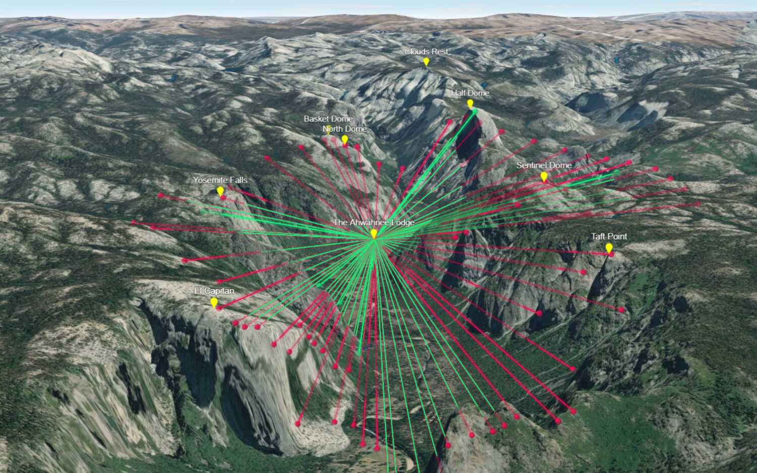
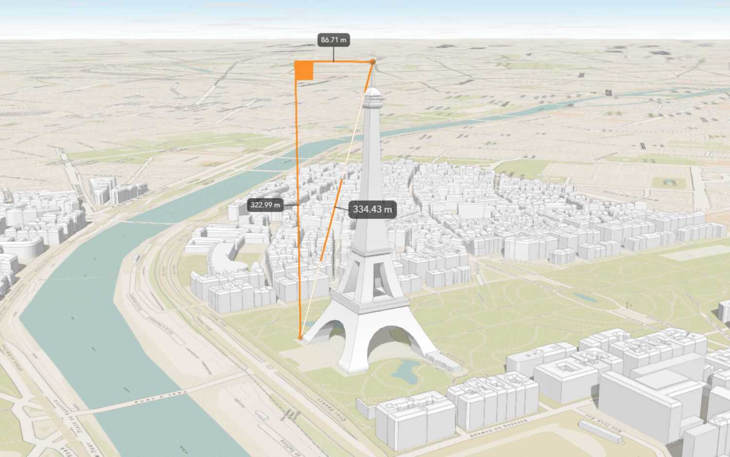
Line of sight
Create a 3D line of sight.
Distance measurement
Create a 3D distance measurement.
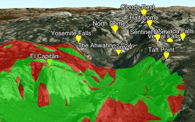
Viewshed
Create a 3D viewshed.
Tutorials
Learn how to perform spatial analyses interactively with the Map Viewer and programmatically with ArcGIS API for Python, ArcGIS REST JS, ArcGIS REST API, and other APIs.
Find spatial relationships
Calculate geometries
Find length and area
Display projected geometries
Services
Spatial analysis service
Process spatial datasets to discover relationships and patterns.
Raster analysis service
Process raster datasets to identify patterns, find features, and understand change.
API support
| Geometry analysis | Feature analysis | Raster analysis | 3D visual analysis | |
|---|---|---|---|---|
| ArcGIS Maps SDK for JavaScript | 1 | 1 | ||
| ArcGIS Maps SDK for .NET | ||||
| ArcGIS Maps SDK for Kotlin | ||||
| ArcGIS Maps SDK for Swift | ||||
| ArcGIS Maps SDK for Flutter | 2 | |||
| ArcGIS Maps SDK for Java | ||||
| ArcGIS Maps SDK for Qt | ||||
| ArcGIS API for Python | ||||
| ArcGIS REST JS | 1 | 1 | ||
| Esri Leaflet | 3 | 3 | ||
| MapBox GL JS | 3 | 3 | ||
| OpenLayers | 3 | 3 |
- 1. Access with geoprocessing task
- 2. Coming soon. Click ArcGIS Maps SDK for Flutter above to learn more.
- 3. Access via ArcGIS REST JS