1.5.0 Release notes
SQL functions
Version 1.5.0 adds 2 new SQL functions to GeoAnalytics Engine:
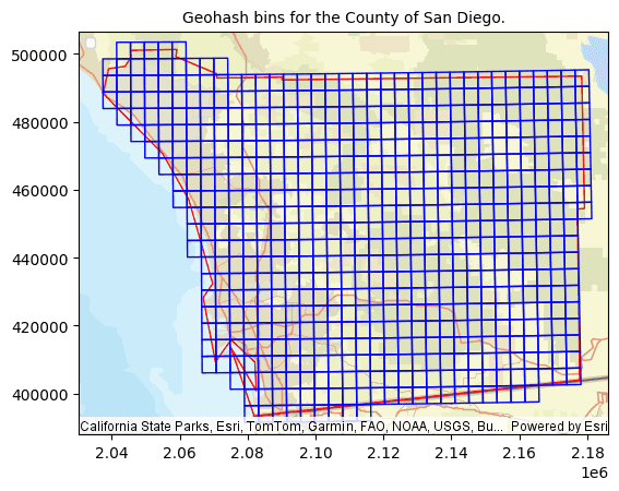
- ST_GeohashBin and ST_GeohashBins—Return the Geohash bin or bins that intersect with a geometry. Geohash encodes a geographic location into a short string of letters and digits. It is a hierarchical spatial data structure which subdivides space into buckets of grid shape. Like square, hex or H3 bins, Geohash bins can be used to index, aggregate, and summarize data.

Track functions
GeoAnalytics Engine 1.5.0 adds 6 new Track functions:
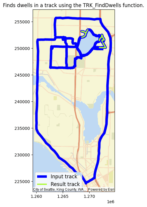
- TRK_CollapseDwells, TRK_FindDwells and TRK_SplitByDwells—These functions take a track, a distance and a duration threshold and return a track or array of tracks. Depending on the function used, the result collapses, finds dwells in a track or splits a track into segments wherever there is a dwell detected based on the distance and duration thresholds provided.

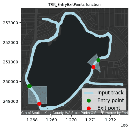
- TRK_DistanceWithin, TRK_DurationWithin and TRK_EntryExitPoints—These functions take a track and geofence-like geometry and return information about the track within the geometry.
TRKand_Distance Within TRKreturn a float column representing the track's length or duration within the geometry._Duration Within TRKreturns an array of struct representing the points at which the track enters or exits the geometry._Entry Exit Points

Scala API functions
GeoAnalytics Engine 1.5.0 includes a Scala API. You can now call any SQL or TRK function in Scala, Python, or SQL syntax. Scala API examples can be found in each function's documentation page.
Tools
GeoAnalytics Engine 1.5.0 includes one new tool: Find Co-Travelers. The release also includes enhancements to the Find Dwell Locations tool, as well as network and geocoding tools.
Find Co-Travelers
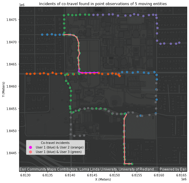
Find Co-Travelers analyzes time-enabled points representing moving entities. The tool finds where two entities are moving together in space (location) and time, also known as co-traveling.

Find Dwell Locations
This release enhances the Find Dwell Locations tool to return a new output type that collapses dwell events into a single point. This type can be set using the Collapse option. The tool has also been updated to correctly convert between linear units when using planar distance calculations.
Geocoding and Network Analysis
Beginning with this release, you can load a locator or network dataset onto your Spark cluster using Spark. For more information see Set up locator and network datasets.
The core geocoding and network analysis components in GeoAnalytics Engine have been upgraded. This may cause minor changes in the results of Create Routes, Create Service Areas, Find Closest Facilities, Generate OD Matrix, Geocode, and Reverse Geocode.
Data sources
GeoAnalytics Engine 1.5.0 adds support for Geoparquet 1.1.0. This release also adds support for reading timestamp offset, date only and time only data types from File geodatabases. For more information, see the File geodatabase documentation.
Date functions in ArcGIS Arcade
ArcGIS Arcade in GeoAnalytics Engine was enhanced to fully support date only and time only data types. For more information see Arcade expressions.
Authorization
Beginning with version 1.5.0, you can use an API key to authorize GeoAnalytics Engine. For more information, see Authorization.
Spark 3.4.4, 3.5.3 and new cloud runtime support
With every release, support for the latest Spark versions and cloud runtimes is added if possible. In 1.5.0, GeoAnalytics Engine adds support for Spark 3.4.4, 3.5.3 and the latest of the following cloud runtimes:
- Databricks (15.3 and 15.4)
- AWS EMR (7.2.0 and 7.3.0)