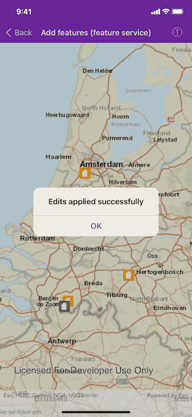
Add features to a feature layer.

Use case
An end-user performing a survey may want to add features to the map during the course of their work.
How to use the sample
Tap on a location on the map to add a feature at that location.
How it works
An AGSFeature instance is added to an AGSServiceFeatureTable. Apply edits on the ServiceGeodatabase which contains the feature table to push the edits to the server.
- Create and load an
AGSServiceFeatureTablewith a feature service URL. - Get the
AGSServiceFeatureTablefrom the service geodatabase. - Create an
AGSFeatureLayerfrom the service feature table. - Create an
AGSFeaturewith attributes and a location using theAGSServiceFeatureTable. - Add the
AGSFeatureto theAGSServiceFeatureTable. - Apply edits to the
AGSServiceGeodatabaseby callingAGSServiceFeatureTable.applyEdits(completion:), which will upload the new feature to the online service.
Relevant API
- AGSFeature
- AGSFeatureEditResult
- AGSFeatureLayer
- AGSServiceFeatureTable
- AGSServiceGeodatabase
Tags
edit, feature, online service
Sample Code
AddFeaturesViewController.swift
// Copyright 2016 Esri.
//
// Licensed under the Apache License, Version 2.0 (the "License");
// you may not use this file except in compliance with the License.
// You may obtain a copy of the License at
//
// http://www.apache.org/licenses/LICENSE-2.0
//
// Unless required by applicable law or agreed to in writing, software
// distributed under the License is distributed on an "AS IS" BASIS,
// WITHOUT WARRANTIES OR CONDITIONS OF ANY KIND, either express or implied.
// See the License for the specific language governing permissions and
// limitations under the License.
import UIKit
import ArcGIS
class AddFeaturesViewController: UIViewController, AGSGeoViewTouchDelegate {
@IBOutlet var mapView: AGSMapView! {
didSet {
mapView.map = AGSMap(basemapStyle: .arcGISStreets)
// Set touch delegate on map view as self.
mapView.touchDelegate = self
}
}
/// The service geodatabase that contains damaged property features.
var serviceGeodatabase: AGSServiceGeodatabase!
/// The feature table to add features to.
var featureTable: AGSServiceFeatureTable!
override func viewDidLoad() {
super.viewDidLoad()
// Add the source code button item to the right of navigation bar.
(navigationItem.rightBarButtonItem as? SourceCodeBarButtonItem)?.filenames = ["AddFeaturesViewController"]
// Load the service geodatabase.
let damageFeatureService = URL(string: "https://sampleserver6.arcgisonline.com/arcgis/rest/services/DamageAssessment/FeatureServer")!
loadServiceGeodatabase(from: damageFeatureService)
}
/// Load and set a service geodatabase from a feature service URL.
/// - Parameter serviceURL: The URL to the feature service.
func loadServiceGeodatabase(from serviceURL: URL) {
let serviceGeodatabase = AGSServiceGeodatabase(url: serviceURL)
serviceGeodatabase.load { [weak self] error in
guard let self = self else { return }
if let error = error {
self.presentAlert(error: error)
} else {
let featureTable = serviceGeodatabase.table(withLayerID: 0)!
self.featureTable = featureTable
self.serviceGeodatabase = serviceGeodatabase
// Add the feature layer to the operational layers on map.
let featureLayer = AGSFeatureLayer(featureTable: featureTable)
self.mapView.map?.operationalLayers.add(featureLayer)
self.mapView.setViewpoint(AGSViewpoint(center: AGSPoint(x: 544871.19, y: 6806138.66, spatialReference: .webMercator()), scale: 2e6))
}
}
}
/// Add a feature at the tapped point.
/// - Parameter mapPoint: The point where user tapped.
func addFeature(at mapPoint: AGSPoint) {
// Disable interaction with map view.
mapView.isUserInteractionEnabled = false
// Normalize geometry.
let normalizedGeometry = AGSGeometryEngine.normalizeCentralMeridian(of: mapPoint)!
// Attributes for the new feature.
let featureAttributes = ["typdamage": "Minor", "primcause": "Earthquake"]
// Create a new feature.
let feature = featureTable.createFeature(attributes: featureAttributes, geometry: normalizedGeometry)
// Add the feature to the feature table.
featureTable.add(feature) { [weak self] (error: Error?) in
guard let self = self else { return }
// Enable interaction with map view.
self.mapView.isUserInteractionEnabled = true
if let error = error {
self.presentAlert(message: "Error while adding feature: \(error.localizedDescription)")
} else {
// Applied edits on success.
self.applyEdits()
}
}
}
/// Apply local edits to the geodatabase.
func applyEdits() {
guard serviceGeodatabase.hasLocalEdits() else { return }
serviceGeodatabase.applyEdits { [weak self] _, error in
if let error = error {
self?.presentAlert(message: "Error while applying edits: \(error.localizedDescription)")
}
}
}
// MARK: - AGSGeoViewTouchDelegate
func geoView(_ geoView: AGSGeoView, didTapAtScreenPoint screenPoint: CGPoint, mapPoint: AGSPoint) {
// Add a feature at the tapped location.
addFeature(at: mapPoint)
}
}