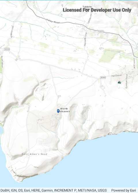
Use pictures for markers.

Use case
When marking geoelements on a map, using custom, unique symbols can be helpful for highlighting and differentiating between locations. For example, a tourism office may use pictures of landmarks as symbols on an online map or app, to help prospective visitors to orient themselves more easily around a city.
How to use the sample
When launched, this sample displays a map with picture marker symbols. Pan and zoom to explore the map.
How it works
- Create a
PictureMarkerSymbolusing the URI to an online or local image or a JavaFX Image (platform dependent). - Create a
Graphicand set its symbol to the picture marker symbol.
Relevant API
- PictureMarkerSymbol
About the data
The picture marker symbols in this sample are all constructed from different types of resources:
- Campsite symbol constructed from a URL
- Blue pin with a star stored in the resource folder that comes with the application
Tags
graphics, marker, picture, symbol, visualization
Sample Code
<?xml version="1.0" encoding="utf-8" ?>
<ContentPage x:Class="ArcGISRuntime.Samples.RenderPictureMarkers.RenderPictureMarkers"
xmlns="http://xamarin.com/schemas/2014/forms"
xmlns:x="http://schemas.microsoft.com/winfx/2009/xaml"
xmlns:esriUI="clr-namespace:Esri.ArcGISRuntime.Xamarin.Forms;assembly=Esri.ArcGISRuntime.Xamarin.Forms">
<Grid>
<esriUI:MapView x:Name="MyMapView" />
</Grid>
</ContentPage>