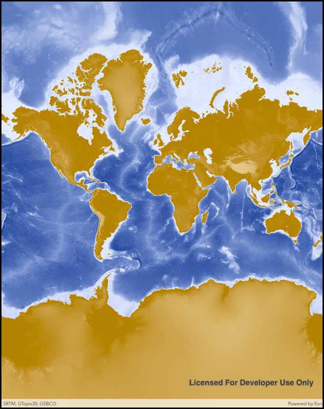
Add an ArcGIS Map Image Layer from a URL to a map.

Use case
ArcGISMapImageLayer instances are rendered server side as a single raster image, so they always show the latest data at the time of the request. Since the data is rendered as a single image, it can have performance benefits versus a feature layer with complex geometries.
How it works
- Create a new
Mapand set it to aMapView. - Create a new
ArcGISMapImageLayerwith an input URL. - Add the layer to the map.
Relevant API
- Map
- ArcGISMapImageLayer
- MapView
Tags
ArcGIS dynamic map service layer, ArcGISMapImageLayer, layers
Sample Code
ArcGISMapImageLayerUrl.cs
// Copyright 2016 Esri.
//
// Licensed under the Apache License, Version 2.0 (the "License"); you may not use this file except in compliance with the License.
// You may obtain a copy of the License at: http://www.apache.org/licenses/LICENSE-2.0
//
// Unless required by applicable law or agreed to in writing, software distributed under the License is distributed on an
// "AS IS" BASIS, WITHOUT WARRANTIES OR CONDITIONS OF ANY KIND, either express or implied. See the License for the specific
// language governing permissions and limitations under the License.
using System;
using Esri.ArcGISRuntime.Mapping;
using Esri.ArcGISRuntime.UI.Controls;
using Foundation;
using UIKit;
namespace ArcGISRuntime.Samples.ArcGISMapImageLayerUrl
{
[Register("ArcGISMapImageLayerUrl")]
[ArcGISRuntime.Samples.Shared.Attributes.Sample(
name: "ArcGIS map image layer",
category: "Layers",
description: "Add an ArcGIS Map Image Layer from a URL to a map.",
instructions: "",
tags: new[] { "ArcGIS dynamic map service layer", "ArcGISMapImageLayer", "layers" })]
public class ArcGISMapImageLayerUrl : UIViewController
{
// Hold references to UI controls.
private MapView _myMapView;
public ArcGISMapImageLayerUrl()
{
Title = "ArcGIS map image layer (URL)";
}
private void Initialize()
{
// Create new Map.
Map map = new Map();
// Create URL to the map image layer.
Uri serviceUri = new Uri("https://sampleserver5.arcgisonline.com/arcgis/rest/services/Elevation/WorldElevations/MapServer");
// Create new image layer from the URL.
ArcGISMapImageLayer imageLayer = new ArcGISMapImageLayer(serviceUri);
// Add created layer to the basemaps collection.
map.Basemap.BaseLayers.Add(imageLayer);
// Assign the map to the MapView.
_myMapView.Map = map;
}
public override void ViewDidLoad()
{
base.ViewDidLoad();
Initialize();
}
public override void LoadView()
{
// Create the views.
View = new UIView() { BackgroundColor = ApplicationTheme.BackgroundColor };
_myMapView = new MapView();
_myMapView.TranslatesAutoresizingMaskIntoConstraints = false;
// Add the views.
View.AddSubviews(_myMapView);
// Lay out the views.
NSLayoutConstraint.ActivateConstraints(new[]
{
_myMapView.TopAnchor.ConstraintEqualTo(View.SafeAreaLayoutGuide.TopAnchor),
_myMapView.BottomAnchor.ConstraintEqualTo(View.BottomAnchor),
_myMapView.LeadingAnchor.ConstraintEqualTo(View.LeadingAnchor),
_myMapView.TrailingAnchor.ConstraintEqualTo(View.TrailingAnchor)
});
}
}
}