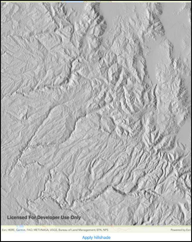
Use a hillshade renderer on a raster.

How to use the sample
Configure the options for rendering, then tap 'Apply hillshade'.
How it works
- The parameters provided by the user are passed to
HillshadeRenderat instantiation:new HillshadeRenderer(mAltitude, mAzimuth, mZFactor, mSlopeType, mPixelSizeFactor, mPixelSizePower, mOutputBitDepth);which returns aRasterRenderer. TheRasterRendereris then added to theRasterLayer.
Offline data
This sample downloads the following items from ArcGIS Online automatically:
- srtm-hillshade.zip - SRTM DEM
Tags
Visualization, hillshade, raster, shadow, slope
Sample Code
RasterHillshade.cs
// Copyright 2018 Esri.
//
// Licensed under the Apache License, Version 2.0 (the "License"); you may not use this file except in compliance with the License.
// You may obtain a copy of the License at: http://www.apache.org/licenses/LICENSE-2.0
//
// Unless required by applicable law or agreed to in writing, software distributed under the License is distributed on an
// "AS IS" BASIS, WITHOUT WARRANTIES OR CONDITIONS OF ANY KIND, either express or implied. See the License for the specific
// language governing permissions and limitations under the License.
using System;
using ArcGISRuntime.Samples.Managers;
using CoreGraphics;
using Esri.ArcGISRuntime.Mapping;
using Esri.ArcGISRuntime.Rasters;
using Esri.ArcGISRuntime.UI.Controls;
using Foundation;
using UIKit;
namespace ArcGISRuntime.Samples.RasterHillshade
{
[Register("RasterHillshade")]
[ArcGISRuntime.Samples.Shared.Attributes.OfflineData("134d60f50e184e8fa56365f44e5ce3fb")]
[ArcGISRuntime.Samples.Shared.Attributes.Sample(
name: "Raster hillshade renderer",
category: "Layers",
description: "Use a hillshade renderer on a raster.",
instructions: "Configure the options for rendering, then tap 'Apply hillshade'.",
tags: new[] { "Visualization", "hillshade", "raster", "shadow", "slope" })]
public class RasterHillshade : UIViewController
{
// Hold references to UI controls.
private MapView _myMapView;
private HillshadeSettingsController _settingsVC;
private UIBarButtonItem _configureButton;
// Store a reference to the raster layer.
private RasterLayer _rasterLayer;
public RasterHillshade()
{
Title = "Raster hillshade";
}
private async void Initialize()
{
// Create a map with a streets basemap.
Map map = new Map(BasemapStyle.ArcGISStreets);
// Get the file name for the local raster dataset.
string filepath =
DataManager.GetDataFolder("134d60f50e184e8fa56365f44e5ce3fb", "srtm-hillshade", "srtm.tiff");
// Load the raster file.
Raster rasterFile = new Raster(filepath);
try
{
// Create and load a new raster layer to show the image.
_rasterLayer = new RasterLayer(rasterFile);
await _rasterLayer.LoadAsync();
// Set up the settings controls.
_settingsVC = new HillshadeSettingsController(_rasterLayer);
// Set the initial viewpoint to the raster's full extent.
map.InitialViewpoint = new Viewpoint(_rasterLayer.FullExtent);
// Add the layer to the map.
map.OperationalLayers.Add(_rasterLayer);
// Add the map to the map view.
_myMapView.Map = map;
}
catch (Exception e)
{
new UIAlertView("Error", e.ToString(), (IUIAlertViewDelegate) null, "OK", null).Show();
}
}
private void HandleSettings_Clicked(object sender, EventArgs e)
{
UINavigationController controller = new UINavigationController(_settingsVC);
controller.ModalPresentationStyle = UIModalPresentationStyle.Popover;
controller.PreferredContentSize = new CGSize(300, 250);
UIPopoverPresentationController pc = controller.PopoverPresentationController;
if (pc != null)
{
pc.BarButtonItem = (UIBarButtonItem) sender;
pc.PermittedArrowDirections = UIPopoverArrowDirection.Down;
pc.Delegate = new PpDelegate();
}
PresentViewController(controller, true, null);
}
public override void ViewDidLoad()
{
base.ViewDidLoad();
Initialize();
}
public override void LoadView()
{
// Create the views.
View = new UIView {BackgroundColor = ApplicationTheme.BackgroundColor};
_myMapView = new MapView();
_myMapView.TranslatesAutoresizingMaskIntoConstraints = false;
_configureButton = new UIBarButtonItem();
_configureButton.Title = "Configure hillshade";
UIToolbar toolbar = new UIToolbar();
toolbar.TranslatesAutoresizingMaskIntoConstraints = false;
toolbar.Items = new[]
{
new UIBarButtonItem(UIBarButtonSystemItem.FlexibleSpace),
_configureButton
};
// Add the views.
View.AddSubviews(_myMapView, toolbar);
// Lay out the views.
NSLayoutConstraint.ActivateConstraints(new[]
{
_myMapView.TopAnchor.ConstraintEqualTo(View.SafeAreaLayoutGuide.TopAnchor),
_myMapView.LeadingAnchor.ConstraintEqualTo(View.LeadingAnchor),
_myMapView.TrailingAnchor.ConstraintEqualTo(View.TrailingAnchor),
_myMapView.BottomAnchor.ConstraintEqualTo(toolbar.TopAnchor),
toolbar.LeadingAnchor.ConstraintEqualTo(View.LeadingAnchor),
toolbar.TrailingAnchor.ConstraintEqualTo(View.TrailingAnchor),
toolbar.BottomAnchor.ConstraintEqualTo(View.SafeAreaLayoutGuide.BottomAnchor)
});
}
public override void ViewWillAppear(bool animated)
{
base.ViewWillAppear(animated);
// Subscribe to events.
_configureButton.Clicked += HandleSettings_Clicked;
}
public override void ViewDidDisappear(bool animated)
{
base.ViewDidDisappear(animated);
// Unsubscribe from events, per best practice.
_configureButton.Clicked -= HandleSettings_Clicked;
}
// Force popover to display on iPhone.
private class PpDelegate : UIPopoverPresentationControllerDelegate
{
public override UIModalPresentationStyle GetAdaptivePresentationStyle(
UIPresentationController forPresentationController) => UIModalPresentationStyle.None;
public override UIModalPresentationStyle GetAdaptivePresentationStyle(UIPresentationController controller,
UITraitCollection traitCollection) => UIModalPresentationStyle.None;
}
}
public class HillshadeSettingsController : UIViewController
{
private readonly RasterLayer _rasterLayer;
private UISegmentedControl _slopeTypePicker;
private UISlider _altitudeSlider;
private UISlider _azimuthSlider;
public HillshadeSettingsController(RasterLayer rasterLayer)
{
_rasterLayer = rasterLayer;
Title = "Hillshade settings";
}
public override void LoadView()
{
View = new UIView() { BackgroundColor = ApplicationTheme.BackgroundColor };
UIScrollView scrollView = new UIScrollView();
scrollView.TranslatesAutoresizingMaskIntoConstraints = false;
View.AddSubviews(scrollView);
scrollView.TopAnchor.ConstraintEqualTo(View.TopAnchor).Active = true;
scrollView.LeadingAnchor.ConstraintEqualTo(View.LeadingAnchor).Active = true;
scrollView.TrailingAnchor.ConstraintEqualTo(View.TrailingAnchor).Active = true;
scrollView.BottomAnchor.ConstraintEqualTo(View.BottomAnchor).Active = true;
UIStackView formContainer = new UIStackView();
formContainer.TranslatesAutoresizingMaskIntoConstraints = false;
formContainer.Spacing = 8;
formContainer.LayoutMarginsRelativeArrangement = true;
formContainer.Alignment = UIStackViewAlignment.Fill;
formContainer.LayoutMargins = new UIEdgeInsets(8, 8, 8, 8);
formContainer.Axis = UILayoutConstraintAxis.Vertical;
formContainer.WidthAnchor.ConstraintEqualTo(300).Active = true;
UILabel slopeTypeLabel = new UILabel();
slopeTypeLabel.TranslatesAutoresizingMaskIntoConstraints = false;
slopeTypeLabel.Text = "Slope type:";
formContainer.AddArrangedSubview(slopeTypeLabel);
_slopeTypePicker = new UISegmentedControl("Degree", "% Rise", "Scaled", "None");
_slopeTypePicker.TranslatesAutoresizingMaskIntoConstraints = false;
formContainer.AddArrangedSubview(_slopeTypePicker);
UILabel altitudeLabel = new UILabel();
altitudeLabel.TranslatesAutoresizingMaskIntoConstraints = false;
altitudeLabel.Text = "Altitude:";
formContainer.AddArrangedSubview(altitudeLabel);
_altitudeSlider = new UISlider();
_altitudeSlider.TranslatesAutoresizingMaskIntoConstraints = false;
_altitudeSlider.MinValue = 0;
_altitudeSlider.MaxValue = 90;
_altitudeSlider.Value = 45;
formContainer.AddArrangedSubview(_altitudeSlider);
UILabel azimuthLabel = new UILabel();
azimuthLabel.TranslatesAutoresizingMaskIntoConstraints = false;
azimuthLabel.Text = "Azimuth:";
formContainer.AddArrangedSubview(azimuthLabel);
_azimuthSlider = new UISlider();
_azimuthSlider.TranslatesAutoresizingMaskIntoConstraints = false;
_azimuthSlider.MinValue = 0;
_azimuthSlider.MaxValue = 360;
_azimuthSlider.Value = 270;
formContainer.AddArrangedSubview(_azimuthSlider);
scrollView.AddSubview(formContainer);
formContainer.TopAnchor.ConstraintEqualTo(scrollView.TopAnchor).Active = true;
formContainer.LeadingAnchor.ConstraintEqualTo(scrollView.LeadingAnchor).Active = true;
formContainer.TrailingAnchor.ConstraintEqualTo(scrollView.TrailingAnchor).Active = true;
formContainer.BottomAnchor.ConstraintEqualTo(scrollView.BottomAnchor).Active = true;
}
public override void ViewWillAppear(bool animated)
{
base.ViewWillAppear(animated);
// Subscribe to events.
_azimuthSlider.ValueChanged += UpdateSettings;
_altitudeSlider.ValueChanged += UpdateSettings;
_slopeTypePicker.ValueChanged += UpdateSettings;
}
public override void ViewDidDisappear(bool animated)
{
base.ViewDidDisappear(animated);
// Unsubscribe from events, per best practice.
_azimuthSlider.ValueChanged -= UpdateSettings;
_altitudeSlider.ValueChanged -= UpdateSettings;
_slopeTypePicker.ValueChanged -= UpdateSettings;
}
private void UpdateSettings(object sender, EventArgs e)
{
SlopeType type = SlopeType.None;
switch (_slopeTypePicker.SelectedSegment)
{
case 0:
type = SlopeType.Degree;
break;
case 1:
type = SlopeType.PercentRise;
break;
case 2:
type = SlopeType.Scaled;
break;
}
HillshadeRenderer renderer = new HillshadeRenderer(
altitude: _altitudeSlider.Value,
azimuth: _azimuthSlider.Value,
zfactor: 1,
slopeType: type,
pixelSizeFactor: 1,
pixelSizePower: 1,
nbits: 8);
_rasterLayer.Renderer = renderer;
}
}
}