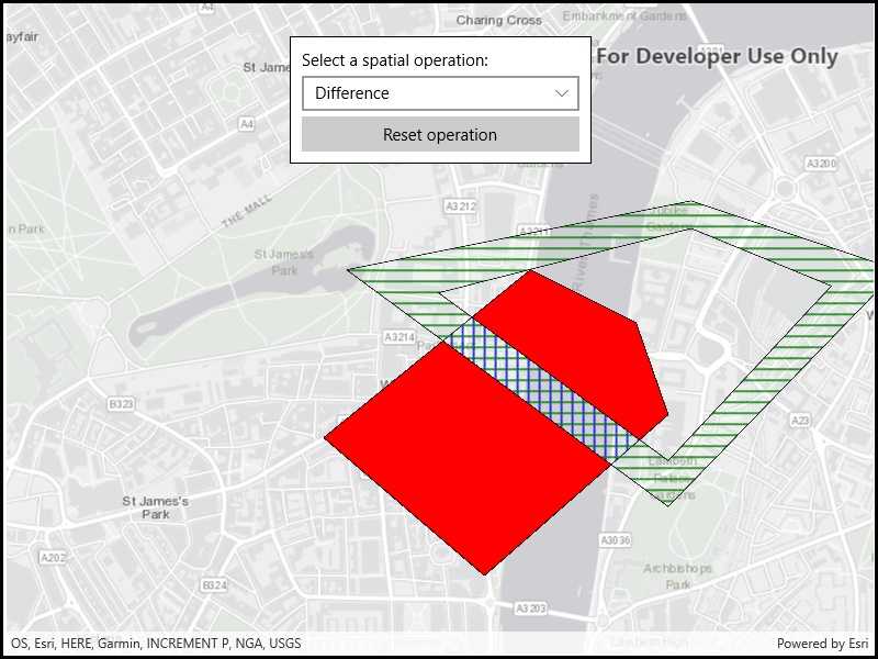
Find the union, intersection, or difference of two geometries.

Use case
The different spatial operations (union, difference, symmetric difference, and intersection) can be used for a variety of spatial analyses. For example, government authorities may use the intersect operation to determine whether a proposed road cuts through a restricted piece of land such as a nature reserve or a private property. When these operations are chained together, they become even more powerful. An analysis of food deserts within an urban area might begin by union-ing service areas of grocery stores, farmer's markets, and food co-ops. Taking the difference between this single geometry of all services areas and that of a polygon delineating a neighborhood would reveal the areas within that neighborhood where access to healthy, whole foods may not exist.
How to use the sample
The sample provides an option to select a spatial operation. When an operation is selected, the resulting geometry is shown in red. The 'reset operation' button undoes the action and allow selecting a different operation.
How it works
- Create a
GraphicsOverlayand add it to theMapView. - Define a
PointCollectionof eachGeometry. - Add the overlapping polygons to the graphics overlay.
- Perform spatial relationships between the polygons by using the appropriate operation:
GeometryEngine.Union(geometry1, geometry2)- This method returns the two geometries united together as one geometry.GeometryEngine.Difference(geometry1, geometry2)- This method returns any part of Geometry2 that does not intersect Geometry1.GeometryEngine.SymmetricDifference(geometry1, geometry2)- This method returns any part of Geometry1 or Geometry2 which do not intersect.GeometryEngine.Intersection(geometry1, geometry2)- This method returns the intersection of Geometry1 and Geometry2.
- Use the geometry that is returned from the method call to create a new
Graphicand add it to the graphics overlay for it to be displayed.
Relevant API
- Geometry
- GeometryEngine
- GeometryEngine.Difference
- GeometryEngine.Intersection
- GeometryEngine.SymmetricDifference
- GeometryEngine.Union
- Graphic
- GraphicsOverlay
Tags
analysis, combine, difference, geometry, intersection, merge, polygon, union
Sample Code
<UserControl
x:Class="ArcGISRuntime.UWP.Samples.SpatialOperations.SpatialOperations"
xmlns="http://schemas.microsoft.com/winfx/2006/xaml/presentation"
xmlns:x="http://schemas.microsoft.com/winfx/2006/xaml"
xmlns:esriUI="using:Esri.ArcGISRuntime.UI.Controls">
<Grid>
<esriUI:MapView x:Name="MyMapView" />
<Border Background="White" BorderBrush="Black" BorderThickness="1"
HorizontalAlignment="Center" VerticalAlignment="Top"
Margin="30" Padding="10" Width="275">
<StackPanel>
<TextBlock Text="Select a spatial operation:"/>
<ComboBox x:Name="SpatialOperationComboBox"
Margin="0,5"
SelectionChanged="SpatialOperationComboBox_SelectionChanged" Width="253"/>
<Button x:Name="ResetOperationButton"
Content="Reset operation"
Click="ResetOperationButton_Click" Width="253"/>
</StackPanel>
</Border>
</Grid>
</UserControl>