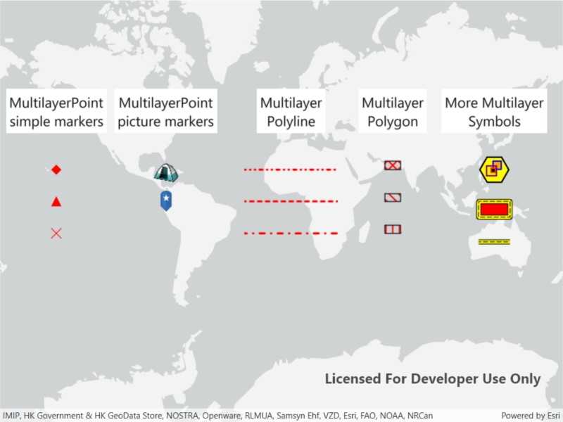
Show different kinds of multilayer symbols on a map similar to some pre-defined 2D simple symbol styles.

Use case
Allows you to customize a graphic with a multilayer symbol. For example, you may want more customizable symbols than the one that is provided with the API to display a unique representation of a landmark.
How to use the sample
The sample loads multilayer symbols for points, polylines, and polygons.
How it works
- Create multilayer symbols for each predefined 2D simple symbol style.
- For multilayer point symbols, use the
MultilayerPointconstructor. - For multilayer polyline symbols, use the
MultiLayerPolylineconstructor. - For multilayer polygon symbols, use the
MultiLayerPolygonconstructor.
- For multilayer point symbols, use the
- Create graphics by passing in a geometry and the associated symbol.
- Add graphics to the graphics overlay with
graphicsOverlay.Graphics.Add(graphic)
Relevant API
- Graphic
- GraphicsOverlay
- MultiLayerPoint
- MultiLayerPolygon
- MultiLayerPolyline
- PictureMarkerSymbolLayer
- SolidFillSymbolLayer
- SolidStrokeSymbolLayer
- VectorMarkerSymbolLayer
Tags
graphic, marker, multilayer, picture, symbol
Sample Code
<UserControl x:Class="ArcGISRuntime.WPF.Samples.RenderMultilayerSymbols.RenderMultilayerSymbols"
xmlns="http://schemas.microsoft.com/winfx/2006/xaml/presentation"
xmlns:x="http://schemas.microsoft.com/winfx/2006/xaml"
xmlns:esri="http://schemas.esri.com/arcgis/runtime/2013">
<esri:MapView x:Name="MyMapView" />
</UserControl>