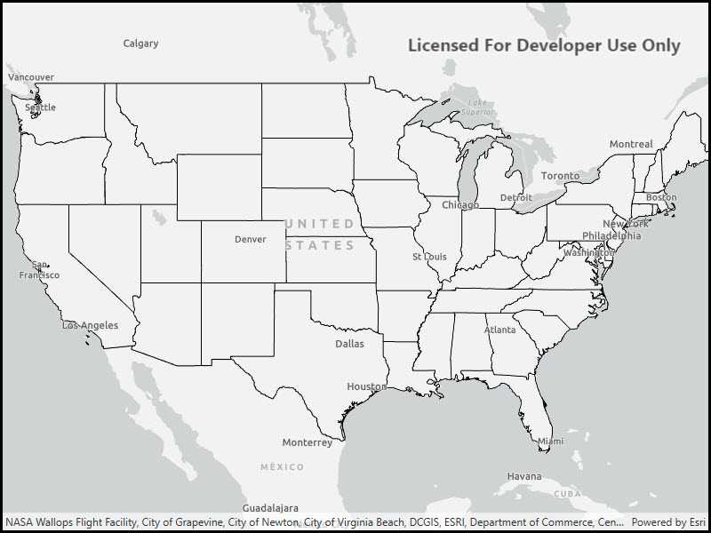
Start the Local Server and Local Map Service, create an ArcGIS Map Image Layer from the Local Map Service, and add it to a map.

Use case
For executing offline geoprocessing tasks in your apps via an offline (local) server.
How to use the sample
The Local Server and local map service will automatically be started and, once running, a map image layer will be created and added to the map.
How it works
- Create and run a local server with
LocalServer.Instance. - Start the server asynchronously with
server.StartAsync(). - Create and run a local service, example of running a
LocalMapService.- Instantiate
LocalMapService(Url)to create a local map service with the given URL path to the map package (mpkxfile). - Start the service asynchronously with
LocalMapService.StartAsync(). The service is added to the Local Server automatically.
- Instantiate
- Create an ArcGIS map image layer from local map service.
- Create a
ArcGISMapImageLayer(Url)from local map service url provided by theLocalMapService.Urlproperty. - Add the layer to the map's operational layers.
- Wait for the layer to load with
await myImageLayer.LoadAsync() - Set the map view's extent to the layer's full extent.
- Create a
Relevant API
- ArcGISMapImageLayer
- LocalMapService
- LocalServer
- LocalServerStatus
Offline data
This sample downloads the following items from ArcGIS Online automatically:
- RelationshipID.mpkx - This map package is included in the ArcGIS sample data.
Additional information
Local Server can be downloaded for Windows and Linux platforms from the developers website. Local Server is not supported on macOS.
Tags
image, layer, local, offline, server
Sample Code
// Copyright 2021 Esri.
//
// Licensed under the Apache License, Version 2.0 (the "License"); you may not use this file except in compliance with the License.
// You may obtain a copy of the License at: http://www.apache.org/licenses/LICENSE-2.0
//
// Unless required by applicable law or agreed to in writing, software distributed under the License is distributed on an
// "AS IS" BASIS, WITHOUT WARRANTIES OR CONDITIONS OF ANY KIND, either express or implied. See the License for the specific
// language governing permissions and limitations under the License.
using ArcGIS.Samples.Managers;
using Esri.ArcGISRuntime.LocalServices;
using Esri.ArcGISRuntime.Mapping;
using System;
using System.Diagnostics;
using System.IO;
using System.Reflection;
using System.Threading.Tasks;
using System.Windows;
namespace ArcGIS.WPF.Samples.LocalServerMapImageLayer
{
[ArcGIS.Samples.Shared.Attributes.Sample(
name: "Local Server map image layer",
category: "Local Server",
description: "Start the Local Server and Local Map Service, create an ArcGIS Map Image Layer from the Local Map Service, and add it to a map.",
instructions: "The Local Server and local map service will automatically be started and, once running, a map image layer will be created and added to the map.",
tags: new[] { "image", "layer", "local", "offline", "server" })]
[ArcGIS.Samples.Shared.Attributes.OfflineData("85c34847bbe1402fa115a1b9b87561ce")]
public partial class LocalServerMapImageLayer
{
// Hold a reference to the local map service
private LocalMapService _localMapService;
public LocalServerMapImageLayer()
{
InitializeComponent();
// set up the sample
_ = Initialize();
}
private async Task Initialize()
{
// Create a map and add it to the view
MyMapView.Map = new Map(BasemapStyle.ArcGISLightGray);
try
{
// LocalServer must not be running when setting the data path.
if (LocalServer.Instance.Status == LocalServerStatus.Started)
{
await LocalServer.Instance.StopAsync();
}
// Set the local data path - must be done before starting. On most systems, this will be C:\EsriSamples\AppData.
// This path should be kept short to avoid Windows path length limitations.
string tempDataPathRoot = Directory.GetParent(Environment.GetFolderPath(Environment.SpecialFolder.Windows)).FullName;
string tempDataPath = Path.Combine(tempDataPathRoot, "EsriSamples", "AppData");
Directory.CreateDirectory(tempDataPath); // CreateDirectory won't overwrite if it already exists.
LocalServer.Instance.AppDataPath = tempDataPath;
// Start the local server instance
await LocalServer.Instance.StartAsync();
// Get the path to the map package that will be served
string datapath = GetDataPath();
// Create the Map Service from the data
_localMapService = new LocalMapService(datapath);
// Start the feature service
await _localMapService.StartAsync();
// Get the url to the map service
Uri myServiceUri = _localMapService.Url;
// Create the layer from the url
ArcGISMapImageLayer myImageLayer = new ArcGISMapImageLayer(myServiceUri);
// Add the layer to the map
MyMapView.Map.OperationalLayers.Add(myImageLayer);
// Wait for the layer to load
await myImageLayer.LoadAsync();
// Set the viewpoint on the map to show the data
MyMapView.SetViewpoint(new Viewpoint(myImageLayer.FullExtent));
}
catch (Exception ex)
{
var localServerTypeInfo = typeof(LocalMapService).GetTypeInfo();
var localServerVersion = FileVersionInfo.GetVersionInfo(localServerTypeInfo.Assembly.Location);
MessageBox.Show($"Please ensure that local server {localServerVersion.FileVersion} is installed prior to using the sample. The download link is in the description. Message: {ex.Message}", "Local Server failed to start");
}
}
private static string GetDataPath()
{
return DataManager.GetDataFolder("85c34847bbe1402fa115a1b9b87561ce", "RelationshipID.mpkx");
}
}
}