In this notebook, we will explore using utility functions to build interactivity. This can usually be split into two procedures: call back and display message. The call back function can be used to collect gis data on screen through digitization, while the display message function can be used to prompt users to perform a desired action.
To do this, we will need to setup an asynchronous callback function using the on_click() or on_draw_end() methods to create dynamic, interactive 'apps'. We will need to create a callback function, like function_name(map_inst, geometry), with map_inst being the MapView instance and geometry being the geometry instance that the user is clicking.
Demonstrate callback features with on_click, and on_draw_end
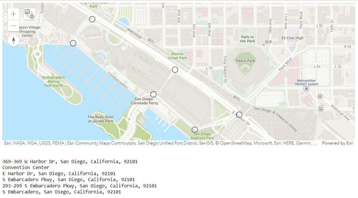
Our first example will take a point that a user clicks on the map, reverse geocode it from the geometry, and print out the resulting location.
Note, you can either create the GIS connection using an existing profile, or you can simply enter your username and password, e.g. gis = GIS("https://www.arcgis.com", "username", "password").
from arcgis.gis import GIS
import arcgis.geocoding as geocoding

gis = GIS('home')
callback_map = gis.map('San Diego convention center, San Diego, CA', 16)
def find_addr(callback_map, g):
try:
callback_map.draw(g)
geocoded = geocoding.reverse_geocode(g)
print(geocoded['address']['Match_addr'])
except:
print("Couldn't match address. Try another place...")callback_map
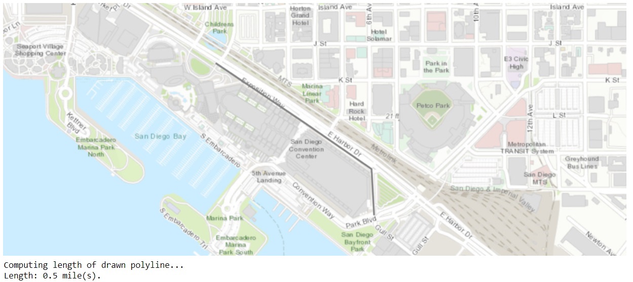
callback_map.on_click(find_addr)Next, we want a user to draw a freehand polyline to indicate the paths they take for their runs. When the drawing operation ends, we use the GIS's Geometry service to compute the length of the drawn path. We can do this by adding an event listener to the map widget that gets called when drawing is completed (i.e. on_draw_end). The event listener then computes the geodesic length of the drawn geometry using the geometry service and prints it out:
drawend_map = gis.map('San Diego convention center, San Diego, CA', 16)from arcgis.geometry import lengths
# Define the callback function that computes the length.
def calc_dist(drawend_map, g):
print("Computing length of drawn polyline...")
length = lengths(g['spatialReference'], [g], "", "geodesic")
print("Length: " + str(length[0]) + " mile(s).")# Set calc_dist as the callback function to be invoked when a polyline is drawn on the map
drawend_map.on_draw_end(calc_dist)
drawend_map
drawend_map.draw("polyline")Show message in map widget via display_message
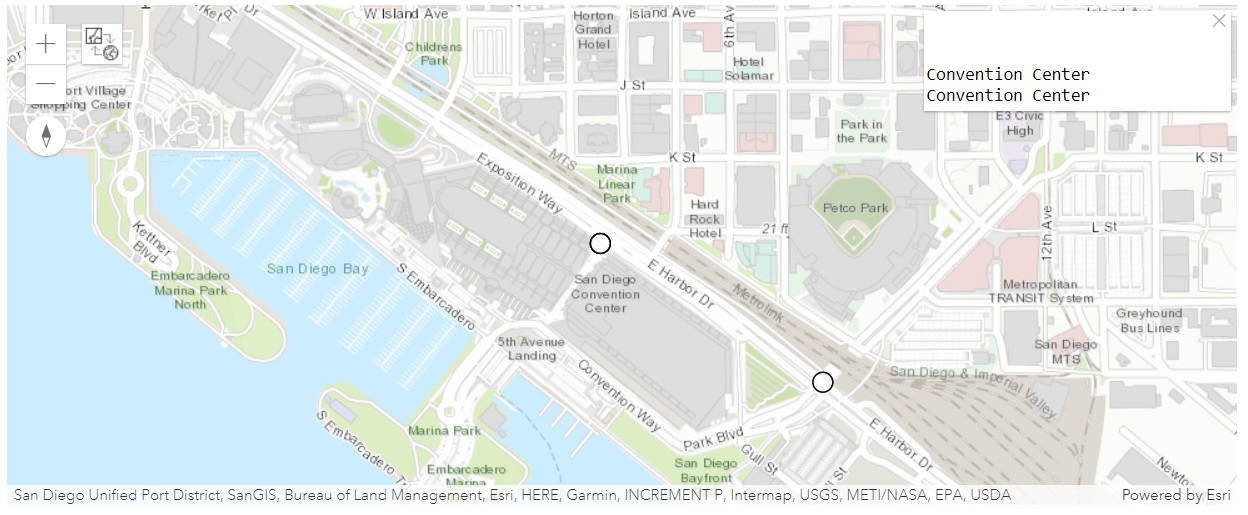
The display_message method displays a message on the upper-right corner of the map widget.
callback_map
def find_addr2(callback_map, g):
    try:
        callback_map.draw(g)
        geocoded = geocoding.reverse_geocode(g)
        callback_map.display_message(geocoded['address']['Match_addr'])
    except:
callback_map.display_message("Couldn't match address. Try another place...")callback_map.on_click(find_addr2)Hide the Map/Scene Switch button using hide_mode_switch
When hide_mode_switch is set to True, the 2D/3D switch button will be hidden from the widget.
callback_map.hide_mode_switch = FalseConfigure the map widget with the Javascript API using set_js_cdn
The set_js_cdn function is called before the creation of any MapView object, and each instantiated object will use the specified js_cdn parameter as the ArcGIS API for JavaScript CDN URL, rather than the default <Scheme> ://<netloc>.<path>. This functionality is necessary in disconnected environments if the enterprise you are connecting to does not ship with the minimum necessary JavaScript API version.
For example, if gis.map() does not return a map, run the following code to configure the map widget with the Javascript API shipped with the enterprise:
if callback_map.set_js_cdn("https://pythonapi.playground.esri.com/portal/home/10.8.1/js/jsapi") :
    print("True")
True
Conclusion
In Part 6 of this guide series, we discussed the utility functions of the MapView object, particularly in regard to using the callback and display_message mechanisms in creating interactivity for users.