Clone a Group

This sample notebook can be used for cloning one or more groups, either on the same portal or from one portal to another.

Note: If you want to clone all portal users, groups and content refer to the sample Clone Portal users, groups and content

In this sample, we will clone the Vector Basemaps group from ArcGIS Online to an ArcGIS Enterprise.

from arcgis.gis import GIS
from IPython.display import display

Define the source and target portals

To start with, define the source and target portals.

# an anonymous connection to ArcGIS Online is sufficient, 
# since we are cloning a public group
source = GIS()

target = GIS("https://pythonapi.playground.esri.com/portal")

Search for the group and its contents in the source portal

In the source portal, search for the group to be cloned. In our case the title of the group is 'Vector Basemaps'.

source_groups = source.groups.search("title:Vector Basemaps AND owner:esri", outside_org = True)
source_groups
[<Group title:"OpenStreetMap Vector Basemap" owner:esri>,
 <Group title:"Vector Basemaps" owner:esri>,
 <Group title:"Vector Basemaps (for Export)" owner:esri>]
source_group = source_groups[1]
source_group
Vector Basemaps

Summary: This group contains a set of Esri vector basemaps that are available for use in ArcGIS Online. The group contains both web maps and tile layers.
Description:
For several years, Esri has made available a suite of basemaps that can be used through ArcGIS Online and other apps to create maps and apps. These multi-scale basemaps have been delivered as pre-rendered image tiles (JPG or PNG format) to optimize performance. These basemaps have proven to be very useful and popular, with several billion tiles served each month, but they have some limitations (e.g. users can not customize map, low-res image tiles not optimal for display on high-res devices, etc.).

To provide additional options for users, Esri has introduced a new set of vector basemaps. These basemaps are delivered as vector tiles (PBF format) that are rendered client-side based on a style file that is delivered with the vector tiles. Vector basemaps are available in Map Viewer and Scene Viewer, as well as in ArcGIS Pro, configurable apps that include a basemap gallery, Workforce for ArcGIS, Explorer for ArcGIS, and apps created using Web AppBuilder. To find out whether vector basemaps are available in a specific ArcGIS app, refer to the app documentation. Users are able to customize the look and feel of the vector basemaps by creating custom styles that are used to render the vector tiles.

Available Vector Basemaps

This group includes vector basemaps in multiple styles, some that closely resemble existing Esri basemaps (e.g. Streets, Topographic, Light and Dark Gray Canvas, Terrain with Labels), and others that are new (e.g. Streets at Night, Navigation, and Imagery Hybrid).  The group also includes several more 'creative' styles (e.g. Colored Pencil, Charted Territory, Mid-Century, Modern Antique) that are optimized for specific uses.  It also includes a new OpenStreetMap vector basemap created and hosted by Esri.  The vector basemaps are available as both web maps, which can be used as a basemap for adding other layers, and as tile layers, which can be added to existing maps either as a basemap or overlay layer.

Learn More

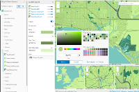
To learn more, including how you can customize the Esri vector basemaps, you can refer to the blog posts tagged with "vector basemaps".  You can also use the new Vector Tile Style Editor app to quickly create your own custom map.  The Vector Tile Style Editor app has now been integrated with ArcGIS Online so it is accessible from vector tile layer items in the ArcGIS.com Map Viewer.

Owner: esri
Created: October 27, 2015

List the items that are a part of the group 'Vector Basemaps'.

source_items = source_group.content()
source_items
[<Item title:"ArcGIS Vector Tile Style Editor" type:Web Mapping Application owner:esri_basemaps>,
 <Item title:"Charted Territory" type:Vector Tile Layer owner:esri>,
 <Item title:"Charted Territory Map" type:Web Map owner:esri>,
 <Item title:"Colored Pencil" type:Vector Tile Layer owner:esri>,
 <Item title:"Colored Pencil Map" type:Web Map owner:esri>,
 <Item title:"Community" type:Vector Tile Layer owner:esri>,
 <Item title:"Community Map" type:Web Map owner:esri>,
 <Item title:"Dark Gray Canvas" type:Web Map owner:esri>,
 <Item title:"Dark Gray Canvas" type:Vector Tile Layer owner:esri>,
 <Item title:"Dark Gray Canvas (Local Language)" type:Web Map owner:esri>,
 <Item title:"Dark Gray Canvas Base" type:Vector Tile Layer owner:esri>,
 <Item title:"Dark Gray Canvas Reference" type:Vector Tile Layer owner:esri>,
 <Item title:"Dark Gray Canvas Reference (Local Language)" type:Vector Tile Layer owner:esri>,
 <Item title:"Human Geography Base" type:Vector Tile Layer owner:esri>,
 <Item title:"Human Geography Dark Base" type:Vector Tile Layer owner:esri>,
 <Item title:"Human Geography Dark Detail" type:Vector Tile Layer owner:esri>,
 <Item title:"Human Geography Dark Label" type:Vector Tile Layer owner:esri>,
 <Item title:"Human Geography Dark Map" type:Web Map owner:esri>,
 <Item title:"Human Geography Detail" type:Vector Tile Layer owner:esri>,
 <Item title:"Human Geography Label" type:Vector Tile Layer owner:esri>,
 <Item title:"Human Geography Map" type:Web Map owner:esri>,
 <Item title:"Hybrid Reference Layer" type:Vector Tile Layer owner:esri>,
 <Item title:"Hybrid Reference Layer (Local Language)" type:Vector Tile Layer owner:esri>,
 <Item title:"Imagery Hybrid" type:Web Map owner:esri>,
 <Item title:"Imagery Hybrid (Local Language)" type:Web Map owner:esri>,
 <Item title:"Light Gray Canvas" type:Web Map owner:esri>,
 <Item title:"Light Gray Canvas" type:Vector Tile Layer owner:esri>,
 <Item title:"Light Gray Canvas (Local Language)" type:Web Map owner:esri>,
 <Item title:"Light Gray Canvas Base" type:Vector Tile Layer owner:esri>,
 <Item title:"Light Gray Canvas Reference" type:Vector Tile Layer owner:esri>,
 <Item title:"Light Gray Canvas Reference (Local Language)" type:Vector Tile Layer owner:esri>,
 <Item title:"Mid-Century" type:Vector Tile Layer owner:esri>,
 <Item title:"Mid-Century Map" type:Web Map owner:esri>,
 <Item title:"Modern Antique" type:Vector Tile Layer owner:esri>,
 <Item title:"Modern Antique Map" type:Web Map owner:esri>,
 <Item title:"National Geographic Style" type:Vector Tile Layer owner:esri>,
 <Item title:"National Geographic Style Map" type:Web Map owner:esri>,
 <Item title:"Navigation" type:Web Map owner:esri>,
 <Item title:"Navigation (Local Language)" type:Web Map owner:esri>,
 <Item title:"Newspaper" type:Vector Tile Layer owner:esri>,
 <Item title:"Newspaper Map" type:Web Map owner:esri>,
 <Item title:"Nova" type:Vector Tile Layer owner:esri>,
 <Item title:"Nova Map" type:Web Map owner:esri>,
 <Item title:"Ocean Basemap" type:Web Map owner:esri>,
 <Item title:"OpenStreetMap" type:Vector Tile Layer owner:esri>,
 <Item title:"OpenStreetMap Vector Basemap" type:Web Map owner:esri>,
 <Item title:"Streets" type:Web Map owner:esri>,
 <Item title:"Streets (Local Language)" type:Web Map owner:esri>,
 <Item title:"Streets (Night - Local Language)" type:Web Map owner:esri>,
 <Item title:"Streets (Night)" type:Web Map owner:esri>,
 <Item title:"Streets (with Relief)" type:Web Map owner:esri>,
 <Item title:"Terrain with Labels" type:Web Map owner:esri>,
 <Item title:"Terrain with Labels (Local Language)" type:Web Map owner:esri>,
 <Item title:"Topographic" type:Web Map owner:esri>,
 <Item title:"Topographic (Local Language)" type:Web Map owner:esri>,
 <Item title:"World Navigation Map" type:Vector Tile Layer owner:esri>,
 <Item title:"World Navigation Map (Local Language)" type:Vector Tile Layer owner:esri>,
 <Item title:"World Ocean Reference" type:Vector Tile Layer owner:esri>,
 <Item title:"World Street Map" type:Vector Tile Layer owner:esri>,
 <Item title:"World Street Map (Local Language)" type:Vector Tile Layer owner:esri>,
 <Item title:"World Street Map (Night - Local Language)" type:Vector Tile Layer owner:esri>,
 <Item title:"World Street Map (Night)" type:Vector Tile Layer owner:esri>,
 <Item title:"World Street Map (with Relief)" type:Vector Tile Layer owner:esri>,
 <Item title:"World Terrain Base" type:Vector Tile Layer owner:esri>,
 <Item title:"World Terrain Reference" type:Vector Tile Layer owner:esri>,
 <Item title:"World Terrain Reference (Local Language)" type:Vector Tile Layer owner:esri>,
 <Item title:"World Terrain with Labels" type:Vector Tile Layer owner:esri>,
 <Item title:"World Topographic Map" type:Vector Tile Layer owner:esri>,
 <Item title:"World Topographic Map (Local Language)" type:Vector Tile Layer owner:esri>]

Clone the group in the target portal if it does not already exist.

We create a new group in the target portal with all the properties of the group in the source portal.

import tempfile
if not target.groups.search('Vector Basemaps'):
    try:
        with tempfile.TemporaryDirectory() as temp_dir:
            thumbnail_file = source_group.download_thumbnail(temp_dir)
            
            #create a group in the target portal with all the properties of the group in the source
            target_group = target.groups.create(title = source_group.title,
                                                 tags = source_group.tags,
                                                 description = source_group.description,
                                                 snippet = source_group.snippet,
                                                 access = source_group.access, 
                                                 thumbnail= thumbnail_file,
                                                 is_invitation_only = True,
                                                 sort_field = 'avgRating',
                                                 sort_order ='asc',
                                                 is_view_only=True)
            #display the group
            display(target_group)
            
    except Exception as e:
        print('Group {} could not be created'.format(source_group.title))
        print(e)
else:
    print('Group {} already exists in the portal'.format(source_group.title))
    target_group = target.groups.search('Vector Basemaps')[0]
Vector Basemaps

Summary: This group contains a set of Esri vector basemaps that are available for use in ArcGIS Online. The group contains both web maps and tile layers.
Description:
For several years, Esri has made available a suite of basemaps that can be used through ArcGIS Online and other apps to create maps and apps. These multi-scale basemaps have been delivered as pre-rendered image tiles (JPG or PNG format) to optimize performance. These basemaps have proven to be very useful and popular, with several billion tiles served each month, but they have some limitations (e.g. users can not customize map, low-res image tiles not optimal for display on high-res devices, etc.).

To provide additional options for users, Esri has introduced a new set of vector basemaps. These basemaps are delivered as vector tiles (PBF format) that are rendered client-side based on a style file that is delivered with the vector tiles. Vector basemaps are available in Map Viewer and Scene Viewer, as well as in ArcGIS Pro, configurable apps that include a basemap gallery, Workforce for ArcGIS, Explorer for ArcGIS, and apps created using Web AppBuilder. To find out whether vector basemaps are available in a specific ArcGIS app, refer to the app documentation. Users are able to customize the look and feel of the vector basemaps by creating custom styles that are used to render the vector tiles.

Available Vector Basemaps

This group includes vector basemaps in multiple styles, some that closely resemble existing Esri basemaps (e.g. Streets, Topographic, Light and Dark Gray Canvas, Terrain with Labels), and others that are new (e.g. Streets at Night, Navigation, and Imagery Hybrid).  The group also includes several more 'creative' styles (e.g. Colored Pencil, Charted Territory, Mid-Century, Modern Antique) that are optimized for specific uses.  It also includes a new OpenStreetMap vector basemap created and hosted by Esri.  The vector basemaps are available as both web maps, which can be used as a basemap for adding other layers, and as tile layers, which can be added to existing maps either as a basemap or overlay layer.

Learn More

To learn more, including how you can customize the Esri vector basemaps, you can refer to the blog posts tagged with "vector basemaps".  You can also use the new Vector Tile Style Editor app to quickly create your own custom map.  The Vector Tile Style Editor app has now been integrated with ArcGIS Online so it is accessible from vector tile layer items in the ArcGIS.com Map Viewer.

Owner: arcgis_python
Created: August 08, 2019

Clone the contents of the group to the target portal

It is possible that some items to be cloned may already be present on the target portal. In such a situation, we simply share those items with the target group. Thus, in the section below, we renew our list of items to be cloned by removing from it, any item that was existing on the target portal beforehand.

#making a list for the items to be cloned in the target portal
items_to_be_cloned = list(source_items)

#checking for the presence of the item in the target portal 
for item in source_items:
    searched_items = target.content.search(query='title:'+item.title, item_type = item.type)   
    
    for s_item in searched_items:
        
        if s_item.title == item.title:
            
            #if an item is not a part of the group in the target portal then share it 
            if s_item not in target_group.content():
                s_item.share(groups= [target_group])
            
            #remove the already existing item from the list of items to be cloned
            items_to_be_cloned.remove(item)                
            
            #display the item
            display(s_item)      
                     
            break

Now after having removed the existing items from the list of items to be cloned, we can easily copy the remaining content of the source group to the newly created group in the target portal.

#cloning all items that were not present on the portal before
for item in items_to_be_cloned:    
    try:
        with tempfile.TemporaryDirectory() as temp_dir:
            thumbnail_file = item.download_thumbnail(temp_dir)
            metadata_file = item.download_metadata(temp_dir)
            target_item_properties = {'title': item.title,
                                      'tags': item.tags,
                                      'text':item.get_data(True),
                                      'type':item.type,
                                      'url':item.url
                                     }       
            #create an item
            target_item = target.content.add(target_item_properties, thumbnail=thumbnail_file)
            
            #share that item with the group on the target portal
            target_item.share(groups=[target_group])
            
            #display the item
            display(target_item)
            
    except Exception as e:
        print('Item {} could not be created in the target portal'.format(item.title))
        print(e)
ArcGIS Vector Tile Style Editor
Web Mapping Application by arcgis_python
Last Modified: August 08, 2019
0 comments, 0 views
Charted Territory
Vector Tile Layer by arcgis_python
Last Modified: August 08, 2019
0 comments, 0 views
Charted Territory Map
Web Map by arcgis_python
Last Modified: August 08, 2019
0 comments, 0 views
Colored Pencil
Vector Tile Layer by arcgis_python
Last Modified: August 08, 2019
0 comments, 0 views
Colored Pencil Map
Web Map by arcgis_python
Last Modified: August 08, 2019
0 comments, 0 views
Community
Vector Tile Layer by arcgis_python
Last Modified: August 08, 2019
0 comments, 0 views
Community Map
Web Map by arcgis_python
Last Modified: August 08, 2019
0 comments, 0 views
Dark Gray Canvas
Web Map by arcgis_python
Last Modified: August 08, 2019
0 comments, 0 views
Dark Gray Canvas
Vector Tile Layer by arcgis_python
Last Modified: August 08, 2019
0 comments, 0 views
Dark Gray Canvas (Local Language)
Web Map by arcgis_python
Last Modified: August 08, 2019
0 comments, 0 views
Dark Gray Canvas Base
Vector Tile Layer by arcgis_python
Last Modified: August 08, 2019
0 comments, 0 views
Dark Gray Canvas Reference
Vector Tile Layer by arcgis_python
Last Modified: August 08, 2019
0 comments, 0 views
Dark Gray Canvas Reference (Local Language)
Vector Tile Layer by arcgis_python
Last Modified: August 08, 2019
0 comments, 0 views
Human Geography Base
Vector Tile Layer by arcgis_python
Last Modified: August 08, 2019
0 comments, 0 views
Human Geography Dark Base
Vector Tile Layer by arcgis_python
Last Modified: August 08, 2019
0 comments, 0 views
Human Geography Dark Detail
Vector Tile Layer by arcgis_python
Last Modified: August 08, 2019
0 comments, 0 views
Human Geography Dark Label
Vector Tile Layer by arcgis_python
Last Modified: August 08, 2019
0 comments, 0 views
Human Geography Dark Map
Web Map by arcgis_python
Last Modified: August 08, 2019
0 comments, 0 views
Human Geography Detail
Vector Tile Layer by arcgis_python
Last Modified: August 08, 2019
0 comments, 0 views
Human Geography Label
Vector Tile Layer by arcgis_python
Last Modified: August 08, 2019
0 comments, 0 views
Human Geography Map
Web Map by arcgis_python
Last Modified: August 08, 2019
0 comments, 0 views
Hybrid Reference Layer
Vector Tile Layer by arcgis_python
Last Modified: August 08, 2019
0 comments, 0 views
Hybrid Reference Layer (Local Language)
Vector Tile Layer by arcgis_python
Last Modified: August 08, 2019
0 comments, 0 views
Imagery Hybrid
Web Map by arcgis_python
Last Modified: August 08, 2019
0 comments, 0 views
Imagery Hybrid (Local Language)
Web Map by arcgis_python
Last Modified: August 08, 2019
0 comments, 0 views
Light Gray Canvas
Web Map by arcgis_python
Last Modified: August 08, 2019
0 comments, 0 views
Light Gray Canvas
Vector Tile Layer by arcgis_python
Last Modified: August 08, 2019
0 comments, 0 views
Light Gray Canvas (Local Language)
Web Map by arcgis_python
Last Modified: August 08, 2019
0 comments, 0 views
Light Gray Canvas Base
Vector Tile Layer by arcgis_python
Last Modified: August 08, 2019
0 comments, 0 views
Light Gray Canvas Reference
Vector Tile Layer by arcgis_python
Last Modified: August 08, 2019
0 comments, 0 views
Light Gray Canvas Reference (Local Language)
Vector Tile Layer by arcgis_python
Last Modified: August 08, 2019
0 comments, 0 views
Mid-Century
Vector Tile Layer by arcgis_python
Last Modified: August 08, 2019
0 comments, 0 views
Mid-Century Map
Web Map by arcgis_python
Last Modified: August 08, 2019
0 comments, 0 views
Modern Antique
Vector Tile Layer by arcgis_python
Last Modified: August 08, 2019
0 comments, 0 views
Modern Antique Map
Web Map by arcgis_python
Last Modified: August 08, 2019
0 comments, 0 views
National Geographic Style
Vector Tile Layer by arcgis_python
Last Modified: August 08, 2019
0 comments, 0 views
National Geographic Style Map
Web Map by arcgis_python
Last Modified: August 08, 2019
0 comments, 0 views
Navigation
Web Map by arcgis_python
Last Modified: August 08, 2019
0 comments, 0 views
Navigation (Local Language)
Web Map by arcgis_python
Last Modified: August 08, 2019
0 comments, 0 views
Newspaper
Vector Tile Layer by arcgis_python
Last Modified: August 08, 2019
0 comments, 0 views
Newspaper Map
Web Map by arcgis_python
Last Modified: August 08, 2019
0 comments, 0 views
Nova
Vector Tile Layer by arcgis_python
Last Modified: August 08, 2019
0 comments, 0 views
Nova Map
Web Map by arcgis_python
Last Modified: August 08, 2019
0 comments, 0 views
Ocean Basemap
Web Map by arcgis_python
Last Modified: August 08, 2019
0 comments, 0 views
OpenStreetMap
Vector Tile Layer by arcgis_python
Last Modified: August 08, 2019
0 comments, 0 views
OpenStreetMap Vector Basemap
Web Map by arcgis_python
Last Modified: August 08, 2019
0 comments, 0 views
Streets
Web Map by arcgis_python
Last Modified: August 08, 2019
0 comments, 0 views
Streets (Local Language)
Web Map by arcgis_python
Last Modified: August 08, 2019
0 comments, 0 views
Streets (Night - Local Language)
Web Map by arcgis_python
Last Modified: August 08, 2019
0 comments, 0 views
Streets (Night)
Web Map by arcgis_python
Last Modified: August 08, 2019
0 comments, 0 views
Streets (with Relief)
Web Map by arcgis_python
Last Modified: August 08, 2019
0 comments, 0 views
Terrain with Labels
Web Map by arcgis_python
Last Modified: August 08, 2019
0 comments, 0 views
Terrain with Labels (Local Language)
Web Map by arcgis_python
Last Modified: August 08, 2019
0 comments, 0 views
Topographic
Web Map by arcgis_python
Last Modified: August 08, 2019
0 comments, 0 views
Topographic (Local Language)
Web Map by arcgis_python
Last Modified: August 08, 2019
0 comments, 0 views
World Navigation Map
Vector Tile Layer by arcgis_python
Last Modified: August 08, 2019
0 comments, 0 views
World Navigation Map (Local Language)
Vector Tile Layer by arcgis_python
Last Modified: August 08, 2019
0 comments, 0 views
World Ocean Reference
Vector Tile Layer by arcgis_python
Last Modified: August 08, 2019
0 comments, 0 views
World Street Map
Vector Tile Layer by arcgis_python
Last Modified: August 08, 2019
0 comments, 0 views
World Street Map (Local Language)
Vector Tile Layer by arcgis_python
Last Modified: August 08, 2019
0 comments, 0 views
World Street Map (Night - Local Language)
Vector Tile Layer by arcgis_python
Last Modified: August 08, 2019
0 comments, 0 views
World Street Map (Night)
Vector Tile Layer by arcgis_python
Last Modified: August 08, 2019
0 comments, 0 views
World Street Map (with Relief)
Vector Tile Layer by arcgis_python
Last Modified: August 08, 2019
0 comments, 0 views
World Terrain Base
Vector Tile Layer by arcgis_python
Last Modified: August 08, 2019
0 comments, 0 views
World Terrain Reference
Vector Tile Layer by arcgis_python
Last Modified: August 08, 2019
0 comments, 0 views
World Terrain Reference (Local Language)
Vector Tile Layer by arcgis_python
Last Modified: August 08, 2019
0 comments, 0 views
World Terrain with Labels
Vector Tile Layer by arcgis_python
Last Modified: August 08, 2019
0 comments, 0 views
World Topographic Map
Vector Tile Layer by arcgis_python
Last Modified: August 08, 2019
0 comments, 0 views
World Topographic Map (Local Language)
Vector Tile Layer by arcgis_python
Last Modified: August 08, 2019
0 comments, 0 views

Your browser is no longer supported. Please upgrade your browser for the best experience. See our browser deprecation post for more details.