- URL:
- https://<rasteranalysistools-url>/TrainRandomTreesRegressionModel
- Methods:
GET- Version Introduced:
- 10.9.1
Description

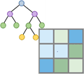
The Train Random Trees Regression Model task models the relationship between explanatory variables (independent variables) and a target dataset (dependent variable).
As of 10.9.1, you must license your ArcGIS Server as an ArcGIS Image Server to use this resource.
Request parameters
| Parameter | Details |
|---|---|
(Required) | A raster or a list of input rasters. The input rasters can be the Portal Item ID, Image Service URL, cloud multidimensional raster dataset or shared raster dataset. The rasters can be single-band, multidimensional, multiband raster datasets, or mosaic datasets, containing explanatory variables An input mosaic dataset will be treated as a raster dataset, not a collection of rasters. To use a collection of rasters as input, build multidimensional info for the mosaic dataset and use the result as input. At least one type of input needs to be provided in the JSON object. If multiple inputs are given, the Syntax: A JSON object describing the input raster(s). Example for a single Example for multiple |
(Required) | The raster or point feature class containing the target variable (dependent variable) data. This parameter can have either a raster input or a feature input. For raster input, this parameter can be specified as a portal item ID, a URL to a raster image service layer, a cloud raster dataset, or a shared raster dataset. For feature input, this parameter can be specified as a URL to a feature service layer, shared data path or service properties. When the target is a feature, the If the input target feature has a date field or a field that defines a dimension, specify a value for both Syntax: A JSON object that describes the input. Example |
(Optional) | The field name of the information to model in the target point feature class or raster dataset. Syntax: String representing the Example |
(Optional) | A date field or numeric field in the input point feature class that defines the dimension values. Syntax: String representing the Example |
(Optional) | The dimension name of the input multidimensional raster (explanatory variables) that links to the dimension in the target data. Syntax: String representing the Example |
(Optional) | The output table feature service name that will be created. You can specify the name, or you can create an empty service using Portal Admin Sharing API and use the returned JSON object as input to this parameter. Syntax: A JSON object that describes the name of the output or the output table. Example of |
(Optional) | The maximum number of trees in the random forest. Increasing the number of trees will lead to higher accuracy rates, although this improvement will level off. The number of trees increases the processing time linearly. The default is 50. Syntax: A long value that represents the Example |
(Optional) | The maximum depth of each tree in the random forest. Depth determines the number of rules each tree can create, resulting in a decision. Trees will not grow any deeper than this setting. The default is 30. Syntax: A long value that represents the Example |
(Optional) | The maximum number of samples that will be used for the regression analysis. A value that is less than or equal to 0 means that the system will use all the samples from the input target raster or point feature class to train the regression model. The default value is 100,000. Syntax: A long value that represents the Example |
(Optional) | Specifies whether the average will be calculated when multiple training points fall into one cell. This parameter is applicable only when the input target is a point feature class.
Syntax: A String value representing the Example |
(Optional) | The output scatterplots in PDF or HTML format. It includes scatterplots of training data, test data, and location test data. Syntax: A JSON object that describes the name of the output or path to the datastore. Examples |
(Optional) | Outputs a feature class containing target values and predicted values for training points, test points, and location test points. You can specify the name, or you can create an empty service using Portal Admin Sharing API and use the returned JSON object as input to this parameter. Syntax: A JSON object that describes the output feature service name. Example |
(Optional) | Defines the percentage of test points used for error checking. The tool checks for three types of errors: errors on training points, errors on test points, and errors on test location points. The default is 10. Syntax: A double value that represents the Example: 20 |
(Optional) | Contains additional settings that affect task execution. This task has the following settings:
|
(Optional) |
The response format. The default response format is html. Values: |
Response
When you submit a request, the task assigns a unique job ID for the transaction.
Syntax:
{
"jobId": "<unique job identifier>",
"jobStatus": "<job status>"
}After the initial request is submitted, you can use job to periodically review the status of the job and messages as described in Checking job status. Once the job has successfully completed, use job to retrieve the results. To track the status, you can make a request of the following form:
https://<raster analysis tools url>/TrainRandomTreesRegressionModel/jobs/<jobId>When the status of the job request is esri , you can access the results of the analysis by making a request of the following form:
To access the output regression definition file:
http://<raster analysis url>/
TrainRandomTreesRegressionModel/jobs/<jobId>/results/outputRegressionDefinitionFile
?token=<your token>&f=jsonThe ecd is the value property of the resulting JSON.
To access the output importance table:
http://<raster analysis url>/
TrainRandomTreesRegressionModel/jobs/<jobId>/results/outputImportanceTable
?token=<your token>&f=jsonTo access the output scatter plots:
http://<raster analysis url>/
TrainRandomTreesRegressionModel/jobs/<jobId>/results/outputScatterPlots
?token=<your token>&f=jsonTo access the output sample features:
http://<raster analysis url>/
TrainRandomTreesRegressionModel/jobs/<jobId>/results/outputSampleFeatures
?token=<your token>&f=json