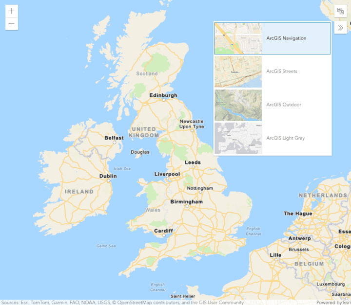
The static basemap tiles service is a location service that provides access to raster basemap tiles for the world. The service supports a number of ArcGIS styles such as navigation, streets, outdoor, and light-gray. The tiles are returned as PNG files.
To access tiles from the service, you use the static tile endpoint for your preferred style and supply the desired level, row, and column.
For example:
/arcgis/streets/static/tile/{level}/{row}/{column}; or,/arcgis/streets/static/tile/{z}/{y}/{x}.
Tiles are supplied as 512x512 .png files in a Web Mercator spatial reference.
Each style also has a metadata endpoint (for example /arcgis/streets/static) that provides details such as the tiling scheme and attribution. Basemap attribution is required when building and deploying mapping applications that use the Static basemap tiles service. There are two types of attribution that you need to display:
- Powered by Esri.
- Attribution for the data source providers.
For more details see Basemap attribution.
This documentation is the REST API reference for the service endpoint, requests, parameters, and supported types. The API reference is also available with the OpenAPI Specification.
Service endpoints
The following table lists all of the static basemap tiles service endpoints:
| Name | Method | Description |
|---|---|---|
GET | Static basemap tiles for the ArcGIS Navigation style in PNG format. | |
GET | Static basemap tiles for the ArcGIS Navigation Night style in PNG format. | |
GET | Static basemap tiles for the ArcGIS Streets style in PNG format. | |
GET | Static basemap tiles for the ArcGIS Streets Night style in PNG format. | |
GET | Static basemap tiles for the ArcGIS Outdoor style in PNG format. | |
GET | Static basemap tiles for the ArcGIS Light Gray Canvas style in PNG format. | |
GET | Static basemap tiles for the ArcGIS Dark Gray Canvas style in PNG format. | |
GET | Static basemap tiles for the ArcGIS Imagery Labels style in PNG format. | |
GET | Static basemap tiles for the ArcGIS Oceans Labels style in PNG format. | |
GET | Static basemap tiles for the ArcGIS Community style in PNG format. | |
GET | Static basemap tiles for the ArcGIS Nova style in PNG format. | |
GET | Static basemap tiles for the ArcGIS Midcentury style in PNG format. | |
GET | Static basemap tiles for the ArcGIS Newspaper style in PNG format. | |
GET | Static basemap tiles for the ArcGIS Human Geography style in PNG format. | |
GET | Static basemap tiles for the ArcGIS Human Geography Dark style in PNG format. | |
GET | Metadata for ArcGIS Navigation static basemap tiles. | |
GET | Metadata for ArcGIS Navigation Night static basemap tiles. | |
GET | Metadata for ArcGIS Streets static basemap tiles. | |
GET | Metadata for ArcGIS Streets Night static basemap tiles. | |
GET | Metadata for ArcGIS Outdoor static basemap tiles. | |
GET | Metadata for ArcGIS Light Gray Canvas static basemap tiles. | |
GET | Metadata for ArcGIS Dark Gray Canvas static basemap tiles. | |
GET | Metadata for Imagery Labels static basemap tiles. | |
GET | Metadata for ArcGIS Oceans Labels static basemap tiles. | |
GET | Metadata for ArcGIS Community static basemap tiles. | |
GET | Metadata for ArcGIS Nova static basemap tiles. | |
GET | Metadata for ArcGIS Midcentury static basemap tiles. | |
GET | Metadata for ArcGIS Newspaper static basemap tiles. | |
GET | Metadata for ArcGIS Human Geography static basemap tiles. | |
GET | Metadata for ArcGIS Human Geography Dark static basemap tiles. | |
GET | Describes the static basemap tiles service. |
Service access
To access the static basemap tiles service, you need the following:
- An ArcGIS Location Platform account.
- An access token that includes the static basemap tiles privilege.
Products and accounts
You can only access the static basemap tiles service if you have an ArcGIS Location Platform account. Use with ArcGIS Online or ArcGIS Enterprise is not supported.
Terms of use
To see a complete description of the allowable usage, attribution, and usage rules, please see the Terms of use.
