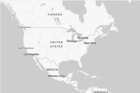
Static basemap tiles for the ArcGIS Human Geography style in PNG format.
Returns static basemap tiles for the ArcGIS Human Geography style in PNG format.

For more information about the style, data providers, attribution, and terms of use, go to the item page in ArcGIS.
Query parameters
| Name | Type | Required | Default value | Description |
|---|---|---|---|---|
| | Optional case-sensitive parameter to specify the preferred language for basemap labels. | ||
| | The authentication token, created from an ArcGIS Location Platform account, with the |
language
Optional case-sensitive parameter to specify the preferred language for basemap labels.
This query parameter uses language codes to specify the preferred language. If not set, or if no translation is available, the default basemap labels will be used.
The language codes use the CLDR (Common Locale Data Repository) format string that uses a two letter language code (e.g. "fr" for French) optionally followed by a two letter country code (e.g. "fr-CA" for French in Canada).
If an unsupported language code is used, then the service will attempt
to fall-back to the closest available language. This is done by
stripping regional and extension sub-tags to find a known language code.
For example, French Canadian (fr-) is unsupported so this falls back
to French fr.
Should the fallback fail, then the service will default to showing the default basemap labels.
Language codes:
- English -
en - Dutch -
nl - Danish -
da - Finnish -
fi - French -
fr - German -
de - Norwegian -
noornb
Enumerated values
token
The authentication token, created from an ArcGIS Location Platform account, with the premium privilege, used to access the static basemap tiles service.
The token parameter can be either an API Key or short-lived token. See
ArcGIS security
documentation
for more information on authenticating with a token or API key.
Alternatively, you can supply a token in the request header with one of the following keys using the "Bearer" scheme:
Authorization: Bearer <YOUR _TOKEN > X-Esri- Authorization : Bearer <YOUR _TOKEN >
Path parameters
| Name | Type | Required | Default value | Description |
|---|---|---|---|---|
| | The level of detail (or "tile matrix set") requested for a tile. | ||
| | Row index of the tile on the selected level of detail. | ||
| | Column index of the tile on the selected level of detail. |
level
The level of detail (or "tile matrix set") requested for a tile.
The level parameter is described as the z component in some systems.
Supplying a level of 0 returns the smallest scale of tiles (e.g. the
global scale) and a level of 22 returns ths largest scale (e.g. street
scale).
Note that the static basemap tiles service uses the tiling scheme of the underlying vector tile service (512x512 pixels), rather than the traditional image tile scheme (256x256 pixels). This means that static basemap tiles service zoom levels are 1 less than those of other APIs. For example: level 12 is equivalent to level 13 for other image map tile services.
The table below shows the resolution and scale of each level:
| level | resolution | scale |
|---|---|---|
| 0 | 78271.516964 | 1:295828763.795777 |
| 1 | 39135.75848199995 | 1:147914381.897889 |
| 2 | 19567.87924100005 | 1:73957190.948944 |
| 3 | 9783.93962049995 | 1:36978595.474472 |
| 4 | 4891.96981024998 | 1:18489297.737236 |
| 5 | 2445.98490512499 | 1:9244648.868618 |
| 6 | 1222.992452562495 | 1:4622324.434309 |
| 7 | 611.496226281245 | 1:2311162.217155 |
| 8 | 305.74811314069 | 1:1155581.108577 |
| 9 | 152.874056570279 | 1:577790.554289 |
| 10 | 76.4370282852055 | 1:288895.277144 |
| 11 | 38.2185141425366 | 1:144447.638572 |
| 12 | 19.1092570712683 | 1:72223.819286 |
| 13 | 9.55462853563415 | 1:36111.909643 |
| 14 | 4.777314267817075 | 1:18055.954822 |
| 15 | 2.388657133974685 | 1:9027.977411 |
| 16 | 1.19432856698734 | 1:4513.9887055 |
| 17 | 0.597164283427525 | 1:2256.9943525 |
| 18 | 0.2985821417799085 | 1:1128.4971765 |
| 19 | 0.1492910708238085 | 1:564.248588 |
| 20 | 0.07464553541190416 | 1:282.124294 |
| 21 | 0.03732276770595208 | 1:141.062147 |
| 22 | 0.01866138385297604 | 1:70.5310735 |
For more information on levels of detail see this page.
- Maximum
- 22
row
Row index of the tile on the selected level of detail.
The row parameter is described as the y component in some systems.
column
Column index of the tile on the selected level of detail.
The column parameter is described as the x component in some systems.
Examples
Request
# You can also use wget
curl -X GET https://static-map-tiles-api.arcgis.com/arcgis/rest/services/static-basemap-tiles-service/beta/arcgis/human-geography/static/tile/{level}/{row}/{column} \
-H 'Accept: image/png'Response
| Status | Meaning | Description | Schema |
|---|---|---|---|
| Tile in PNG format with a size of 512 x 512 pixels. | string | |
| Invalid query parameters. | ||
| Authentication Error. The API key or token is missing, invalid or expired. | ||
| The required parameter 'token' is valid, but does not have permission to access the service. | ||
| The requested resource was not found. | ||
| Unknown | An error occurred on the server. |