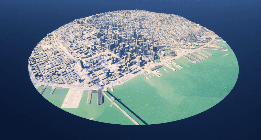
The choice between a global or local scene depends on the spatial reference of your data, the layer types, and what you are trying to achieve in your scene. Use the global scene to display your spatial content on an ellipsoid based on the world coordinate systems. In a local scene, the terrain and layers are shown projected on a planar surface rather than on an ellipsoid.
Global scene
A Global scene is typically used to display data that spans the globe when viewing the curvature of the earth is important. Choose a global scene to show your data in a global context, allowing your audience to zoom in and out and see the entire earth.

A global scene supports all the geographic coordinate systems. For a projected coordinate system, only Web Mercator (Auxiliary Sphere) (WKID: 3857) is supported. When you set up a map with Web Mercator (Auxiliary Sphere) in a global scene, data will be projected to WGS84 (WKID: 4326) and displayed on an ellipsoid.
The geographic coordinate system defines where the data is located on the earth's surface. Use angular units (usually degrees) for the X, Y values to specify a point. For Z values in a global scene, the unit is meters. See Spatial references for more information about the geographic coordinate system.
Local scene
Use a local scene to view data in a smaller extent. Because data is not reprojected in a projected coordinate system, use a local scene for editing, analysis, or measurement. Often local scenes are used to visualize data such as cities or construction sites.

A local scene supports all projected coordinate systems. For the geographic coordinate system, WGS84 (WKID: 4326) and China Geodetic Coordinate System 2000 (WKID: 4490) are supported. When you set up a map with one of these supported geographic systems in a local scene, data will be converted to Plate Carrée (WKID: 32662) to reproject the data on a planar surface.
Projected coordinate systems render geographic data on a three-dimensional Cartesian plane (fish-tank view) in a local scene. It uses linear units (usually meters) for the X, Y values to specify a point. For Z values in a local scene, the units depend on the spatial reference. See Spatial references for more information about projected coordinate systems.
Map extent
In a local scene, you can clip the basemap and layers to the custom extent of your view. This is useful for increasing performance, focusing on key elements of your project, and interacting with underground layers.
The map extent is defined by a series of bounding coordinates that delineate the area of the map or scene with which you want to work with. You can select either a circular or rectangular shape and define values for the dimensions.
Values for extent
- X (Longitude) : Specifies the east–west position of the center of the extent. A projected position value for projected coordinate systems or a longitude value for geographic coordinate systems.
- Y (Latitude) : Specifies the north–south position of the center of the extent. A projected position value for projected coordinate systems or a latitude value for geographic coordinate systems.
- Spatial Reference WKID : The spatial reference of the X and Y values in Well-Known ID (WKID).
- X (Width) : Side-to-side measurement of the extent. It is a radius value when the extent shape is a circle. The units depend on the spatial reference.
- Y (Height) : Base to the top measurement of the extent. The units depend on the spatial reference.
To configure an extent:
- Click on the Map tab, and make sure the Map Type is Local.
- Under the Map Extent section, check Enable Extent.
- In the Geographic Center, set the position values and spatial reference WKID.
- Select an Extent Shape from the drop-down and set the dimension values.