 Hide Table of Contents
 Analysis
 Dynamic Layers
 Editing
 Feature Layers
 Feature Table
 Graphics
 Map
Map
 Mobile
 Online and Portal
 Popups and Info Windows
 Query and Select
 Renderers, Symbols, Visualization
 Search

Feature collection
Explore in the sandbox
Open in CodePen
View live sample
Description
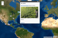
This sample shows how to create a feature layer based on a feature collection. A feature collection consists of a layer definition and feature set. This sample creates a new feature layer to display the location of geo-enabled photos from Flickr using the geo-enabled information from Flickr's public feed.
In this sample a new feature collection that will contain point features is created. After creating the feature collection a layer definition is applied that specifies the default renderer and fields for the feature collection. A picture marker symbol is defined as the default renderer.After creating the feature collection, it is passed it into the FeatureLayer's constructor to create a new feature layer.
Code
<!DOCTYPE html>
<html>
  <head>
    <meta http-equiv="Content-Type" content="text/html; charset=utf-8">

    <meta name="viewport" content="initial-scale=1, maximum-scale=1,user-scalable=no">
    <title>Flickr</title>

    <link rel="stylesheet" href="https://js.arcgis.com/3.46/esri/css/esri.css">
    <style>
      html, body, #map {
        height:100%;
        width:100%;
        margin:0;
        padding:0;
      }
      .esriScalebar{
        padding: 20px 20px;
      }
      #map{
        padding:0;
      }
    </style>

    <script>var dojoConfig = { parseOnLoad: true };</script>
    <script src="https://js.arcgis.com/3.46/"></script>
    <script>
      var map;
      require([
        "esri/map",
        "esri/layers/FeatureLayer",
        "esri/dijit/PopupTemplate",
        "esri/request",
        "esri/geometry/Point",
        "esri/graphic",
        "dojo/on",
        "dojo/_base/array",
        "dojo/domReady!"
      ], function(
        Map,
        FeatureLayer,
        PopupTemplate,
        esriRequest,
        Point,
        Graphic,
        on,
        array
      ) {

        var featureLayer;

        map = new Map("map", {
          basemap: "satellite",
          center: [-46.807, 32.553],
          zoom: 3
        });

        //hide the popup if its outside the map's extent
        map.on("mouse-drag", function(evt) {
          if (map.infoWindow.isShowing) {
            var loc = map.infoWindow.getSelectedFeature().geometry;
            if (!map.extent.contains(loc)) {
              map.infoWindow.hide();
            }
          }
        });

        //create a feature collection for the flickr photos
        var featureCollection = {
          "layerDefinition": null,
          "featureSet": {
            "features": [],
            "geometryType": "esriGeometryPoint"
          }
        };
        featureCollection.layerDefinition = {
          "geometryType": "esriGeometryPoint",
          "objectIdField": "ObjectID",
          "drawingInfo": {
            "renderer": {
              "type": "simple",
              "symbol": {
                "type": "esriPMS",
                "url": "images/flickr.png",
                "contentType": "image/png",
                "width": 15,
                "height": 15
              }
            }
          },
          "fields": [{
            "name": "ObjectID",
            "alias": "ObjectID",
            "type": "esriFieldTypeOID"
          }, {
            "name": "description",
            "alias": "Description",
            "type": "esriFieldTypeString"
          }, {
            "name": "title",
            "alias": "Title",
            "type": "esriFieldTypeString"
          }]
        };

        //define a popup template
        var popupTemplate = new PopupTemplate({
          title: "{title}",
          description: "{description}"
        });

        //create a feature layer based on the feature collection
        featureLayer = new FeatureLayer(featureCollection, {
          id: 'flickrLayer',
          infoTemplate: popupTemplate
        });

        //associate the features with the popup on click
        featureLayer.on("click", function(evt) {
          map.infoWindow.setFeatures([evt.graphic]);
        });

        map.on("layers-add-result", function(results) {
          requestPhotos();
        });
        //add the feature layer that contains the flickr photos to the map
        map.addLayers([featureLayer]);

      function requestPhotos() {
        //get geotagged photos from flickr
        //tags=flower&tagmode=all
        var requestHandle = esriRequest({
          url: "https://api.flickr.com/services/feeds/geo?&format=json",
          callbackParamName: "jsoncallback"
        });
        requestHandle.then(requestSucceeded, requestFailed);
      }

      function requestSucceeded(response, io) {
        //loop through the items and add to the feature layer
        var features = [];
        array.forEach(response.items, function(item) {
          var attr = {};
          attr["description"] = item.description;
          attr["title"] = item.title ? item.title : "Flickr Photo";

          var geometry = new Point(item);

          var graphic = new Graphic(geometry);
          graphic.setAttributes(attr);
          features.push(graphic);
        });

        featureLayer.applyEdits(features, null, null);
      }

      function requestFailed(error) {
        console.log('failed');
      }
    });
    </script>
  </head>
  <body >
    <div id="map"></div>
  </body>

</html>