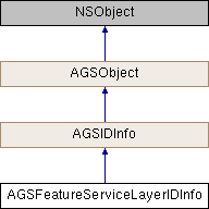
An object that represents the metadata for a Feature service layer.
You can get this object from AGSArcGISFeatureServiceInfo::layerInfos.
- See also
AGSArcGISFeatureServiceInfo::layerInfos
- Since
- 100.6
◆ defaultVisibility
| - (BOOL) defaultVisibility |
|
readnonatomicassign |
Whether the features in the layer should be visible when loaded.
- Since
- 100.6
◆ geometryType
The type of geometry that all the features in the layer possess. For point, multipoint, polyline or polygon feature layers, this will be the type of the feature's geometry. For annotation and dimension feature layers, this will be AGSGeometryTypePolygon (referring to the outline of the text graphic). For tables, this will be AGSGeometryTypeUnknown.
- Since
- 100.6
◆ ID
|
|
readnonatomicassigninherited |
The id info's id.
Will return -1 if an error occurs.
- Since
- 100.0
◆ maxScale
The maximum scale at which the layer's contents will be visible. The layer is only visible when you are zoomed further out than the maxScale.
- Since
- 100.6
◆ minScale
The minimum scale at which the layer's contents will be visible. The layer is only visible when you are zoomed further in than the minScale. However, zero indicates that there is no minScale restriction.
- Since
- 100.6
◆ name
|
|
readnonatomiccopyinherited |
The id info's name.
- Since
- 100.0
◆ serviceType
The type of data held in the layer on the service. Indicates the type of data contained in the layer, e.g. table row, geometric feature, annotation or dimension feature.
- Since
- 100.6
