Description
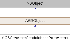
Parameters to generate a sync-enabled geodatabase.
Instances of this class represent parameters that are used with generateJobWithParameters:downloadFileURL: (AGSGeodatabaseSyncTask) to generate sync-enabled geodatabases from supporting ArcGIS Feature services.
- Note
- Consider using the convenience method
AGSGeodatabaseSyncTask::getDefaultGenerateGeodatabaseParametersWithCompletion:to get a properly initialized instance of this class which takes into account the capabilities supported by the ArcGIS Feature service and the data it contains.
- Since
- 100
- See also
AGSGeodatabaseSyncTaskto generate the geodatabase-
AGSGeodatabasefor edit and query operations suppported by the geodatabase

Class Methods | |
| (instancetype) | + generateGeodatabaseParameters |
Method Documentation
◆ generateGeodatabaseParameters
| + (instancetype) generateGeodatabaseParameters |
Property Documentation
◆ attachmentSyncDirection
|
readwritenonatomicassign |
Specifies how the geodatabase should be configured to sync attachment data with its originating service.
- Since
- 100
◆ extent
|
readwritenonatomicstrong |
The geographic extent within which features will be included in the sync-enabled geodatabase. To include non-spatial records, you must properly set up the layerOptions for that layer to include a AGSGenerateLayerOption::whereClause and set AGSGenerateLayerOption::useGeometry to NO
- Since
- 100
◆ layerOptions
|
readwritenonatomiccopy |
Options specifiying how to filter features for inclusion into the sync-enabled geodatabase on a layer-by-layer basis. If not specified, all features within the extent are included. For non-spatial records, you must set AGSGenerateLayerOption::useGeometry to NO and provide a AGSGenerateLayerOption::whereClause.
- Since
- 100
◆ outSpatialReference
|
readwritenonatomicstrong |
The spatial reference in which you would like the generated geodatabase. If the data on the server is not in this spatial reference, it will be reprojected before being included in the geodatabase.
- Since
- 100
◆ returnAttachments
|
readwritenonatomicassign |
Indicates whether or not the sync-enabled geodatabase should contain attachments for the features that are included. Only applicable if the feature service supports attachments.
- Since
- 100
◆ shouldSyncAnnotations
|
readwritenonatomicassign |
A Boolean value that indicates whether annotation data is to be included from the service, when generating, or downloading to, an offline geodatabase.
Feature layers and tables are always included in the generation and synchronization of the geodatabase. Annotation data can be optionally included when downloading from the service.
Once this data is taken offline to a local geodatabase, any subsequent inserts, edits or deletions will NOT be applied to the server data when re-synchronized. If features linked to the annotation have been changed, the server WILL apply the feature-linked-annotation updates. Another download from the server will replace any offline inserts, edits or deletions of annotation features.
The default value is YES. Annotation data will be included.
AGSSyncCapabilities::supportsAnnotations can be used to check whether Annotation data is available from the service.
This property can be used at the same time as specifying other additional data types to be included.
- Since
- 100.14
◆ shouldSyncContingentValues
|
readwritenonatomicassign |
A Boolean value that indicates whether contingent value data is to be included from the service when either generating or synchronizing with an offline geodatabase.
Feature layers and tables are always included in the generation and synchronization of the geodatabase. Contingent value data can be optionally included.
The default value is YES. Contingent Value data will be included.
AGSSyncCapabilities::supportsContingentValues can be used to check whether vontingent value data is available from the service.
This property can be used at the same time as specifying other additional data types to be included.
- Since
- 100.13
◆ shouldSyncDimensions
|
readwritenonatomicassign |
A Boolean value that indicates whether dimension data is to be included from the service, when generating, or synchronizing with, an offline geodatabase.
Feature layers and tables are always included in the generation and synchronization of the geodatabase. Dimension data can be optionally included.
The default value is YES. Dimension data will be included.
AGSSyncCapabilities::supportsDimensions can be used to check whether dimension data is available from the service.
This property can be used at the same time as specifying other additional data types to be included.
- Since
- 100.14
◆ syncModel
|
readwritenonatomicassign |
Specifies whether the geodatabase should be configured to sync with the originating service as a whole or individually on a per layer basis.
- Since
- 100
◆ utilityNetworkSyncMode
|
readwritenonatomicassign |
Specifies the generation and synchronization mode of Utility Network data from the service to an offline geodatabase.
Feature layers and tables are always included in the generation and synchronization of the geodatabase. Utility Network System data can be optionally included.
The default value is AGSUtilityNetworkSyncModeNone. Utility Network System data will not be included.
This property can be used at the same time as specifying other additional data types to be included.
- Since
- 100.11