Description
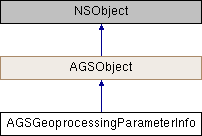
Information about an input/output Geoprocessing Task parameter.
Instances of this class represent information about a parameter of a Geoprocessing Task such as its name, type, whether or not it is optional (for input parameters), and whether it is an input or output parameter.
- Since
- 100.1

Properties | |
| NSString * | category |
| NSArray< NSString * > * | choiceList |
| AGSGeoprocessingParameterType | dataType |
| AGSGeoprocessingParameter * | defaultParameter |
| AGSGeoprocessingParameterDirection | direction |
| NSString * | displayName |
| BOOL | featuresRequireGeometry |
| AGSGeoprocessingParameterType | multiValueDataType |
| NSString * | name |
| NSString * | parameterDescription |
| BOOL | required |
Property Documentation
◆ category
|
readnonatomiccopy |
Category of the parameter.
- Since
- 100.1
◆ choiceList
|
readnonatomiccopy |
Permissible values for the parameter.
- Since
- 100.1
◆ dataType
|
readnonatomicassign |
Data type of the parameter.
- Since
- 100.1
◆ defaultParameter
|
readnonatomicstrong |
Default value of the parameter.
- Since
- 100.1
◆ direction
|
readnonatomicassign |
Indicates whether the parameter is input (needed to execute the task) or output (generated when the task finishes).
- Since
- 100.1
◆ displayName
|
readnonatomiccopy |
User-friendly name of the parameter.
- Since
- 100.1
◆ featuresRequireGeometry
|
readnonatomicassign |
When the parameter represents features, this property indicates whether the features require a geometry or not.
- Since
- 100.1
◆ multiValueDataType
|
readnonatomicassign |
When the parameter is a multivalue parameter, this property indicates the data type of the values. If the parameter is not a multivalue parameter, this property will be AGSGeoprocessingParameterTypeUnknown.
- Since
- 100.1
◆ name
|
readnonatomiccopy |
Name of the parameter.
- Since
- 100.1
◆ parameterDescription
|
readnonatomiccopy |
Description of the parameter.
- Since
- 100.1
◆ required
|
readnonatomicassign |
Indicates whether the parameter is mandatory or not.
- Since
- 100.1