Description
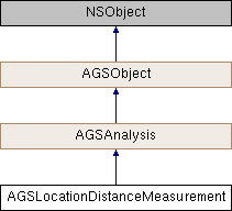
Analysis of distance between two locations.
Instances of this class represent an analysis object that evaluates direct, vertical, and horizontal distances between two points defined by start and end point locations.
- Since
- 100.3

Instance Methods | |
| (instancetype) | - initWithStartLocation:endLocation: |
Class Methods | |
| (instancetype) | + locationDistanceMeasurementWithStartLocation:endLocation: |
Method Documentation
◆ initWithStartLocation:endLocation:
| - (instancetype) initWithStartLocation: | (AGSPoint *) | startLocation | |
| endLocation: | (AGSPoint *) | endLocation | |
Creates a measurement analysis object based on the provided locations.
- Parameters
-
startLocation A point that defines the start location of the measurement. endLocation A point that defines the end location of the measurement.
- Since
- 100.3
◆ locationDistanceMeasurementWithStartLocation:endLocation:
| + (instancetype) locationDistanceMeasurementWithStartLocation: | (AGSPoint *) | startLocation | |
| endLocation: | (AGSPoint *) | endLocation | |
Creates a measurement analysis object based on the provided locations.
- Parameters
-
startLocation A point that defines the start location of the measurement. endLocation A point that defines the end location of the measurement.
- Returns
- A new measurement analysis object.
- Since
- 100.3
Property Documentation
◆ directDistance
|
readnonatomicstrong |
The direct distance length measurement component.
- Since
- 100.3
◆ endLocation
|
readwritenonatomicstrong |
Point that defines the end location of the measurement.
- Since
- 100.3
◆ horizontalDistance
|
readnonatomicstrong |
The horizontal distance length measurement component.
- Since
- 100.3
◆ measurementChangedHandler
|
readwritenonatomiccopy |
Block that is invoked when distance components become available or change, for instance if the start/end locations are changed.
- Note
- The block will be invoked on the same thread on which the event occurred, which could be any arbitrary thread. You need to dispatch any UI related work to the main thread.
- Since
- 100.3
◆ startLocation
|
readwritenonatomicstrong |
Point that defines the start location of the measurement.
- Since
- 100.3
◆ unitSystem
|
readwritenonatomicassign |
Unit system under which distances are calculated.
- Since
- 100.3
◆ verticalDistance
|
readnonatomicstrong |
The vertical distance length measurement component.
- Since
- 100.3
◆ visible
|
readwritenonatomicassigninherited |
Indicates whether the results of this analysis should be visible or not. Visibility can be controlled for individual analyses as well as for the analysis overlay that contains them.
- Since
- 100.2