AGSNMEASatelliteInfo Class Reference
Description
An NMEA satellite info instance.
Contains information about a satellite visible at the location.
- Since
- 100.10
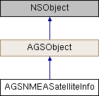
Inheritance diagram for AGSNMEASatelliteInfo:

Properties | |
| double | azimuth |
| double | elevation |
| BOOL | inUse |
| NSInteger | satelliteID |
| AGSNMEAGNSSSystem | system |
Property Documentation
◆ azimuth
|
readnonatomicassign |
The azimuth of the satellite info in degrees.
- Since
- 100.10
◆ elevation
|
readnonatomicassign |
The elevation of the satellite info in degrees.
- Since
- 100.10
◆ inUse
|
readnonatomicassign |
Indicates if the satellite was used in the calculation of the location.
- Since
- 100.10
◆ satelliteID
|
readnonatomicassign |
The ID of the satellite info.
- Since
- 100.10
◆ system
|
readnonatomicassign |
The GNSS (Global Navigation Satellite System) system.
Included in NMEA specification as of v4.11.
- Since
- 100.10