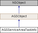
Metadata about the network analyst service or dataset used by AGSServiceAreaTask.
Instances of this class represent metadata about the network analyst service or dataset used by AGSServiceAreaTask. It provides default values for the parameters created through defaultServiceAreaParametersWithCompletion: (AGSServiceAreaTask)
- Since
- 100.1
◆ accumulateAttributeNames
| - (NSArray<NSString*>*) accumulateAttributeNames |
|
readnonatomiccopy |
A list of network attributes that can be accumulated and returned as part of the analysis result. You might want to perform the analysis using a distance-based impedance attribute and accumulate a time-based cost attribute. The results of this kind of analysis are based on distance, but they also specify how long it would take to reach a portion of the service area.
- Since
- 100.1
◆ costAttributes
A list of cost attributes that can be used as a travel mode impedance (AGSTravelMode::impedanceAttributeName) to optimize the route. The key in the dictionary represents the name of the cost attribute.
- Since
- 100.1
◆ defaultImpedanceCutoffs
| - (NSArray<NSNumber*>*) defaultImpedanceCutoffs |
|
readnonatomiccopy |
Specifies the default cutoff beyond which the service area won't be computed.
The cutoff is a measure of the attribute specified by AGSTravelMode::impedanceAttributeName. Cutoffs specify the quantity of the impedance to apply. They constrain the extent of the service area to be calculated. For example, if you apply breaks of 5, 10, and 15 when the impedance is set to time, the service area will include those streets that can be reached within 5, 10, and 15 minutes.
- Since
- 100.1
◆ defaultTravelModeName
| - (NSString*) defaultTravelModeName |
|
readnonatomiccopy |
The name of the travel mode that is used by default
- Since
- 100.1
- See also
travelModes
◆ geometryAtCutoff
The type of service area geometries to generate at each cutoff when multiple cutoff values are specified. This parameter does not apply to line output.
- Since
- 100.1
◆ geometryAtOverlap
Options available for generating polygons or lines for multiple facilities in relation to one another.
- Since
- 100.1
◆ maxLocatingDistance
| - (double) maxLocatingDistance |
|
readnonatomicassign |
Maximum locating distance is the furthest distance in meters that is searched when locating or relocating a point onto the network. The search looks for suitable edges or junctions and snaps the point to the nearest one. If a suitable location isn't found within the maximum locating distance, the object is marked as unlocated.
- Since
- 100.6
◆ networkName
| - (NSString*) networkName |
|
readnonatomiccopy |
Name of the underlying transportation network dataset
- Since
- 100.1
◆ outputSpatialReference
The spatial reference in which the result geometries are returned
- Since
- 100.1
◆ polygonBufferDistance
| - (double) polygonBufferDistance |
|
readnonatomicassign |
Amount by which to buffer the output service area polygons. Specified in units of the outputSpatialReference. The buffer refers to the distance from the road the service area polygon should extend when no other reachable roads are nearby, similar to a line buffer size. This is useful if the network is very sparse and you don't want the service area to cover large areas where there are no features.
- Since
- 100.1
◆ polygonDetail
The level of detail for output service area polygons
- Since
- 100.1
◆ restrictionAttributes
The list of supported restrictions for constraining the analysis. The key in the dictionary represents the name of the restriction attribute.
- Since
- 100.1
◆ returnPolygons
Specifies whether to return the service area result geometries as polygons. Default is true.
- Since
- 100.1
◆ returnPolylines
Specifies whether to return the service area result geometries as polylines. Default if false.
- Since
- 100.1
◆ startTime
Specifies when the service area starts from or finishes at the facility. If not specified, defaults to the time the task is executed.
- Since
- 100.1
◆ supportedRestrictionUsageParameterValues
| - (NSArray<NSString*>*) supportedRestrictionUsageParameterValues |
|
readnonatomiccopy |
The list of supported restriction parameter values.
- Since
- 100.1
◆ travelDirection
Specifies the direction of travel for the service area computation. The direction you should choose depends on the nature of your service area analysis. The service area for a pizza delivery store, for example, should be created away from the facility since pizzas are delivered from the store to the customer. Alternatively, a hospital should choose the opposite direction since the urgent part of the trip for an incoming patient is going to the hospital, not returning home afterwards.
- Since
- 100.1
◆ travelModes
Specifies the available travel modes that can be used to customize the route.
- Since
- 100.1
