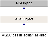
Metadata about the network analyst service or dataset used by AGSClosestFacilityTask.
Instances of this class represent metadata about the network analyst service or dataset used by AGSClosestFacilityTask. It provides default values for the parameters created through defaultClosestFacilityParametersWithCompletion: (AGSClosestFacilityTask).
- Since
- 100.1
◆ accumulateAttributeNames
| - (NSArray<NSString*>*) accumulateAttributeNames |
|
readnonatomiccopy |
A list of network attributes that can be accumulated and returned as part of the analysis result. You might want to perform the analysis using a distance-based impedance attribute and accumulate a time-based cost attribute. The results of this kind of analysis are based on distance, but they also specify how long it would take to reach a portion of the service area.
- Since
- 100.1
◆ costAttributes
A list of cost attributes that can be used as a travel mode impedance (AGSTravelMode::impedanceAttributeName) to optimize the route. The key in the dictionary represents the name of the cost attribute.
- Since
- 100.1
◆ defaultImpedanceCutoff
| - (double) defaultImpedanceCutoff |
|
readnonatomicassign |
◆ defaultTargetFacilityCount
| - (NSInteger) defaultTargetFacilityCount |
|
readnonatomicassign |
◆ defaultTravelModeName
| - (NSString*) defaultTravelModeName |
|
readnonatomiccopy |
The name of travel mode that is used by default
- Since
- 100.1
- See also
travelModes
◆ directionsDistanceUnits
The linear units used while providing distances for turn-by-turn directions.
- Since
- 100.1
◆ directionsLanguage
| - (NSString*) directionsLanguage |
|
readnonatomiccopy |
The language used when computing directions. For example, en, fr, pt-BR, zh-Hans etc.
- Since
- 100.1
◆ directionsStyle
The style used for providing directions.
- Since
- 100.1
◆ directionsSupport
Whether the underlying network dataset supports the returning of directions. For services prior to ArcGIS 10.8, this value will be AGSNetworkDirectionsSupportUnknown
- See also
AGSNetworkDirectionsSupport
- Since
- 100.7
◆ maxLocatingDistance
| - (double) maxLocatingDistance |
|
readnonatomicassign |
Maximum locating distance is the furthest distance in meters that is searched when locating or relocating a point onto the network. The search looks for suitable edges or junctions and snaps the point to the nearest one. If a suitable location isn't found within the maximum locating distance, the object is marked as unlocated.
- Since
- 100.6
◆ networkName
| - (NSString*) networkName |
|
readnonatomiccopy |
Name of the underlying transportation network dataset
- Since
- 100.1
◆ outputSpatialReference
◆ restrictionAttributes
The list of supported restrictions for constraining the analysis. The key in the dictionary represents the name of the restriction attribute.
- Since
- 100.1
◆ routeShapeType
◆ startTime
The time the route begins. If not specified, defaults to the time the task is executed.
- Since
- 100.1
- See also
startTimeUsage
◆ startTimeUsage
Determines whether the startTime is used as the time of departing from the facility or incident, or time of arriving at the facility or incident.
- Since
- 100.1
◆ supportedLanguages
| - (NSArray<NSString*>*) supportedLanguages |
|
readnonatomiccopy |
The list of languages supported for generating turn-by-turn driving directions.
- Since
- 100.1
◆ supportedRestrictionUsageParameterValues
| - (NSArray<NSString*>*) supportedRestrictionUsageParameterValues |
|
readnonatomiccopy |
The list of supported restriction parameter values.
- Since
- 100.1
◆ travelDirection
Specifies the direction of travel between facilities and incidents. The direction of travel may influence the facilities found if the network contains one-way streets or impedances based on the direction of travel. For instance, it might take 10 minutes to drive from a particular incident to a particular facility, but the journey might take 15 minutes traveling in the other direction, from the facility to the incident, because of one-way streets or different traffic conditions.
- Since
- 100.1
◆ travelModes
Specifies the available travel modes that can be used to customize the route.
- Since
- 100.1
