Description
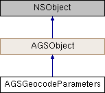
Parameters to refine gecoding results returned by AGSLocatorTask.
Instances of this class represent input parameters to refine results of geocode operations on AGSLocatorTask
- Since
- 100
- See also
AGSLocatorInfofor metadata about the locator service or dataset used byAGSLocatorTask. The metadata contains information that can be used to set up these parameters.

Class Methods | |
| (instancetype) | + geocodeParameters |
Properties | |
| NSArray< NSString * > * | categories |
| NSString * | countryCode |
| BOOL | forStorage |
| NSInteger | maxResults |
| double | minScore |
| NSString * | outputLanguageCode |
| AGSSpatialReference * | outputSpatialReference |
| AGSPoint * | preferredSearchLocation |
| NSArray< NSString * > * | resultAttributeNames |
| AGSGeometry * | searchArea |
Method Documentation
◆ geocodeParameters
| + (instancetype) geocodeParameters |
Property Documentation
◆ categories
|
readwritenonatomiccopy |
Categories by which to filter geocoded results. Categories represent address and place types, for example "city", "school", "Ski Resort". By default no category filtering is applied.
- Since
- 100
◆ countryCode
|
readwritenonatomiccopy |
Country by which to filter results. This can speed up the geocoding operation. Acceptable values include the full country name in English or the official language of the country, the ISO 3166-1 2-digit country code, or the ISO 3166-1 3-digit country code.
- Since
- 100
◆ forStorage
|
readwritenonatomicassign |
Specifies whether the results of the operation should be persisted. The default value is false, which indicates the results of the operation can't be stored, but they can be temporarily displayed on a map for instance. If you store the results in a database, for example, you need to set this parameter to true.
Applications are contractually prohibited from storing the results of geocoding transactions unless they perform the operation as an authenticated user. ArcGIS Online service credits are deducted from the organization account for each geocode transaction that uses this capability.
- Since
- 100
◆ maxResults
|
readwritenonatomicassign |
The maximum number of results desired.
- Note
- Only applies when using an ArcGIS Geocode service (i.e not geocoding locally on the device using a locator dataset). Please consult the service properties for information on the largest acceptable value for this parameter.
- Since
- 100
◆ minScore
|
readwritenonatomicassign |
Minimum match score of the results. Results which have a match score lower than this value will not be returned.
- Note
- Only applies when geocoding locally on the device using a locator dataset (i.e not using an ArcGIS Geocode service)
- Since
- 100
◆ outputLanguageCode
|
readwritenonatomiccopy |
The language in which results should be returned. Based on the 2-digit ISO 639-1 language code.
- Since
- 100
◆ outputSpatialReference
|
readwritenonatomicstrong |
The spatial reference in which result geometries should be returned.
- Since
- 100
◆ preferredSearchLocation
|
readwritenonatomicstrong |
The location by which to prioritize/order geocoded results. Results that fall within a 50 KM buffer of this location are boosted in rank so that they show up higher in the list of candidates, but results further away are still included. To exclude results based on a region, use searchArea instead. The preferred search location is only intended to influence the sort order of results so that the most locationally-relevant candidates are returned first.
- Since
- 100
◆ resultAttributeNames
|
readwritenonatomiccopy |
List of attributes to be returned for each geocoded result. The attributes available are specified by AGSLocatorInfo::resultAttributes and AGSLocatorInfo::intersectionResultAttributes. Use "*" to return all attributes.
- Since
- 100
◆ searchArea
|
readwritenonatomicstrong |
The search area used to spatially filter the geocoded results. Only results that lie within this area are included.
- Since
- 100