Description
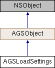
Settings for layers in a Map or Scene.
Instances of this class represent settings that are applied to layers while loading a map or a scene. Making changes to these settings does not affect maps or scenes that have already been loaded.
- Since
- 100.2

Class Methods | |
| (instancetype) | + loadSettings |
Method Documentation
◆ loadSettings
| + (instancetype) loadSettings |
Property Documentation
◆ featureRequestMode
|
readwritenonatomicassign |
The request mode to use for requesting features. Default is AGSFeatureRequestModeOnInteractionCache.
- Since
- 100.9
◆ featureServiceSessionType
|
readwritenonatomicassign |
The session type to use for branch-versioned AGSServiceGeodatabase objects. Default is AGSFeatureServiceSessionTypeTransient.
- Since
- 100.10
◆ featureTilingMode
|
readwritenonatomicassign |
The feature tiling mode in use. Sets the feature tiling mode of each feature layer that is loaded. Default is AGSFeatureTilingModeEnabledWhenSupported.
Changes how feature tiling is handled by each feature layer. Individual feature layers can override these settings.
- See also
AGSFeatureTilingMode
- Since
- 100.10
◆ preferredPointFeatureRenderingMode
|
readwritenonatomicassign |
Preferred rendering mode for feature layers containing point features. Defaults to Automatic
- Since
- 100.2
◆ preferredPolygonFeatureRenderingMode
|
readwritenonatomicassign |
Preferred rendering mode for feature layers containing polygon features. Defaults to Automatic
- Since
- 100.2
◆ preferredPolylineFeatureRenderingMode
|
readwritenonatomicassign |
Preferred rendering mode for feature layers containing polyline features. Defaults to Automatic
- Since
- 100.2
◆ useAdvancedSymbology
|
readwritenonatomicassign |
Indicates whether feature layers should be visualized using advanced CIM symbols. The default is true. Servers which don't support this simply ignore the parameter and return regular symbols instead.
- Since
- 100.2