require(["esri/views/View"], (View) => { /* code goes here */ });
import View from "@arcgis/core/views/View.js";
esri/views/View
A view provides the means of viewing and interacting with the components of a Map. The Map is merely a container, storing the geographic information contained in base layers and operational layers. The View renders the Map and its various layers, making them visible to the user.
There are two types of views: MapView and SceneView. The MapView renders a Map and its layers in 2D. The SceneView renders these elements in 3D. View is the base class of MapView and SceneView and has no constructor. To create a view, you must do so by directly creating an instance of either MapView or SceneView.
| MapView (2D) | SceneView (3D) |
|---|---|
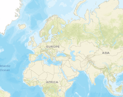 |
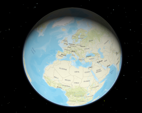 |
To associate a view with a map, you must set the map property to an instance of Map.
// Load the Map and MapView modules
require(["esri/Map", "esri/views/MapView"], function(Map, MapView) {
  // Create a Map instance
  let map = new Map({
    basemap: "topo-vector"
  });

  // Create a MapView instance (for 2D viewing) and set its map property to
  // the map instance we just created
  let view = new MapView({
    map: map,
    container: "viewDiv"
  });
});
In the snippet above, you'll notice a container property set on the view. The container
property is the reference to the DOM node that contains the view. This is commonly a <div> element. The container
referenced in the example above might look something like:
<body>
 <div id="viewDiv"></div>
</body>
You can observe the view's relationship to the HTML container in the Create a 2D map tutorial and any of the available samples.
Other properties may be set on the view, such as the rotation, scale, popup, and padding. See MapView and SceneView for additional properties specific to creating views in 2D and 3D.
A Map may have multiple views associated with it, including a combination of MapViews and SceneViews. See the Geodesic buffers and 2D overview map in SceneView samples to learn how a MapView and a SceneView can display the same map in a single application. While multiple views can reference the same map, a view may not associate itself with more than one Map instance.
The View also allows users to interact with components of the map. For example, when a user clicks or touches the location of a
feature in a map, they are not touching the feature nor the map; the event is actually handled with the View that references the map and
the LayerView that references the layer. Therefore, events such as click are not
handled on the Map or the Layer, but rather on the View. See MapView and
SceneView for additional details.
Property Overview
| Name | Type | Summary | Class |
|---|---|---|---|
Collection containing a flat list of all the created LayerViews related to the basemap, operational layers, and group layers in this view. | View | ||
Represents an ongoing view animation initialized by goTo(). | View | ||
Represents the view for a single basemap after it has been added to the map. | View | ||
The name of the class. | Accessor | ||
Indicates whether displayFilters are honored across all layers in the view. | View | ||
A fatal error returned when the view loses its WebGL context. | View | ||
Allows for adding graphics directly to the default graphics in the View. | View | ||
Represents a collection of HighlightOptions objects which can be used to highlight features throughout an application. | View | ||
Options to configure input handling of the View. | View | ||
Indication whether the view is being interacted with (for example when panning or by an interactive tool). | View | ||
A collection containing a hierarchical list of all the created LayerViews of the operational layers in the map. | View | ||
The magnifier allows for showing a portion of the view as a magnifier image on top of the view. | View | ||
An instance of a Map object to display in the view. | View | ||
Indication whether the view is being navigated (for example when panning). | View | ||
Options to configure the navigation behavior of the View. | View | ||
Use the padding property to make the center, and extent, etc. | View | ||
When | View | ||
Provides more granular information about the view's process of becoming ready. | View | ||
Represents the current value of one pixel in the unit of the view's spatialReference. | View | ||
The spatial reference of the view. | View | ||
Indication whether the view is animating, being navigated with or resizing. | View | ||
This property specifies the base colors used by some widgets and components to render graphics and labels. | View | ||
The view's time extent. | View | ||
The type of the view is either | View | ||
Indicates whether the view is being updated by additional data requests to the network, or by processing received data. | View | ||
Contains the collection of active views on the page. | View |
Property Details
-
allLayerViews
PropertyallLayerViews Collection<LayerView>readonly -
Collection containing a flat list of all the created LayerViews related to the basemap, operational layers, and group layers in this view.
- See also
-
basemapView
PropertybasemapView BasemapView -
Represents the view for a single basemap after it has been added to the map.
-
displayFilterEnabled
PropertydisplayFilterEnabled BooleanSince: ArcGIS Maps SDK for JavaScript 4.32View since 4.0, displayFilterEnabled added at 4.32. -
Indicates whether displayFilters are honored across all layers in the view. If
false, display filters are ignored on all layers and all features are rendered. To ignore display filters on a per-layer basis, set the layer's displayFilterEnabled property tofalse.- Default Value:true
-
Since: ArcGIS Maps SDK for JavaScript 4.12View since 4.0, fatalError added at 4.12. -
A fatal error returned when the view loses its WebGL context. Watch this property to properly handle the error and attempt to recover the WebGL context.
- See also
ExamplereactiveUtils.when( () => view.fatalError, () => { console.error("Fatal Error! View has lost its WebGL context. Attempting to recover..."); view.tryFatalErrorRecovery(); } );
-
graphics
Propertygraphics Collection<Graphic>autocast -
Allows for adding graphics directly to the default graphics in the View.
- See also
Examples// Adds a graphic to the View view.graphics.add(pointGraphic);// Removes a graphic from the View view.graphics.remove(pointGraphic);
-
highlights
Propertyhighlights Collection<HighlightOptions>autocastSince: ArcGIS Maps SDK for JavaScript 4.32View since 4.0, highlights added at 4.32. -
Represents a collection of HighlightOptions objects which can be used to highlight features throughout an application. Highlighting works by applying highlight options to one or more features. You can configure these options (such as color or opacity) to define how a feature will be visually emphasized.
A maximum of six HighlightOptions objects are supported in the collection, and they can be added, removed, and reordered freely. Their order in the collection determines priority, with the last object having the highest priority. If you apply more than one highlight to a feature, the one that is last within the collection will be applied. The HighlightOptions object must be part of this collection in order to be applied to features.
To highlight a feature, use the highlight() method on the relevant LayerView instance. To apply specific HighlightOptions, include the name in the
highlight()method'soptionsparameter. If nonameis provided, the feature will use thedefaulthighlight options.In a 2D MapView, a layerView's highlightOptions will take precedence over the MapView's
highlightsif both properties are set.The table below shows the default highlight options in the View's highlights collection if the collection has not been modified:
Highlight options name Description Default settings default The default highlight options. Used when layerView.highlight()is called without specifying any particular highlight options.{ name: "default", color: "cyan", haloOpacity: 1, fillOpacity: 0.25, shadowColor: "black", shadowOpacity: 0.4, shadowDifference: 0.2}temporary The temporary highlight options, pre-configured for common use cases such as hovering over a feature in the view. { name: "temporary", color: "yellow", haloOpacity: 1, fillOpacity: 0.25, shadowColor: "black", shadowOpacity: 0.4, shadowDifference: 0.2 }Examples// Use the default highlights collection to apply a highlight to features when you hover over them // A handler can be used to remove any previous highlight when applying a new one let hoverHighlight; view.on("pointer-move", (event) => { // Search for the first feature in the featureLayer at the hovered location view.hitTest(event, { include: featureLayer }).then((response) => { if (response.results[0]) { const graphic = response.results[0].graphic; view.whenLayerView(graphic.layer).then((layerView) => { // Remove any previous highlight, if it exists hoverHighlight?.remove(); // Highlight the hit features with the temporary highlight options, which are pre-configured for this use case hoverHighlight = layerView.highlight(graphic, { name: "temporary"}); }); } }); });// Override the default highlights collection const view = new MapView({ map: map, container: "viewDiv", // Set the highlight options to be used in the view highlights: [ { name: "default", color: "orange" }, { name: "temporary", color: "magenta" }, { name: "table", color: "cyan", fillOpacity: 0.5, haloOpacity: 0} ] });// Add highlight options to the collection after initialization const selectionHighlightOptions = { name: "selection", color: "#ff00ff", // bright fuchsia haloOpacity: 0.8, fillOpacity: 0.2 }; // Add the options to the highlights collection at the first position view.highlights.add(selectionGroup, 0);
-
input
Propertyinput InputreadonlySince: ArcGIS Maps SDK for JavaScript 4.9View since 4.0, input added at 4.9. -
Options to configure input handling of the View.
Example// Make gamepad events to emit independently of focus. view.input.gamepad.enabledFocusMode = "none";
-
interacting
Propertyinteracting Booleanreadonly -
Indication whether the view is being interacted with (for example when panning or by an interactive tool).
- Default Value:false
-
layerViews
PropertylayerViews Collection<LayerView>readonly -
A collection containing a hierarchical list of all the created LayerViews of the operational layers in the map.
- See also
-
magnifier
Propertymagnifier MagnifierreadonlySince: ArcGIS Maps SDK for JavaScript 4.19View since 4.0, magnifier added at 4.19. -
The magnifier allows for showing a portion of the view as a magnifier image on top of the view.
-
An instance of a Map object to display in the view. A view may only display one map at a time. On the other hand, one Map may be viewed by multiple MapViews and/or SceneViews simultaneously.
This property is typically set in the constructor of the MapView or SceneView. See the class description for examples demonstrating the relationship between the map and the view.
-
navigating
Propertynavigating Booleanreadonly -
Indication whether the view is being navigated (for example when panning).
- Default Value:false
-
navigation
Propertynavigation NavigationautocastSince: ArcGIS Maps SDK for JavaScript 4.9View since 4.0, navigation added at 4.9. -
Options to configure the navigation behavior of the View.
Example// Disable the gamepad usage, single touch panning, panning momentum and mouse wheel zooming. const view = new MapView({ container: "viewDiv", map: new Map({ basemap: "satellite" }), center: [176.185, -37.643], zoom: 13, navigation: { gamepad: { enabled: false }, actionMap: { dragSecondary: "none", // Disable rotating the view with the right mouse button mouseWheel: "none" // Disable zooming with the mouse wheel }, browserTouchPanEnabled: false, momentumEnabled: false, } });
-
padding
Propertypadding Object -
Use the padding property to make the center, and extent, etc. work off a subsection of the full view. This is particularly useful when layering UI elements or semi-transparent content on top of portions of the view. See the view padding sample for an example of how this works.
- Properties
- Default Value:{left: 0, top: 0, right: 0, bottom: 0}
- See also
-
ready
Propertyready Booleanreadonly -
When
true, this property indicates whether the view successfully satisfied all dependencies, signaling that the following conditions are met.- The view has a map. If map is a WebMap or a WebScene, then the map or scene must be loaded.
- The view has a container with a size greater than
0. - The view has a spatialReference, a center, and a scale. These also can be inferred by setting an extent.
When a view becomes ready it will resolve itself and invoke the callback defined in when() where code can execute on a working view. Subsequent changes to a view's readiness would typically be handled by watching
view.readyand providing logic for cases where the map or container change.- Default Value:false
- See also
-
readyState
PropertyreadyState StringreadonlySince: ArcGIS Maps SDK for JavaScript 4.32View since 4.0, readyState added at 4.32. -
Provides more granular information about the view's process of becoming ready. This property helps manage view properties when the view fails to become ready, such as when the basemap fails to load.
The following are the possible expected values and their descriptions:
Value Description loadingThe view is currently loading information from the map. readyThe view is ready. This is similar to the readyproperty.missing-mapThe view is missing a map. Set the view's map property. missing-containerThe view is missing a container. Set the view's container property. empty-mapThe view's map has no layers. Add layers to the map. rendering-errorThe view failed to render. This is similar to the fatalErrorproperty.map-content-errorThe view failed to find information from the map and couldn't derive the spatialReference. Verify that the mapcorrectly loaded with theloadErrorproperty, as well as its basemap, and the first layer in the map's layers collection. Alternatively, set a validcenter,scale, andspatialReference.Possible Values:"loading" |"missing-map" |"missing-container" |"empty-map" |"map-content-error" |"rendering-error" |"ready"
- Default Value:"loading"
Examples// Watch the view's readyState immediately after its initialization. reactiveUtils.watch( () => view.readyState, (state) => { switch (state) { case "missing-map": // Map is missing. Set a default map. view.map = new Map({ basemap: "streets" }); break; } }, { initial: true // fire the callback immediately after initialization. } );const view = new MapView({ container: "viewDiv", map: new Map({ basemap: { baseLayers: [ new TileLayer({ url: "my-failing-tiled-service" }) ] } }); reactiveUtils.watch(() => view.readyState, (state) => { switch (state) { case "map-content-error": // Defaults to a different map in case of failure view.map = new Map({ basemap: "streets" }); break; case "rendering-error": view.tryFatalErrorRecovery(); break; default: console.log("View is not ready:", state); } });
-
resolution
Propertyresolution NumberreadonlySince: ArcGIS Maps SDK for JavaScript 4.9View since 4.0, resolution added at 4.9. -
Represents the current value of one pixel in the unit of the view's spatialReference. The value of resolution is calculated by dividing the view's extent width by its width.
-
spatialReference
PropertyspatialReference SpatialReferenceautocast -
The spatial reference of the view. This indicates the projected or geographic coordinate system used to locate geographic features in the map.
- Default Value:null
-
stationary
Propertystationary Booleanreadonly -
Indication whether the view is animating, being navigated with or resizing.
-
Since: ArcGIS Maps SDK for JavaScript 4.28View since 4.0, theme added at 4.28. -
This property specifies the base colors used by some widgets and components to render graphics and labels. This only affects those components that would otherwise use the default orange pattern.
- Default Value:null
- See also
Example// Update the theme to use purple graphics // and slightly transparent green text view.theme = new Theme({ accentColor: "purple", textColor: [125, 255, 13, 0.9] });
-
timeExtent
PropertytimeExtent TimeExtent |null |undefinedautocastSince: ArcGIS Maps SDK for JavaScript 4.12View since 4.0, timeExtent added at 4.12. -
The view's time extent. Time-aware layers display their temporal data that falls within the view's time extent. Setting the view's time extent is similar to setting the spatial extent because once the time extent is set, the view updates automatically to conform to the change.
- Default Value:null
Example// Create a csv layer from an online spreadsheet. let csvLayer = new CSVLayer({ url: "http://test.com/daily-magazines-sold-in-new-york.csv", timeInfo: { startField: "SaleDate" // The csv field contains date information. } }); // Create a mapview showing sales for the last week of March 2019 only. const view = new MapView({ map: map, container: "viewDiv", timeExtent: { start: new Date("2019, 2, 24"), end: new Date("2019, 2, 31") } });
-
type
Propertytype Stringreadonly -
-
updating
Propertyupdating Booleanreadonly -
Indicates whether the view is being updated by additional data requests to the network, or by processing received data.
- Default Value:false
-
views
Propertyviews Collection<View>static,readonlySince: ArcGIS Maps SDK for JavaScript 4.11View since 4.0, views added at 4.11. -
Contains the collection of active views on the page. Only views that are ready appear in the collection.
Method Overview
| Name | Return Type | Summary | Class |
|---|---|---|---|
Adds one or more handles which are to be tied to the lifecycle of the object. | Accessor | ||
Destroys the view, and any associated resources, including its map, popup, and UI elements. | View | ||
Emits an event on the instance. | View | ||
Indicates whether there is an event listener on the instance that matches the provided event name. | View | ||
Returns true if a named group of handles exist. | Accessor | ||
| View | ||
| View | ||
| View | ||
Registers an event handler on the instance. | View | ||
Removes a group of handles owned by the object. | Accessor | ||
Call this method to clear any fatal errors resulting from a lost WebGL context. | View | ||
Promise |
| View | |
Promise<LayerView> | Gets the LayerView created on the view for the given layer. | View |
Method Details
-
Inherited from Accessor
Since: ArcGIS Maps SDK for JavaScript 4.25Accessor since 4.0, addHandles added at 4.25. -
Adds one or more handles which are to be tied to the lifecycle of the object. The handles will be removed when the object is destroyed.
// Manually manage handles const handle = reactiveUtils.when( () => !view.updating, () => { wkidSelect.disabled = false; }, { once: true } ); this.addHandles(handle); // Destroy the object this.destroy();ParametershandleOrHandles WatchHandle|WatchHandle[]Handles marked for removal once the object is destroyed.
groupKey *optionalKey identifying the group to which the handles should be added. All the handles in the group can later be removed with Accessor.removeHandles(). If no key is provided the handles are added to a default group.
-
Since: ArcGIS Maps SDK for JavaScript 4.17View since 4.0, destroy added at 4.17. -
Destroys the view, and any associated resources, including its map, popup, and UI elements. These can no longer be used once the view has been destroyed. To prevent these components from being destroyed, remove them from the view before calling
destroy().// remove popup and legend from the view so that they are not destroyed const popup = view.popup; view.popup = null; view.ui.remove(legend); // unset map from the view so that it is not destroyed const map = view.map; view.map = null; // destroy the view and any remaining associated resources view.destroy();
-
hasHandles
InheritedMethodhasHandles(groupKey){Boolean}Inherited from AccessorSince: ArcGIS Maps SDK for JavaScript 4.25Accessor since 4.0, hasHandles added at 4.25. -
Returns true if a named group of handles exist.
ParametergroupKey *optionalA group key.
ReturnsType Description Boolean Returns trueif a named group of handles exist.Example// Remove a named group of handles if they exist. if (obj.hasHandles("watch-view-updates")) { obj.removeHandles("watch-view-updates"); }
-
isFulfilled
MethodisFulfilled(){Boolean} -
isFulfilled()may be used to verify if creating an instance of the class is fulfilled (either resolved or rejected). If it is fulfilled,truewill be returned.ReturnsType Description Boolean Indicates whether creating an instance of the class has been fulfilled (either resolved or rejected).
-
on
Methodon(type, modifiersOrHandler, handler){Object} -
Registers an event handler on the instance. Call this method to hook an event with a listener. See the Events summary table for a list of listened events.
ParametersThe name of the event or events to listen for.
Additional modifier keys to filter events. Please see Key Values for possible values. All the standard key values are supported. Alternatively, if no modifiers are required, the function will call when the event fires.
The following events don't support modifier keys:
blur,focus,layerview-create,layerview-destroy,resize.handler FunctionoptionalThe function to call when the event is fired, if modifiers were specified.
ReturnsType Description Object Returns an event handler with a remove()method that can be called to stop listening for the event.Property Type Description remove Function When called, removes the listener from the event. Exampleview.on("click", function(event){ // event is the event handle returned after the event fires. console.log(event.mapPoint); }); // Fires `pointer-move` event when user clicks on "Shift" // key and moves the pointer on the view. view.on("pointer-move", ["Shift"], function(event){ let point = view2d.toMap({x: event.x, y: event.y}); bufferPoint(point); });
-
Inherited from Accessor
Since: ArcGIS Maps SDK for JavaScript 4.25Accessor since 4.0, removeHandles added at 4.25. -
Removes a group of handles owned by the object.
ParametergroupKey *optionalA group key or an array or collection of group keys to remove.
Exampleobj.removeHandles(); // removes handles from default group obj.removeHandles("handle-group"); obj.removeHandles("other-handle-group");
-
Since: ArcGIS Maps SDK for JavaScript 4.12View since 4.0, tryFatalErrorRecovery added at 4.12. -
Call this method to clear any fatal errors resulting from a lost WebGL context.
- See also
ExamplereactiveUtils.when( () => view.fatalError, () => view.tryFatalErrorRecovery() );
-
Since: ArcGIS Maps SDK for JavaScript 4.6View since 4.0, when added at 4.6. -
when()may be leveraged once an instance of the class is created. This method takes two input parameters: acallbackfunction and anerrbackfunction. Thecallbackexecutes when the instance of the class loads. Theerrbackexecutes if the instance of the class fails to load.ParametersReturnsType Description Promise Returns a new promise for the result of callbackthat may be used to chain additional functions.Example// Although this example uses MapView, any class instance that is a promise may use when() in the same way let view = new MapView(); view.when(function(){ // This function will execute once the promise is resolved }, function(error){ // This function will execute if the promise is rejected due to an error });
-
whenLayerView
MethodwhenLayerView(layer){Promise<LayerView>} -
Gets the LayerView created on the view for the given layer. The returned promise resolves when the layer view for the given layer has been created, or rejects with an error (for example if the layer is not part of the view, or if the layer type is not supported in this view).
Parameterlayer LayerThe layer for which to obtain its LayerView.
Returns- See also
Example// Create a feature layer from a url pointing to a Feature Service let layer = new FeatureLayer(url); map.add(layer); view.whenLayerView(layer) .then(function(layerView) { // The layerview for the layer }) .catch(function(error) { // An error occurred during the layerview creation });
Event Overview
| Name | Type | Summary | Class |
|---|---|---|---|
|
|
{target: View,native: Object} |
Fires when browser focus is moved away from the view. |
View |
|
|
{mapPoint: Point,x: Number,y: Number,button: Number,buttons: 0|1|2,type: "click",stopPropagation: Function,timestamp: Number,native: Object} |
Fires after a user clicks on the view. |
View |
|
|
{mapPoint: Point,x: Number,y: Number,button: Number,buttons: 0|1|2,type: "double-click",stopPropagation: Function,timestamp: Number,native: Object} |
Fires after double-clicking on the view. |
View |
|
|
{action: "start"|"added"|"update"|"removed"|"end",x: Number,y: Number,origin: Object,origin.x: Number,origin.y: Number,button: 0|1|2,buttons: Number,type: "drag",radius: Number,angle: Number,stopPropagation: Function,timestamp: Number,native: Object} |
Fires during a pointer drag on the view. |
View |
|
|
{target: View,native: Object} |
Fires when browser focus is on the view. |
View |
|
|
{mapPoint: Point,x: Number,y: Number,button: 0|1|2,buttons: Number,type: "hold",stopPropagation: Function,timestamp: Number,native: Object} |
Fires after holding either a mouse button or a single finger on the view for a short amount of time. |
View |
|
|
{mapPoint: Point,x: Number,y: Number,button: 0|1|2,buttons: Number,type: "immediate-click",stopPropagation: Function,timestamp: Number,native: Object} |
Fires right after a user clicks on the view. |
View |
|
|
{mapPoint: Point,x: Number,y: Number,button: 0|1|2,buttons: Number,type: "immediate-double-click",stopPropagation: Function,timestamp: Number,native: Object} |
Is emitted after two consecutive immediate-click events. |
View |
|
|
{repeat: Boolean,key: String,type: "key-down",stopPropagation: Function,timestamp: Number,native: Object} |
Fires after a keyboard key is pressed. |
View |
|
|
{type: "key-up",key: String,stopPropagation: Function,timestamp: Number,native: Object} |
Fires after a keyboard key is released. |
View |
|
|
{layer: Layer,layerView: LayerView} |
Fires after each layer in the map has a corresponding LayerView created and rendered in the view. |
View |
|
|
{layer: Layer,error: Error} |
Fires when an error emits during the creation of a LayerView after a layer has been added to the map. |
View |
|
|
{layer: Layer,layerView: LayerView} |
Fires after a LayerView is destroyed and is no longer rendered in the view. |
View |
|
|
{x: Number,y: Number,deltaY: Number,type: "mouse-wheel",stopPropagation: Function,timestamp: Number,native: Object} |
Fires when a wheel button of a pointing device (typically a mouse) is scrolled on the view. |
View |
|
|
{pointerId: Number,pointerType: "mouse"|"touch",x: Number,y: Number,button: Number,buttons: Number,type: "pointer-down",stopPropagation: Function,timestamp: Number,native: Object} |
Fires after a mouse button is pressed, or a finger touches the display. |
View |
|
|
{pointerId: Number,pointerType: "mouse"|"touch",x: Number,y: Number,button: Number,buttons: Number,type: "pointer-enter",stopPropagation: Function,timestamp: Number,native: Object} |
Fires after a mouse cursor enters the view, or a display touch begins. |
View |
|
|
{pointerId: Number,pointerType: "mouse"|"touch",x: Number,y: Number,button: Number,buttons: Number,type: "pointer-leave",stopPropagation: Function,timestamp: Number,native: Object} |
Fires after a mouse cursor leaves the view, or a display touch ends. |
View |
|
|
{pointerId: Number,pointerType: "mouse"|"touch",x: Number,y: Number,button: Number,buttons: Number,type: "pointer-move",stopPropagation: Function,timestamp: Number,native: Object} |
Fires after the mouse or a finger on the display moves. |
View |
|
|
{pointerId: Number,pointerType: "mouse"|"touch",x: Number,y: Number,button: Number,buttons: Number,type: "pointer-up",stopPropagation: Function,timestamp: Number,native: Object} |
Fires after a mouse button is released, or a display touch ends. |
View |
|
|
{oldWidth: Number,oldHeight: Number,width: Number,height: Number} |
Fires when the view's size changes. |
View |
Event Details
-
Since: ArcGIS Maps SDK for JavaScript 4.7View since 4.0, blur added at 4.7. -
Fires when browser focus is moved away from the view.
- Properties
-
target View
The view that the browser focus is moved away from.
native ObjectA standard DOM KeyboardEvent.
-
Fires after a user clicks on the view. This event emits slightly slower than an immediate-click event to make sure that a double-click event isn't triggered instead. The immediate-click event can be used for responding to a click event without delay.
- Properties
-
mapPoint Point
The point location of the click on the view in the spatial reference of the map.
x NumberThe horizontal screen coordinate of the click on the view.
y NumberThe vertical screen coordinate of the click on the view.
button NumberIndicates which mouse button was clicked.
buttons NumberIndicates the current mouse button state.
Value Description 0 left click (or touch) 1 middle click 2 right click type StringThe event type.
The value is always "click".
stopPropagation FunctionPrevents the event bubbling up the event chain.
timestamp NumberTime stamp (in milliseconds) at which the event was emitted.
native ObjectA standard DOM PointerEvent.
- See also
Examples// Set up a click event handler and retrieve the screen point view.on("click", function(event) { // the hitTest() checks to see if any graphics in the view // intersect the given screen x, y coordinates view.hitTest(event) .then(getGraphics); });view.on("click", function(event) { // you must overwrite default click-for-popup // behavior to display your own popup view.popupEnabled = false; // Get the coordinates of the click on the view let lat = Math.round(event.mapPoint.latitude * 1000) / 1000; let lon = Math.round(event.mapPoint.longitude * 1000) / 1000; view.popup.open({ // Set the popup's title to the coordinates of the location title: "Reverse geocode: [" + lon + ", " + lat + "]", location: event.mapPoint // Set the location of the popup to the clicked location content: "This is a point of interest" // content displayed in the popup }); });
-
Fires after double-clicking on the view.
- Properties
-
mapPoint Point
The point location of the click on the view in the spatial reference of the map.
x NumberThe horizontal screen coordinate of the click on the view.
y NumberThe vertical screen coordinate of the click on the view.
button NumberIndicates which mouse button was clicked.
buttons NumberIndicates the current mouse button state.
Value Description 0 left click (or touch) 1 middle click 2 right click type StringThe event type.
The value is always "double-click".
stopPropagation FunctionPrevents the event bubbling up the event chain.
timestamp NumberTime stamp (in milliseconds) at which the event was emitted.
native ObjectA standard DOM PointerEvent.
Exampleview.on("double-click", function(event) { // The event object contains the mapPoint and the screen coordinates of the location // that was clicked. console.log("screen point", event.x, event.y); console.log("map point", event.mapPoint); });
-
Fires during a pointer drag on the view.
- Properties
-
action String
Indicates the state of the drag. The two values
addedandremovedindicate a change in the number of pointers involved.Possible Values:"start"|"added"|"update"|"removed"|"end"
x NumberThe horizontal screen coordinate of the pointer on the view.
y NumberThe vertical screen coordinate of the pointer on the view.
origin ObjectScreen coordinates of the start of the drag.
button NumberIndicates which mouse button was clicked at the start of the drag. See MouseEvent.button.
Value Description 0 left mouse button (or touch) 1 middle mouse button 2 right mouse button buttons NumberIndicates which mouse buttons are pressed when the event is triggered. See MouseEvent.buttons.
type StringThe event type.
The value is always "drag".
radius NumberThe radius of a sphere around the multiple pointers involved in this drag. Or 0 while only a single pointer is used.
angle NumberAmount of rotation (in degrees) since the last event of type
start.stopPropagation FunctionPrevents the event bubbling up the event chain.
timestamp NumberTime stamp (in milliseconds) at which the event was emitted.
native ObjectA standard DOM MouseEvent.
Exampleview.on("drag", function(event){ // Print out the current state of the // drag event. console.log("drag state", event.action); });
-
Since: ArcGIS Maps SDK for JavaScript 4.7View since 4.0, focus added at 4.7. -
Fires when browser focus is on the view.
- Properties
-
target View
The view that the browser focus is currently on.
native ObjectA standard DOM KeyboardEvent.
-
Fires after holding either a mouse button or a single finger on the view for a short amount of time.
- Properties
-
mapPoint Point
The point location of the click on the view in the spatial reference of the map.
x NumberThe horizontal screen coordinate of the hold on the view.
y NumberThe vertical screen coordinate of the hold on the view.
button NumberIndicates which mouse button was held down. See MouseEvent.button.
Value Description 0 left mouse button (or touch) 1 middle mouse button 2 right mouse button buttons NumberIndicates which mouse buttons are pressed when the event is triggered. See MouseEvent.buttons.
type StringThe event type.
The value is always "hold".
stopPropagation FunctionPrevents the event bubbling up the event chain.
timestamp NumberTime stamp (in milliseconds) at which the event was emitted.
native ObjectA standard DOM PointerEvent.
Exampleview.on("hold", function(event) { // The event object contains the mapPoint and the screen coordinates of the location // that was clicked. console.log("hold at screen point", event.x, event.y); console.log("hold at map point", event.mapPoint); });
-
Since: ArcGIS Maps SDK for JavaScript 4.7View since 4.0, immediate-click added at 4.7. -
Fires right after a user clicks on the view. In contrast to the click event, the
immediate-clickevent is emitted as soon as the user clicks on the view, and is not inhibited by a double-click event. This event is useful for interactive experiences that require feedback without delay.- Properties
-
mapPoint Point
The point location of the click on the view in the spatial reference of the map.
x NumberThe horizontal screen coordinate of the click on the view.
y NumberThe vertical screen coordinate of the click on the view.
button NumberIndicates which mouse button was clicked. See MouseEvent.button.
Value Description 0 left click (or touch) 1 middle click 2 right click buttons NumberIndicates which buttons are pressed when the event is triggered. See MouseEvent.buttons.
type StringThe event type.
The value is always "immediate-click".
stopPropagation FunctionPrevents the event bubbling up the event chain. Inhibits the associated click and double-click events.
timestamp NumberTime stamp (in milliseconds) at which the event was emitted.
native ObjectA standard DOM PointerEvent.
Example// Set up an immediate-click event handler and retrieve the screen point view.on("immediate-click", function(event) { // the hitTest() checks to see if any graphics in the view // intersect the given screen x, y coordinates view.hitTest(event) .then(getGraphics); });
-
Since: ArcGIS Maps SDK for JavaScript 4.15View since 4.0, immediate-double-click added at 4.15. -
Is emitted after two consecutive immediate-click events. In contrast to double-click, an
immediate-double-clickcannot be prevented by use ofstopPropagationon the immediate-click event and can therefore be used to react to double-clicking independently of usage of the immediate-click event.- Properties
-
mapPoint Point
The point location of the click on the view in the spatial reference of the map.
x NumberThe horizontal screen coordinate of the click on the view.
y NumberThe vertical screen coordinate of the click on the view.
button NumberIndicates which mouse button was clicked. See MouseEvent.button.
Value Description 0 left click (or touch) 1 middle click 2 right click buttons NumberIndicates which buttons are pressed when the event is triggered. See MouseEvent.buttons.
type StringThe event type.
The value is always "immediate-double-click".
stopPropagation FunctionPrevents the event bubbling up the event chain.
timestamp NumberTime stamp (in milliseconds) at which the event was emitted.
native ObjectA standard DOM PointerEvent.
-
Fires after a keyboard key is pressed.
- Properties
-
repeat Boolean
Indicates whether this is the first event emitted due to the key press, or a repeat.
key StringThe key value that was pressed, according to the MDN full list of key values.
type StringThe event type.
The value is always "key-down".
stopPropagation FunctionPrevents the event bubbling up the event chain.
timestamp NumberTime stamp (in milliseconds) at which the event was emitted.
native ObjectA standard DOM KeyboardEvent.
Example// Zoom in when user clicks on "a" button // Zoom out when user clicks on "s" button view.on("key-down", function(event){ console.log("key-down", event); if (event.key === "a"){ let zm = view.zoom + 1; view.goTo({ target: view.center, zoom: zm }); } else if(event.key == "s"){ let zm = view.zoom - 1; view.goTo({ target: view.center, zoom: zm }); } });
-
Fires after a keyboard key is released.
- Properties
-
type String
The event type.
The value is always "key-up".
key StringThe key value that was released, according to the MDN full list of key values.
stopPropagation FunctionPrevents the event bubbling up the event chain.
timestamp NumberTime stamp (in milliseconds) at which the event was emitted.
native ObjectA standard DOM KeyboardEvent.
-
Fires after each layer in the map has a corresponding LayerView created and rendered in the view.
- Properties
- See also
Example// This function fires each time a layer view is created for a layer in // the map of the view. view.on("layerview-create", function(event) { // The event contains the layer and its layer view that has just been // created. Here we check for the creation of a layer view for a layer with // a specific id, and log the layer view if (event.layer.id === "satellite") { // The LayerView for the desired layer console.log(event.layerView); } });
-
Fires when an error emits during the creation of a LayerView after a layer has been added to the map.
- Properties
- See also
Example// This function fires each time an error occurs during the creation of a layerview view.on("layerview-create-error", function(event) { console.error("LayerView failed to create for layer with the id: ", event.layer.id); });
-
Fires after a LayerView is destroyed and is no longer rendered in the view. This happens for example when a layer is removed from the map of the view.
-
Fires when a wheel button of a pointing device (typically a mouse) is scrolled on the view.
- Properties
-
x Number
The horizontal screen coordinate of the click on the view.
y NumberThe vertical screen coordinate of the click on the view.
deltaY NumberNumber representing the vertical scroll amount.
type StringThe event type.
The value is always "mouse-wheel".
stopPropagation FunctionPrevents the event bubbling up the event chain.
timestamp NumberTime stamp (in milliseconds) at which the event was emitted.
native ObjectA standard DOM WheelEvent.
Exampleview.on("mouse-wheel", function(event){ // deltaY value is positive when wheel is scrolled up // and it is negative when wheel is scrolled down. console.log(event.deltaY); });
-
Fires after a mouse button is pressed, or a finger touches the display.
- Properties
-
pointerId Number
Uniquely identifies a pointer between multiple down, move, and up events. Ids might get reused after a pointer-up event.
pointerType StringIndicates the pointer type.
Possible Values:"mouse"|"touch"
x NumberThe horizontal screen coordinate of the pointer on the view.
y NumberThe vertical screen coordinate of the pointer on the view.
button NumberIndicates which mouse button was clicked.
buttons NumberIndicates which mouse buttons are pressed when the event is triggered. See MouseEvent.buttons.
type StringThe event type.
The value is always "pointer-down".
stopPropagation FunctionPrevents the event bubbling up the event chain.
timestamp NumberTime stamp (in milliseconds) at which the event was emitted.
native ObjectA standard DOM PointerEvent.
-
Fires after a mouse cursor enters the view, or a display touch begins.
- Properties
-
pointerId Number
Uniquely identifies a pointer between multiple events. Ids might get reused after a pointer-up event.
pointerType StringIndicates the pointer type.
Possible Values:"mouse"|"touch"
x NumberThe horizontal screen coordinate of the pointer on the view.
y NumberThe vertical screen coordinate of the pointer on the view.
button NumberIndicates which mouse button was clicked.
buttons NumberIndicates which mouse buttons are pressed when the event is triggered. See MouseEvent.buttons.
type StringThe event type.
The value is always "pointer-enter".
stopPropagation FunctionPrevents the event bubbling up the event chain.
timestamp NumberTime stamp (in milliseconds) at which the event was created.
native ObjectA standard DOM PointerEvent.
-
Fires after a mouse cursor leaves the view, or a display touch ends.
- Properties
-
pointerId Number
Uniquely identifies a pointer between multiple events. Ids might get reused after a pointer-up event.
pointerType StringIndicates the pointer type.
Possible Values:"mouse"|"touch"
x NumberThe horizontal screen coordinate of the pointer on the view.
y NumberThe vertical screen coordinate of the pointer on the view.
button NumberIndicates which mouse button was clicked.
buttons NumberIndicates which mouse buttons are pressed when the event is triggered. See MouseEvent.buttons.
type StringThe event type.
The value is always "pointer-leave".
stopPropagation FunctionPrevents the event bubbling up the event chain.
timestamp NumberTime stamp (in milliseconds) at which the event was created.
native ObjectA standard DOM PointerEvent.
-
Fires after the mouse or a finger on the display moves.
- Properties
-
pointerId Number
Uniquely identifies a pointer between multiple down, move, and up events. Ids might get reused after a pointer-up event.
pointerType StringIndicates the pointer type.
Possible Values:"mouse"|"touch"
x NumberThe horizontal screen coordinate of the pointer on the view.
y NumberThe vertical screen coordinate of the pointer on the view.
button NumberIndicates which mouse button was clicked.
buttons NumberIndicates which mouse buttons are pressed when the event is triggered. See MouseEvent.buttons.
type StringThe event type.
The value is always "pointer-move".
stopPropagation FunctionPrevents the event bubbling up the event chain.
timestamp NumberTime stamp (in milliseconds) at which the event was created.
native ObjectA standard DOM PointerEvent.
Example// Fires `pointer-move` event when user clicks on "Shift" // key and moves the pointer on the view. view.on('pointer-move', ["Shift"], function(event){ let point = view.toMap({x: event.x, y: event.y}); bufferPoint(point); });
-
Fires after a mouse button is released, or a display touch ends.
- Properties
-
pointerId Number
Uniquely identifies a pointer between multiple down, move, and up events. Ids might get reused after a pointer-up event.
pointerType StringIndicates the pointer type.
Possible Values:"mouse"|"touch"
x NumberThe horizontal screen coordinate of the pointer on the view.
y NumberThe vertical screen coordinate of the pointer on the view.
button NumberIndicates which mouse button was clicked.
buttons NumberIndicates which mouse buttons are pressed when the event is triggered. See MouseEvent.buttons.
type StringThe event type.
The value is always "pointer-up".
stopPropagation FunctionPrevents the event bubbling up the event chain. Inhibits the associated immediate-click, click and double-click events.
timestamp NumberTime stamp (in milliseconds) at which the event was created.
native ObjectA standard DOM PointerEvent.