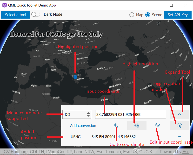
The user interface for the coordinate conversion tool. More...
| Since: | Esri.ArcGISRuntime 100.12 |
Properties
- controller : var
- geoView : var
- inInputMode : bool
- inputFormat : var
Detailed Description
This tool allows a user to select a point on the map or to enter a point by text entry. The point may be highlighted by zooming into that point, or by highlighting the point on the GeoView. A list of different coordinate formats representing the same point are available to the user.

Example code in the QML API (C++ API might differ):
        MapView {
            Map {
                initBasemapStyle: Enums.BasemapStyleArcGISDarkGray
            }
            CoordinateConversion {
                geoView: parent
                anchors {
                    right: parent.right
                    bottom: parent.attributionTop
                    margins: 10
                }
            }
        }
Property Documentation
Whether whether the tool is in input mode.
If true, the tool will convert a point set via a mouse click or text entry.
This is the inputFormat - which dictates what format the user can edit and thereby update all the other formats in the ListModel.