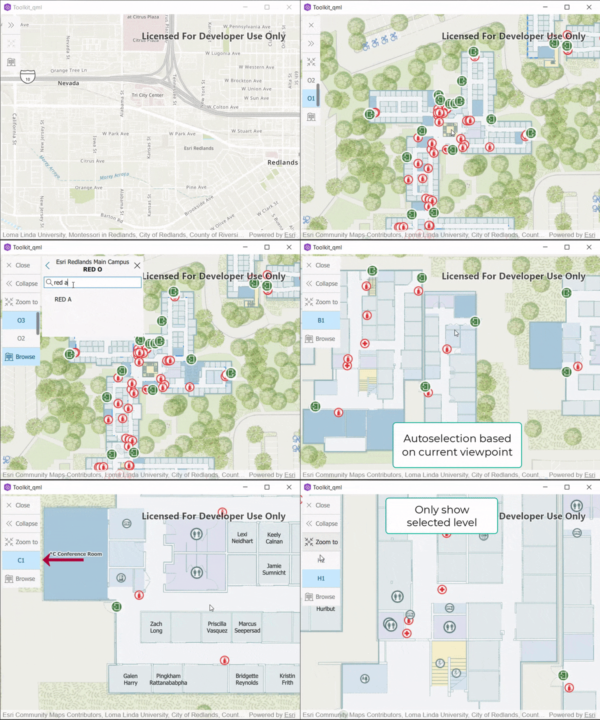
Displays and filters the available floor aware layers in the current GeoModel. This component supports manual selection and text-based filtering for sites and facilities. Once a site and facility is selected, levels can be selected and the GeoView will be updated. More...
| Since: | Qt 100.14 |
Properties
- controller : var
- geoView : var
- maxNumberLevels : int
- updateLevelsMode : int
Detailed Description
In addition to the browsing workflow where sites and facilities are manually selected, automatic facility selection based on the GeoView's current viewpoint. This mode is useful when you are exploring the GeoView but do not know the name of the site or facility. For the same reason, it is possible to list all the facilties available in the FloorManager using the button on the siteView.
The user interface is driven from the FloorAware data that is available in the GeoModel's FloorManager.
2D maps and 3D scenes are supported.

Example code in the QML API (C++ API might differ):
MapView {
    id: viewMap
    Map {
        initUrl: "https://www.arcgis.com/home/item.html?id=f133a698536f44c8884ad81f80b6cfc7"
    }
    FloorFilter {
        geoView: parent
        anchors {
            left: parent.left
            margins: 10
            top: parent.top
        }
    }
}
Property Documentation
The controller handles binding logic between the FloorFilter, GeoModel, FloorManager and the flooraware layers.
The QML controller is documented here and the CPP controller is documented here.
trims the maximum number of viewable levels. A scrollable component is automatically used in case of higher number of levels.
The mode to use for updating levels visibility. Default is FloorFilterController.UpdateLevelsMode.AllLevelsMatchingVerticalOrder.
See also FloorFilterController.updateLevelsMode.