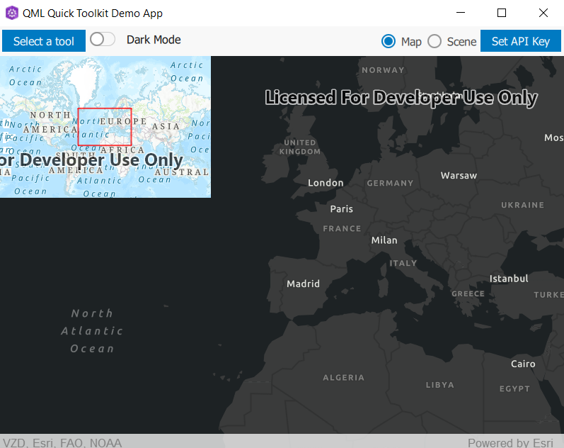
Defines a small "overview" (or "inset") map displaying a representation of the current viewpoint of the given GeoView. For MapViews, the current viewpoint will be represented by a polygon displaying the visible area of the MapView. For SceneViews, the current viewpoint will be represented by a reticle (crosshairs) displaying the viewpoint center. More...
| Since: | Esri.ArcGISRutime 100.12 |
| Inherits: |
Properties
- controller : var
- geoView : var
- scaleFactor : real
Detailed Description

Example code in the QML API (C++ API might differ):
        MapView {
            Map {
                initBasemapStyle: Enums.BasemapStyleArcGISCommunity
            }
            OverviewMap {
                anchors {
                    top: parent.top
                    left: parent.left
                    margins: 10
                }
                geoView: parent
            }
        }
Note: By default, the OverviewMap will attempt to use an ArcGIS Topographic basemap, which requires an API key to access.
Property Documentation
The controller handles binding logic between the OverviewMap and the GeoView where applicable.
The QML controller is documented here and the CPP controller is documented here.
Sets the amount to scale the OverviewMap compared to the geoView.