 Hide Table of Contents
 Tutorials
 About the API
 Work with the API
 Graphics and feature layers
 Popups and Info Windows
 Mobile
 ArcGIS Server Services
 References
 What's New archive
The following changes were made at version 3.0:
Features
Support for new features in ArcGIS Server 10.1 including:
- Dynamic Layers: Change Class Breaks Change Attribute used for Renderer Re-order Layers
- Geodesic Buffering: ArcGIS.com Webmap using the Geometry Service
- Generate a Renderer Server-Side
- Calculate Statistics Server-Side
- Print Service: Print Dijit Print an ArcGIS.com Webmap
- Support for Editor Tracking
- Support for the ArcGIS Admin API
Note: Beta versions of ArcGIS Server 10.1 (Beta 1, Beta 2, Pre-Release) are not supported with version 3.0 of the ArcGIS Server API for JavaScript.
esri.request now automatically detects and uses CORS when supported and uses JSON instead of JSONP where possible. For more information on how to use esri.request, and how it works, please refer to the conceptual help topic on esri.request.
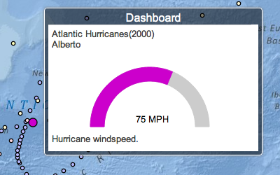
New Gauge Dijit:

Support for Dojo 1.7 and AMD. Esri's ArcGIS API for JavaScript modules have not yet been migrated to AMD but developers can use the new AMD style to write and load custom modules. Please refer to the Migrating to 3.0 topic for common dojo-specific issues that arise when migrating from 2.x to 3.0. Version 3.0 of the ArcGIS API for JavaScript also bundles version 0.3.0 the new Dojo dGrid (which includes put-selector 0.2.0 and xstyle 0.0.2).
New Samples
- Add a result map service from a Geoprocessing task to a map
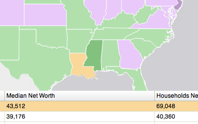
- Display Feature Layer features in a dGrid

- Gauge Dijit: Connect a Gauge to a Feature Layer
- Mobile: Change Layer Opacity Using Tilt Gesture
- Mobile: Compass Using Device Orientation
- Mobile: Shake Gesture Recognition
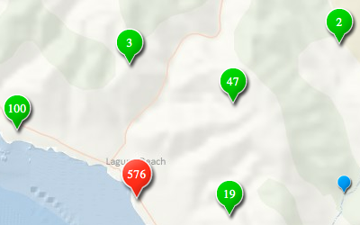
- Point Clustering with a Custom Layer

- Display Feature Layer features in a dGrid
Additions to Documentation
- Migrating to 3.0
- Inside esri.request
- Writing Classes with JavaScript
- Building a Custom Widget
- Dojo and AMD
Enhancements and Bug Fixes
- NIM081330: Obsolete tile images are displayed in the map when the base map layer is replaced with another and the map extent is changed at the same time
- NIM081331: Feature Layer: add Track ID as an attribute for all tracks
- NIM081332: Identity Manager: Do not prompt twice for credentials when a Webmap is private and uses a secure hosted service
- NIM081333: Allow Class Breaks and Unique Value renderers to be created without a default symbol
- NIM081334: Feature Layer: use effectiveMinScale and effectiveMaxScale returned by ArcGIS Server 10.1 services
- NIM081335: Feature Layer: applyEdits throws error when called before adding the layer to map
- NIM081336: Add addressesToLocations to esri.tasks.Locator to support batch geocoding
- NIM081341: Attachment Editor: show only tools that are applicalbe to available editing capabilities such as create-only, create and update, etc.
- NIM081347: Support cancelling a geoprocessing job with ArcGIS Server 10.1 services
- NIM081349: Add a transformation parameter for the Geometry Service's project method
- NIM081350: Add calculationType parameter for the Geometry Service's areasAndLengths method
- NIM081351: Add calculationType parameter for the Geometry Service's lengths method
- NIM081352: Add a geometryPrecision parameter for query and queryRelatedRecords tasks
- NIM081353: Feature Layer: add defaultVisility property for ArcGIS Server 10.1 services
- NIM081354: Feature Layer: allow editing when an app sets a Feature Layer's userIsAdmin to true
- NIM081355: esri.geometry.Extent intersects method fails when polyline has an empty path
- NIM081356: esri.Map should use fullExtent of first layer when map is created without specifying an extent
- NIM081357: esri.arcgis.utils.createMap: better error handling when an operational layer is unavailable
- NIM081358: Identity Manager: Improve error messages
- NIM081359: Print Task/Widget: support asynchronous print services
- NIM081360: esri.request should switch to https when error is "403: SSL is required"
- NIM081361: Print Task: support output spatial reference other than the map's spatial reference
- NIM081362: Identity Manager: Support for ArcGIS Server admin resources
- NIM081363: Popup: add padding when maximized and display feature closest to location of popup ahead of others
- NIM081364: Legend Widget throws error when SimpleMarkerSymbol or SimpleFillSymbol does not have an outline color
- NIM081366: Provide control over sublayer visibility for operational layers when printing
- NIM081412: Use standard URLs for OpenStreetMap tiles
Dojo 1.7
Version 3.0 of the ArcGIS API for JavaScript uses Dojo 1.7.