 Hide Table of Contents
 Analysis
 Dynamic Layers
 Editing
 Feature Layers
 Feature Table
 Graphics
 Map
Map
 Mobile
 Online and Portal
 Popups and Info Windows
 Query and Select
 Renderers, Symbols, Visualization
 Search

ReportPlayer - Geoenrichment
Explore in the sandbox
Open in CodePen
View live sample
Description
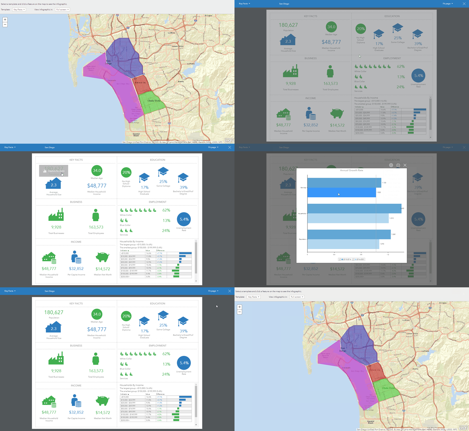
The ReportPlayer widget runs infographic report templates for a provided analysis area. This sample allows users to click on one of 4 locations and show one of the Esri provided Infographics for the location. TheReportPlayeruses the GeoEnrichment service to request and create the Infographic.GeoEnrichmentis a subscription based service available through ArcGIS Online. Log-in credentials are always required when executing a GeoEnrichment task.
For demo purposes, this sample requires a user to have ArcGIS Online credentials with access to GeoEnrichment to run successfully.
Code
<!DOCTYPE html>
<html xmlns="http://www.w3.org/1999/xhtml">
<head>
<meta http-equiv="Content-Type" content="text/html; charset=utf-8">
<meta name="viewport" content="initial-scale=1, maximum-scale=1,user-scalable=no">
<title>GeoEnnrichment ReportPlayer</title>
<link rel="stylesheet" href="https://js.arcgis.com/3.46/dijit/themes/claro/claro.css">
<link rel="stylesheet" href="https://js.arcgis.com/3.46/esri/css/esri.css">
<style>
html,
body {
padding: 0;
margin: 0;
height: 100%;
overflow: hidden;
font-size: 13px;
font-family: "Avenir Next";
}
.topToolbar {
background-color: #EEEEEE;
border-bottom: 1px solid #b2b2b2;
padding: 10px;
}
.topToolbarLabel {
margin-right: 10px;
margin-top: 10px;
margin-bottom: 10px;
}
.topToolbarItem {
margin-right: 50px;
}
.topToolbarItem div {
vertical-align: top;
}
#mapDiv {
position: absolute;
top: 0px;
left: 0px;
bottom: 0px;
right: 0px;
}
.playerDivFullScreen {
position: absolute;
top: 0;
left: 0;
bottom: 0;
right: 0;
}
.playerDivInfoWindow {
padding: 10px;
}
.simpleInfoWindow.playerInfoWindow {
width: auto !important;
height: auto !important;
}
.simpleInfoWindow.playerInfoWindow .title {
display: none;
}
.simpleInfoWindow.playerInfoWindow .content {
width: auto !important;
height: auto !important;
}
.simpleInfoWindow.playerInfoWindow .close {
left: auto !important;
right: -12px;
}
.selectionBox {
position: absolute;
border: 1px solid gray;
background-color: rgba(0, 0, 0, 0.3);
}
</style>
<script src="https://js.arcgis.com/3.46/"></script>
<script>
require(["require"],
function (relativeRequire) {
require([
"dojo/aspect",
"dojo/dom-class",
"dojo/dom-construct",
"dojo/dom-geometry",
"dojo/dom-style",
"dojo/on",
"dojo/sniff",
"esri/map",
"esri/graphic",
"esri/geometry/Extent",
"esri/geometry/ScreenPoint",
"esri/layers/GraphicsLayer",
"esri/dijit/InfoWindowLite",
"esri/dijit/geoenrichment/OnDemandSelect",
"esri/dijit/geoenrichment/ReportPlayer/ReportPlayer",
"esri/dijit/geoenrichment/ReportPlayer/PlayerResizeModes",
"esri/dijit/geoenrichment/ReportPlayer/PlayerViewModes",
"esri/dijit/geoenrichment/ReportPlayer/dataProvider/supportClasses/StandardGraphicReportTemplates",
"esri/dijit/geoenrichment/ReportPlayer/core/supportClasses/map/symbols/HighlightedSymbolGenerator",
"esri/dijit/geoenrichment/utils/signIn/SignInHelper",
"esri/dijit/geoenrichment/utils/DeviceUtil",
"dojo/domReady!"
],
function (
aspect,
domClass,
domConstruct,
domGeom,
domStyle,
on,
has,
Map,
Graphic,
Extent,
ScreenPoint,
GraphicsLayer,
InfoWindowLite,
OnDemandSelect,
ReportPlayer,
PlayerResizeModes,
PlayerViewModes,
StandardGraphicReportTemplates,
HighlightedSymbolGenerator,
SignInHelper,
DeviceUtil
) {
var DEFAULTS = {
portalUrl: "https://www.arcgis.com",
countryID: "US",
};
var isMobile = DeviceUtil.isMobileDevice();
topToolbarHelperText.innerHTML = isMobile ?
"Select a template, then tap a feature on the map to open an infographic." :
"Select a template, then click a feature or shift-drag to select multiple features on the map to open an infographic.";
//--------------------------------------------------------------------------
//
// Top Toolbar
//
//--------------------------------------------------------------------------
var templateSelector = new OnDemandSelect({
listClass: "esriGEOnDemandSelectUnlimitedTallList esriGEOnDemandSelectSpacedOut",
value: StandardGraphicReportTemplates.aliasToID("US", "key-facts"),
options: StandardGraphicReportTemplates.getListOptions("US")
}).placeAt(templateSelectorDiv);
var viewModeSelector = new OnDemandSelect({
listClass: "esriGEOnDemandSelectSpacedOut"
}).placeAt(viewModeSelectorDiv);
if (isMobile) {
viewModeSelector.set("options", [{
value: PlayerViewModes.PANELS_IN_SLIDES,
label: "Slide view"
},
{
value: PlayerViewModes.PANELS_IN_STACK,
label: "Stacked slide view"
}
]);
viewModeSelector.set("value", PlayerViewModes.PANELS_IN_SLIDES);
} else {
viewModeSelector.set("options", [{
value: PlayerViewModes.FULL_PAGES,
label: "Full screen"
},
{
value: PlayerViewModes.PANELS_IN_SLIDES,
label: "Slide view"
},
{
value: PlayerViewModes.PANELS_IN_STACK,
label: "Stacked slide view"
}
]);
viewModeSelector.set("value", PlayerViewModes.FULL_PAGES);
}
//--------------------------------------------------------------------------
//
// Map
//
//--------------------------------------------------------------------------
mapDiv.style.top = topToolbarDiv.clientHeight + 1 + "px";
on(window, "resize", function () {
mapDiv.style.top = topToolbarDiv.clientHeight + 1 + "px";
});
var map = new Map("mapDiv", {
basemap: "streets-vector",
center: [-117.15, 32.68], // longitude, latitude
zoom: 11
});
map.on("load", function () {
// set up the map
map.disableRubberBandZoom();
var selectionBox;
// set up multiple selection
// here we need to detect mouse-down + Shift key
on(map, "mouse-down", function (event) {
if (!event.shiftKey)
return;
map.disablePan();
event.stopPropagation();
function updateBox() {
var sp = boxParams.startScreenPoint;
var ep = boxParams.endScreenPoint;
var xmin = Math.min(sp.x, ep.x);
var ymin = Math.min(sp.y, ep.y);
var xmax = Math.max(sp.x, ep.x);
var ymax = Math.max(sp.y, ep.y);
domStyle.set(selectionBox, {
left: xmin + "px",
top: ymin + "px",
width: (xmax - xmin) + "px",
height: (ymax - ymin) + "px"
});
};
// create box
selectionBox = domConstruct.create("div", {
"class": "selectionBox"
}, document.body);
// initial box params
var boxParams = {};
boxParams.startMapPoint = event.mapPoint;
boxParams.startScreenPoint = {
x: event.clientX,
y: event.clientY
};
boxParams.endScreenPoint = {
x: event.clientX,
y: event.clientY
};
// update box on mousemove
var boxToolMapHanlders = [];
boxToolMapHanlders.push(on(document.body, "mousemove, touchmove, dojotouchmove", function (
e) {
boxParams.endScreenPoint.x = e.clientX;
boxParams.endScreenPoint.y = e.clientY;
updateBox();
}));
// stop selection on mouseup
boxToolMapHanlders.push(on(document.body, "mouseup, touchend", function () {
// try to calculate box extent
var sp = boxParams.startMapPoint;
var mapPos = domGeom.position(map.root);
// give it a few pixels offset to aviod having a zero extent box
if (boxParams.startScreenPoint.x === boxParams.endScreenPoint.x)
boxParams.endScreenPoint.x += 2; // 2 pixels
if (boxParams.startScreenPoint.y === boxParams.endScreenPoint.y)
boxParams.endScreenPoint.y += 2; // 2 pixels
var ep = map.toMap(new ScreenPoint(boxParams.endScreenPoint.x - mapPos.x, boxParams
.endScreenPoint.y - mapPos.y));
var xmin = Math.min(sp.x, ep.x);
var ymin = Math.min(sp.y, ep.y);
var xmax = Math.max(sp.x, ep.x);
var ymax = Math.max(sp.y, ep.y);
var boxExtent = new Extent(xmin, ymin, xmax, ymax, map.spatialReference);
var graphics = graphicsLayer.graphics.filter(function (g) {
return boxExtent.intersects(g.geometry);
});
graphics.length && runPlayerForSelectedGraphics(graphics, event.mapPoint);
boxToolMapHanlders.forEach(function (h) {
h.remove();
})
boxToolMapHanlders.length = 0;
domConstruct.destroy(selectionBox);
map.enablePan();
// pointer, in this case the PointerEvents class thinks the mouse is still pressed and this causes issues
// with future mouse clicks. Set _numTouches to 0 in order to resolve this.
if (has("ie"))
if (map.navigationManager.pointerEvents)
map.navigationManager.pointerEvents._numTouches = 0;
}));
});
// add a few graphics
var graphicsLayer = new GraphicsLayer();
map.addLayer(graphicsLayer);
graphicsLayer.add(new Graphic({
"geometry": {
"rings": [
[
[-13037494.994088652, 3852956.928906343],
[-13034724.151813319, 3853912.3917599064],
[-13034208.201872393, 3853415.5510760536],
[-13033720.915817076, 3852345.4326800625],
[-13033224.075133225, 3850874.019885575],
[-13032736.789077906, 3850138.313488331],
[-13036052.245179772, 3849135.0774920895],
[-13037494.994088652, 3852956.928906343]
]
],
"spatialReference": {
"wkid": 102100
}
},
"symbol": {
"type": "esriSFS",
"style": "esriSFSSolid",
"color": [199, 55, 36, 150],
"outline": {
"type": "esriSLS",
"style": "esriSLSSolid",
"color": [199, 55, 36, 255]
}
},
"attributes": {
"NAME": "National City",
"BUILDING_AREA": 5000.5,
"SITE_AREA": 10000.25,
"FRONTAGE": 800,
"PARKING": 300,
"BUILDING_DATE": new Date().getTime(),
"url": "https://upload.wikimedia.org/wikipedia/commons/thumb/a/ac/USA_CA_NationalCity_Westfield_002_2013.jpg/1280px-USA_CA_NationalCity_Westfield_002_2013.jpg",
"url2": "https://upload.wikimedia.org/wikipedia/commons/7/7b/USA_CA_NationalCity_Center_002_2013_-_Mile_of_Cars.jpg"
}
}));
graphicsLayer.add(new Graphic({
"geometry": {
"rings": [
[
[-13035942.366951615, 3848982.2034355192],
[-13033935.894959131, 3849784.7922325125],
[-13032636.465478284, 3850033.212574439],
[-13031891.204452505, 3849039.531206733],
[-13031069.506398441, 3848561.799779951],
[-13030515.337943373, 3847663.6646976015],
[-13029846.51394588, 3847166.8240137487],
[-13029235.017719598, 3846096.7056177575],
[-13034432.735642985, 3844395.9817384146],
[-13035942.366951615, 3848982.2034355192]
]
],
"spatialReference": {
"wkid": 102100
}
},
"symbol": {
"type": "esriSFS",
"style": "esriSFSSolid",
"color": [55, 199, 36, 150],
"outline": {
"type": "esriSLS",
"style": "esriSLSSolid",
"color": [55, 199, 36, 255]
}
},
"attributes": {
"NAME": "Chula Vista",
"BUILDING_AREA": 4000.5,
"SITE_AREA": 8000.25,
"FRONTAGE": 500,
"PARKING": 200,
"BUILDING_DATE": new Date().getTime(),
"url": "https://upload.wikimedia.org/wikipedia/commons/1/12/ChulaVista_Bayfront.jpg"
}
}));
graphicsLayer.add(new Graphic({
"geometry": {
"rings": [
[
[-13043772.385036565, 3859559.177224467],
[-13041727.69452994, 3862272.691728587],
[-13040542.92059152, 3862865.0786977964],
[-13038230.700485898, 3862845.969440725],
[-13037198.80060405, 3860648.404877529],
[-13036778.396948481, 3859750.2697951794],
[-13035803.824837847, 3858966.7902552574],
[-13035803.824837847, 3857304.284890057],
[-13034905.689755498, 3856119.5109516387],
[-13034829.252727212, 3854093.929702084],
[-13037542.767231332, 3853100.248334378],
[-13040275.390992522, 3854437.896329367],
[-13043523.96469464, 3856883.8812344894],
[-13043772.385036565, 3859559.177224467]
]
],
"spatialReference": {
"wkid": 102100
}
},
"symbol": {
"type": "esriSFS",
"style": "esriSFSSolid",
"color": [36, 55, 199, 150],
"outline": {
"type": "esriSLS",
"style": "esriSLSSolid",
"color": [36, 55, 199, 255]
}
},
"attributes": {
"NAME": "San Diego",
"BUILDING_AREA": 7000.5,
"SITE_AREA": 12000.25,
"FRONTAGE": 900,
"PARKING": 350,
"BUILDING_DATE": new Date().getTime(),
"url": "https://upload.wikimedia.org/wikipedia/commons/thumb/b/be/Harbor_Drive%2C_San_Diego.jpg/1920px-Harbor_Drive%2C_San_Diego.jpg"
}
}));
graphicsLayer.add(new Graphic({
"geometry": {
"rings": [
[
[-13044020.805378487, 3859387.193910824],
[-13043944.368350202, 3858890.353226971],
[-13043753.27577949, 3856826.553463274],
[-13037829.406087395, 3853004.7020490207],
[-13034619.050899422, 3844290.880824522],
[-13038096.935686393, 3842227.0810608254],
[-13039205.272596527, 3843717.603112384],
[-13039778.550308665, 3846163.5880175065],
[-13042148.098185502, 3850864.4652570384],
[-13044364.772005768, 3852890.046506593],
[-13049256.741816014, 3853654.4167894437],
[-13049256.741816014, 3855756.435067283],
[-13044020.805378487, 3859387.193910824]
]
],
"spatialReference": {
"wkid": 102100
}
},
"symbol": {
"type": "esriSFS",
"style": "esriSFSSolid",
"color": [199, 55, 199, 150],
"outline": {
"type": "esriSLS",
"style": "esriSLSSolid",
"color": [199, 55, 199, 255]
}
},
"attributes": {
"NAME": "San Diego Bay",
"BUILDING_AREA": 6500.5,
"SITE_AREA": 11300.25,
"FRONTAGE": 820,
"PARKING": 290,
"BUILDING_DATE": new Date().getTime(),
"url": "https://upload.wikimedia.org/wikipedia/commons/thumb/2/27/OverCoronadoSanDiegoAug07.jpg/800px-OverCoronadoSanDiegoAug07.jpg"
}
}));
// add a listener to the layer
var player, playerDiv;
var infoWindow = new InfoWindowLite(null, domConstruct.create("div", null, null, map.root));
infoWindow.startup();
map.setInfoWindow(infoWindow);
aspect.after(infoWindow, "onHide", function () {
player && player.destroy();
domConstruct.destroy(playerDiv);
});
domClass.add(infoWindow.domNode, "playerInfoWindow");
var highlightedGraphics = [];
function runPlayerForSelectedGraphics(graphics, mapPoint) {
var isFullScreen = isMobile || viewModeSelector.get("value") === PlayerViewModes.FULL_PAGES;
//--------------------------------------------------------------------------
//
// Highlight
//
//--------------------------------------------------------------------------
highlightedGraphics.forEach(function (g) {
g.setSymbol(g.__originalSymbol);
delete g.__originalSymbol;
});
highlightedGraphics.length = 0;
if (!isFullScreen)
graphics.forEach(function (g) {
g.__originalSymbol = g.symbol;
highlightedGraphics.push(g);
HighlightedSymbolGenerator.getHighlightSymbol({
graphic: g,
outlineOnly: true
}).then(function (hInfo) {
hInfo.symbol && g.setSymbol(hInfo.symbol);
});
});
//--------------------------------------------------------------------------
//
// Report Player
//
//--------------------------------------------------------------------------
infoWindow.hide();
player && player.destroy();
domConstruct.destroy(playerDiv);
// configure playerDiv for the current view and resize modes
playerDiv = domConstruct.create("div", null, document.body);
if (isFullScreen)
domClass.add(playerDiv, "playerDivFullScreen");
else {
domClass.add(playerDiv, "playerDivInfoWindow");
map.infoWindow.show(mapPoint);
map.infoWindow.setContent(playerDiv);
}
player = new ReportPlayer({
viewMode: viewModeSelector.get("value"),
resizeMode: isFullScreen ? PlayerResizeModes.FIT_WINDOW : PlayerResizeModes.AUTO,
showCloseButton: isFullScreen,
showToolbarInPopup: !isFullScreen,
showAreaTitle: true,
showToFullScreenAnimation: isFullScreen,
onClose: function () {
player.destroy();
domConstruct.destroy(playerDiv);
}
}).placeAt(playerDiv);
function playerReport(reportID) {
player.playReport({
portalUrl: DEFAULTS.portalUrl,
countryID: DEFAULTS.countryID,
reportID: reportID,
analysisAreas: graphics.map(function (g) {
return {
"name": g.attributes.NAME,
"shortName": g.attributes.NAME,
"feature": g
};
}),
// for multi-feature reports like "Multi-ring Comparison"
combinedAreasInfo: {
address: graphics[0].attributes.NAME + " et al.",
description: graphics.length + " polygon areas"
},
attachmentsProvider: {
supportsMultipleAreas: true,
getAttributesForAreaAt: function (areaIndex) {
var attributes = graphics[areaIndex].attributes;
return [{
name: "BUILDING_AREA",
alias: "Building area (sq. ft)",
type: "esriFieldTypeDouble",
value: attributes["BUILDING_AREA"]
},
{
name: "SITE_AREA",
alias: "Site area (sq. ft)",
type: "esriFieldTypeDouble",
value: attributes["SITE_AREA"]
},
{
name: "FRONTAGE",
alias: "Frontage",
type: "esriFieldTypeInteger",
value: attributes["FRONTAGE"]
},
{
name: "PARKING",
alias: "Parking",
type: "esriFieldTypeInteger",
value: attributes["PARKING"]
},
{
name: "BUILDING_DATE",
alias: "Building date",
type: "esriFieldTypeDate",
value: attributes["BUILDING_DATE"]
}
];
},
getNotesForAreaAt: function (areaIndex) {
var attributes = graphics[areaIndex].attributes;
return [{
text: "This is a note example for area " + attributes.NAME
}];
},
getAttachmentsForAreaAt: function (areaIndex) {
var attributes = graphics[areaIndex].attributes;
var urls = [];
attributes.url && urls.push(attributes.url);
attributes.url2 && urls.push(attributes.url2);
return urls.map(function (url) {
return {
description: "Image for " + attributes.NAME,
getThumbnail: function () {
return url;
},
getAttachmentUrl: function () {
return url;
}
};
});
}
}
}).then(function () {
// refresh the position of the info window
!isFullScreen && infoWindow.resize(infoWindow.width, infoWindow.height);
});
};
// limit the size of the info window
if (!isFullScreen) {
player.setMaxWidth(700);
player.setMaxHeight(500);
} else {
// add a select to choose infographics right from the player
var inPlayerSelect = new OnDemandSelect({
"class": "esriGEOnDemandSelectWhite esriGEOnDemandSelectNoBackground",
listClass: "esriGEOnDemandSelectUnlimitedTallList esriGEOnDemandSelectSpacedOut",
value: templateSelector.get("value"),
options: StandardGraphicReportTemplates.getListOptions("US"),
onChange: function (event) {
templateSelector.set("value", event.value); // sync with the main selector
playerReport(event.value);
}
});
player.playerToolbar.addInfographicsSelect(inPlayerSelect);
}
playerReport(templateSelector.get("value"));
};
graphicsLayer.on("click", function (event) {
runPlayerForSelectedGraphics([event.graphic], event.mapPoint);
});
});
});
});
</script>
</head>
<body class="claro">
<div id="topToolbarDiv" class="topToolbar">
<div id="topToolbarHelperText" class="topToolbarLabel"></div>
<div class="dijitInline" style="white-space:nowrap;">
<div class="dijitInline topToolbarLabel">Template:</div>
<div class="dijitInline topToolbarItem" id="templateSelectorDiv"></div>
</div>
<div class="dijitInline" style="white-space:nowrap;">
<div class="dijitInline topToolbarLabel">View infographic in:</div>
<div class="dijitInline topToolbarItem" id="viewModeSelectorDiv"></div>
</div>
</div>
<div id="mapDiv"></div>
</body>
</html>