 Hide Table of Contents
 Analysis
 Dynamic Layers
 Editing
 Feature Layers
 Feature Table
 Graphics
 Map
Map
 Mobile
 Online and Portal
 Popups and Info Windows
 Query and Select
 Renderers, Symbols, Visualization
 Search

Explore in the sandbox
View live sample
Description
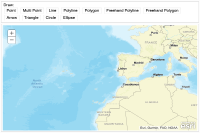
This sample shows how you can use a draw toolbar to sketch many kinds of geometries on the map. This toolbar is included with the ArcGIS JavaScript API.
The toolbar is not a user interface component that you automatically see on the page. Instead, it's a helper class that you can use to let people sketch geometries on the map. It saves you the effort of writing the code for sketching each geometry type. You just activate the type of geometry you want people to sketch. In this example, each HTML button activates a different geometry type.
When you click for example the "Point" button, the toolbar activates the point geometry. Alternatively you could allow people to choose the geometry type from a dropdown list, a set of radio buttons, or some other control.
In this example, the toolbar's "onDrawEnd" event ensures that you see something on the map when you finish sketching a feature.
The addGraphic function sets the appropriate symbol for the geometry type. In this example, the symbol is taken from a dropdown list. Each item of the list is a symbol defined on one line.
See the conceptual help for symbols to learn more about defining different symbols.
Code
<!DOCTYPE html>
<html>
  <head>
    <meta http-equiv="Content-Type" content="text/html; charset=utf-8">
    <meta name="viewport" content="width=device-width,user-scalable=no">

    <meta name="viewport" content="initial-scale=1, maximum-scale=1,user-scalable=no">
    <title>Maps Toolbar</title>

    <link rel="stylesheet" href="https://js.arcgis.com/3.46/dijit/themes/nihilo/nihilo.css">
    <link rel="stylesheet" href="https://js.arcgis.com/3.46/esri/css/esri.css">
    <style>
      html, body, #mainWindow {
        font-family: sans-serif;
        height: 100%;
        width: 100%;
      }
      html, body {
        margin: 0;
        padding: 0;
      }
      #header {
        height: 80px;
        overflow: auto;
        padding: 0.5em;
      }
    </style>

    <script src="https://js.arcgis.com/3.46/"></script>
    <script>
      var map, toolbar, symbol, geomTask;

      require([
        "esri/map",
        "esri/toolbars/draw",
        "esri/graphic",

        "esri/symbols/SimpleMarkerSymbol",
        "esri/symbols/SimpleLineSymbol",
        "esri/symbols/SimpleFillSymbol",

        "dojo/parser", "dijit/registry",

        "dijit/layout/BorderContainer", "dijit/layout/ContentPane",
        "dijit/form/Button", "dijit/WidgetSet", "dojo/domReady!"
      ], function(
        Map, Draw, Graphic,
        SimpleMarkerSymbol, SimpleLineSymbol, SimpleFillSymbol,
        parser, registry
      ) {
        parser.parse();

        map = new Map("map", {
          basemap: "streets-vector",
          center: [-15.469, 36.428],
          zoom: 3
        });

        map.on("load", createToolbar);

        // loop through all dijits, connect onClick event
        // listeners for buttons to activate drawing tools
        registry.forEach(function(d) {
          // d is a reference to a dijit
          // could be a layout container or a button
          if ( d.declaredClass === "dijit.form.Button" ) {
            d.on("click", activateTool);
          }
        });

        function activateTool() {
          var tool = this.label.toUpperCase().replace(/ /g, "_");
          toolbar.activate(Draw[tool]);
          map.hideZoomSlider();
        }

        function createToolbar(themap) {
          toolbar = new Draw(map);
          toolbar.on("draw-end", addToMap);
        }

        function addToMap(evt) {
          var symbol;
          toolbar.deactivate();
          map.showZoomSlider();
          switch (evt.geometry.type) {
            case "point":
            case "multipoint":
              symbol = new SimpleMarkerSymbol();
              break;
            case "polyline":
              symbol = new SimpleLineSymbol();
              break;
            default:
              symbol = new SimpleFillSymbol();
              break;
          }
          var graphic = new Graphic(evt.geometry, symbol);
          map.graphics.add(graphic);
        }
      });
    </script>
  </head>
  <body class="nihilo">

  <div id="mainWindow" data-dojo-type="dijit/layout/BorderContainer" data-dojo-props="design:'headline'">
    <div id="header" data-dojo-type="dijit/layout/ContentPane" data-dojo-props="region:'top'">
      <span>Draw:<br /></span>
      <button data-dojo-type="dijit/form/Button">Point</button>
      <button data-dojo-type="dijit/form/Button">Multi Point</button>
      <button data-dojo-type="dijit/form/Button">Line</button>
      <button data-dojo-type="dijit/form/Button">Polyline</button>
      <button data-dojo-type="dijit/form/Button">Polygon</button>
      <button data-dojo-type="dijit/form/Button">Freehand Polyline</button>
      <button data-dojo-type="dijit/form/Button">Freehand Polygon</button>

      <button data-dojo-type="dijit/form/Button">Arrow</button>
      <button data-dojo-type="dijit/form/Button">Triangle</button>
      <button data-dojo-type="dijit/form/Button">Circle</button>
      <button data-dojo-type="dijit/form/Button">Ellipse</button>
    </div>
    <div id="map" data-dojo-type="dijit/layout/ContentPane" data-dojo-props="region:'center'"></div>
  </div>

  </body>
</html>