 Hide Table of Contents
 Analysis
 Dynamic Layers
 Editing
 Feature Layers
 Feature Table
 Graphics
 Map
Map
 Mobile
 Online and Portal
 Popups and Info Windows
 Query and Select
 Renderers, Symbols, Visualization
 Search

Geoenrichment - StandardGeographyQueryTask
Explore in the sandbox
Open in CodePen
View live sample
Description
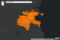
This sample demonstrates how to use the GeoEnrichment service helper method for obtaining geography IDs and features for the supported geographic levels. These IDs can then be used together with other information (parameters) to specify a study area and enrich a geographic region or area. Additional information on this can be foundhere.GeoEnrichmentis a subscription based service available through ArcGIS Online. Log-in credentials are always required when executing a GeoEnrichment task.
Code
<!doctype html>
<html>

<head>
   <meta http-equiv="Content-Type" content="text/html; charset=utf-8">
   <meta name="viewport" content="initial-scale=1, maximum-scale=1, user-scalable=no">
   <title>StandardGeographyQueryTask</title>

   <link rel="stylesheet" href="https://js.arcgis.com/3.46/dijit/themes/claro/claro.css">
   <link rel="stylesheet" href="https://js.arcgis.com/3.46/esri/css/esri.css">

   <style>
      html,
      body,
      #map {
         width: 100%;
         height: 100%;
         margin: 0;
         padding: 0;
      }
   </style>
</head>

<body class="claro">
   <script src="https://js.arcgis.com/3.46"></script>

   <script>
      var map, layer;

      require([
        "dojo/_base/array",
        "dojo/store/Memory",
        "dijit/form/FilteringSelect",
        "esri/map",
        "esri/Color",
        "esri/graphicsUtils",
        "esri/layers/FeatureLayer",
        "esri/tasks/geoenrichment/GeographyQuery",
        "esri/tasks/geoenrichment/SubGeographyQuery",
        "esri/tasks/geoenrichment/StandardGeographyQueryTask",
        "dojo/domReady!"
    ], function (
         array,
         Memory,
         FilteringSelect,
         Map,
         Color,
         graphicsUtils,
         FeatureLayer,
         GeographyQuery,
         SubGeographyQuery,
         StandardGeographyQueryTask
      ) {

         var standardGeographyQueryTask = new StandardGeographyQueryTask();

         function executeStandardGeographyTask(queryItem) {
            if (layer) {
               map.removeLayer(layer);
            }

            return standardGeographyQueryTask.execute(queryItem.query).then(function (result) {
               var fs = result.featureSet;

               if (fs.features.length > 0) {
                  layer = new FeatureLayer({
                     layerDefinition: {
                        geometryType: fs.geometryType,
                        fields: fs.fields
                     },
                     featureSet: {
                        features: fs.features,
                        geometryType: fs.geometryType
                     }
                  });
                  var color = new Color(queryItem.color);
                  color.a = 0.8;
                  layer.renderer.symbol.setColor(color);

                  map.addLayer(layer);
                  map.setExtent(graphicsUtils.graphicsExtent(fs.features).expand(2));
               }
            });
         }

         map = new Map("map", {
            basemap: "dark-gray-vector",
            center: [-119.11, 36.65],
            zoom: 4
         });

         map.on("load", function () {
            var queries = new Memory({
               idProperty: "label",
               data: [{
                  query: new GeographyQuery({
                     countryID: "IT",
                     generalizationLevel: "1",
                     geographyLayerIDs: ["IT.Postcodes2"],
                     outSR: map.spatialReference,
                     returnGeometry: "true",
                     where: "Perugia"
                  }),
                  color: "#1f77b4",
                  label: "Perugia, Italy"
                }, {
                  query: new GeographyQuery({
                     countryID: "IE",
                     generalizationLevel: "1",
                     geographyLayerIDs: ["IE.RegionalAuthorities"],
                     outSR: map.spatialReference,
                     returnGeometry: "true",
                     where: "Dublin"
                  }),
                  color: "#ff7f0e",
                  label: "Dublin, Ireland"
                }, {
                  query: new GeographyQuery({
                     countryID: "FR",
                     generalizationLevel: "6",
                     geographyLayerIDs: ["FR.Postcodes2","FR.Postcodes5"],
                     outSR: map.spatialReference,
                     returnGeometry: "true",
                     where: "Montauban"
                  }),
                  color: "#2ca02c",
                  label: "Montauban, France"
                }, {
                  query: new GeographyQuery({
                     countryID: "SE",
                     generalizationLevel: "6",
                     geographyLayerIDs: ["SE.Postcodes2"],
                     outSR: map.spatialReference,
                     returnGeometry: "true",
                     where: "Lund"
                  }),
                  color: "#d62728",
                  label: "Lund, Sweden"
                }, {
                  query: new GeographyQuery({
                     countryID: "US",
                     generalizationLevel: "6",
                     geographyIDs: ["92129", "92126"],
                     geographyLayerIDs: ["US.ZIP5"],
                     outSR: map.spatialReference,
                     returnGeometry: "true"
                  }),
                  color: "#8c564b",
                  label: "San Diego, California, US ZipCodes"
                }, {
                  query: new SubGeographyQuery({
                     countryID: "US",
                     filterGeographyIDs: ["06059"],
                     filterGeographyLayerID: "US.Counties",
                     generalizationLevel: "6",
                     outSR: map.spatialReference,
                     returnCentroids: "true",
                     returnGeometry: "true",
                     subGeographyLayerID: "US.Tracts"
                  }),
                  color: "#e377c2",
                  label: "Orange County, CA, US(Census Tracts) centroids"
                }, {
                  query: new GeographyQuery({
                     countryID: "US",
                     generalizationLevel: "6",
                     geographyLayerIDs: ["US.Counties"],
                     outSR: map.spatialReference,
                     returnGeometry: "true",
                     where: "orange"
                  }),
                  color: "#bcbd22",
                  label: "US Counties that contain term \"Orange\""
                }, {
                  query: new GeographyQuery({
                     countryID: "US",
                     generalizationLevel: "6",
                     geographyLayerIDs: ["US.Counties", "US.Places"],
                     outSR: map.spatialReference,
                     returnGeometry: "true",
                     where: "orange"
                  }),
                  color: "#17becf",
                  label: "US Counties and Cities that contain term \"Orange\""
                }, {
                  query: new GeographyQuery({
                     countryID: "US",
                     generalizationLevel: "6",
                     geographyLayerIDs: ["US.Counties"],
                     outSR: map.spatialReference,
                     returnGeometry: "true",
                     where: "San"
                  }),
                  color: "#aec7e8",
                  label: "US Counties that contain term \"San\""
                }, {
                  query: new GeographyQuery({
                     countryID: "US",
                     generalizationLevel: "6",
                     geographyLayerIDs: ["US.Counties"],
                     outSR: map.spatialReference,
                     returnGeometry: "true",
                     where: "Name:'Orange County' AND MajorSubdivisionAbbr:CA"
                  }),
                  color: "#ffbb78",
                  label: "US Counties terms \"Orange County\" and \"CA\""
                }, {
                  query: new GeographyQuery({
                     countryID: "US",
                     generalizationLevel: "6",
                     geographyLayerIDs: ["US.States"],
                     outSR: map.spatialReference,
                     returnGeometry: "true",
                     useFuzzySearch: "true",
                     where: "Kalifornia"
                  }),
                  color: "#98df8a",
                  label: "US States Fuzzy Search: Kalifornia"
                }, {
                  query: new GeographyQuery({
                     countryID: "US",
                     generalizationLevel: "6",
                     geographyLayerIDs: ["US.CBSA"],
                     outSR: map.spatialReference,
                     returnGeometry: "true",
                     where: "40140"
                  }),
                  color: "#ff9896",
                  label: "CBSA: Riverside-San Bernardino-Ontario, CA"
                }, {
                  query: new SubGeographyQuery({
                     countryID: "US",
                     filterGeographyLayerID: "US.States",
                     filterGeographyWhere: "California",
                     generalizationLevel: "6",
                     outSR: map.spatialReference,
                     returnGeometry: "true",
                     subGeographyLayerID: "US.Counties"
                  }),
                  color: "#9edae5",
                  label: "Counties within California, United States"
                }]
            });

            new FilteringSelect({
               store: queries,
               placeHolder: "Select a standard geography query",
               searchAttr: "label",
               style: {
                  width: "350px",
                  position: "absolute",
                  left: "75px",
                  top: "20px"
               },
               onChange: function () {
                  var self = this;

                  this.set("disabled", true);

                  executeStandardGeographyTask(this.item).always(function () {
                     self.set("disabled", false);
                  });
               }
            }, "standardGeographyQuerySelect");
         });
      });
   </script>

   <div id="map"></div>
   <div id="standardGeographyQuerySelect">
</body>

</html>