 Hide Table of Contents
 Analysis
 Dynamic Layers
 Editing
 Feature Layers
 Feature Table
 Graphics
 Map
Map
 Mobile
 Online and Portal
 Popups and Info Windows
 Query and Select
 Renderers, Symbols, Visualization
 Search

Measure distances
Explore in the sandbox
Open in CodePen
View live sample
Description
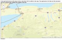
This example shows how you can use an ArcGIS Server geometry service to measure line lengths in your Web application. When you click and drag the mouse, the Draw toolbar captures the geometry of the line you drew. It sends the line to the geometry service, which calculates the length of the line using the GeometryService.lengths() method.Code
<!DOCTYPE html>
<html>
  <head>
    <meta http-equiv="Content-Type" content="text/html; charset=utf-8">

  <meta name="viewport" content="initial-scale=1, maximum-scale=1,user-scalable=no">
   <title>Measure Distances</title>
  <link rel="stylesheet" href="https://js.arcgis.com/3.46/dijit/themes/claro/claro.css">
  <link rel="stylesheet" href="https://js.arcgis.com/3.46/esri/css/esri.css">

  <script src="https://js.arcgis.com/3.46/"></script>
  <script>
    dojo.require("esri.map");
    dojo.require("esri.tasks.geometry");
    dojo.require("esri.toolbars.draw");
    dojo.require("dojo.number");

    var map, geometryService;

    function init() {
      map = new esri.Map("map", {
        basemap: "streets-vector",
        center: [-77.500, 42.500],
        zoom: 7
      });
      dojo.connect(map, "onLoad", initFunctionality);
      geometryService = new esri.tasks.GeometryService("https://utility.arcgisonline.com/ArcGIS/rest/services/Geometry/GeometryServer");
      dojo.connect(geometryService, "onLengthsComplete", outputDistance);
    }

    function initFunctionality(map) {
      var tb = new esri.toolbars.Draw(map);
      var lengthParams = new esri.tasks.LengthsParameters();
      //on draw end add graphic, project it, and get new length
      dojo.connect(tb, "onDrawEnd", function(geometry) {
        map.graphics.clear();

        lengthParams.polylines = [geometry];
        lengthParams.lengthUnit = esri.tasks.GeometryService.UNIT_METER;
        lengthParams.geodesic = true;

        geometryService.lengths(lengthParams);
        var graphic = map.graphics.add(new esri.Graphic(geometry, new esri.symbol.SimpleLineSymbol()));
      });
      tb.activate(esri.toolbars.Draw.FREEHAND_POLYLINE);
    }

    function outputDistance(result) {
      dojo.byId("distance").innerHTML = dojo.number.format(result.lengths[0] / 1000) + " kilometers";
    }

    dojo.ready(init);
  </script>

  </head>
  <body>
    Click and hold down on the map to draw a line that will be added to the map.  The application will then use the geometry service to project and compute the length of the line.
    <div id="map" class="claro" style="width:1024px; height:512px; border:1px solid #000;"></div>
    Distance: <span id="distance"></span>
  </body>
</html>